Sunday, October 30, 2011

Quotes From Narrative of the Voyage of H.M.S Herald

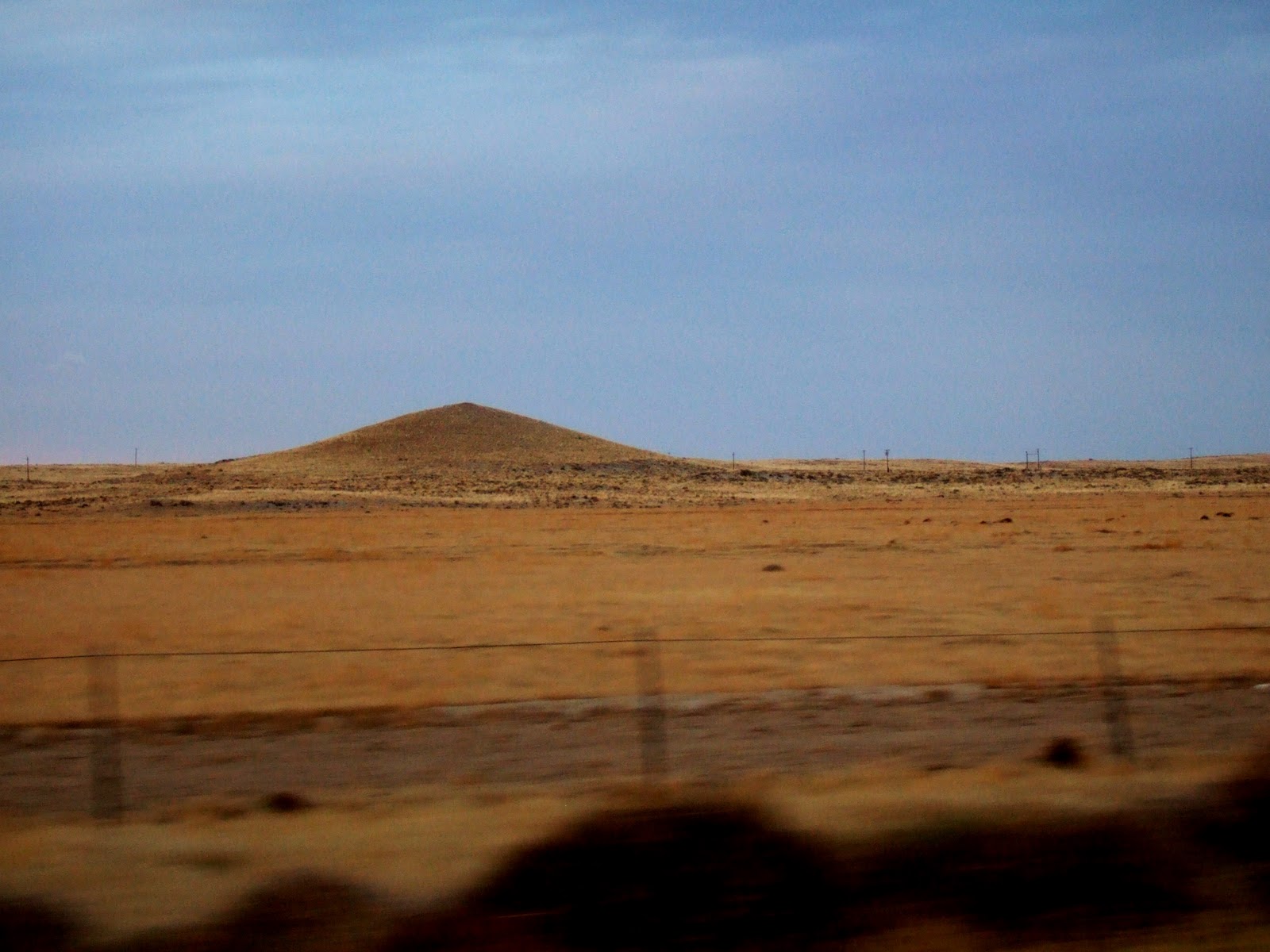
I noted in a previous post how it was hard to leave-off once started reading Narrative of the Voyage of H.M.S. Herald by Berthold Seeman flattery-rocks-berthold-seemann. I found his writing style very enjoyable and very illuminating of certain facts and perceptions. The voyage of the Herald included a survey of the waters and inlets of the Strait of Juan de Fuca in the late 1840s as well surveys in Alaska and off the coast of Central and South America including the Galapagos.

Seeman's observations of sites along the Strait of Juan de Fuca and in particular very early Victoria have been a valuable resource in understanding the landscapes of the area right at that point in time where the transition from First Nations to European/American dominance was taking place. In particular our understanding of the oak/prairie ecosystems as well as the role of fire in western Washington and parts of British Columbia owe much to Seeman and his book is frequency referenced.

But beyond the technical merits I very much enjoyed the book and the writing style.

A few quotes:

"Formerly, when everything was new and striking, both to the author and the reader, an amusing and instructive work was easily written. But now, nearly every school-boy is able to give a tolerably accurate account of the most remote corners of the globe, and if a traveler wants to bring forward something new, he must dive into details which, valuable as they may be to science, are not always appreciated by the general reader." - Preface to the Narrative

"The beautiful service for the dead appears more impressive at sea than in other situations. The silence within the ship, disturbed by nothing but the slow tolling of the bell, - the attentive and even pious demeanor of the men, - the unmarked spot in which the body is committed to the deep, - seem to shadow forth the unknown and illimitable eternity far more than the most solemn pageantry on land."  - Commenting on the three sea burials between Panama and Flattery Rocks

"Our heads were full of American War, in consequence of the dispute about the Oregon Territory." - Given the delays in communication, there was some concern about what circumstances they find themselves when encountering Americans as a huge chunk of land was in dispute between the two countries.

"While nature has imparted to most animals a desire for cleanliness, uncivilized man, with all the intelligence, ingenuity, cunning, and skill of his class, seems in general to be uncleanly, to revel in filth." - Alas perhaps it is all too easy to fall into revelling in filth.

Thursday, October 27, 2011

Goose Egg Hill, Hanford

This a post that I initially thought would take 5 minutes to write up. But the more I looked at this hill the more interesting it got. The post is based on the referenced geologic maps, but the land form itself and how it survived the Missolua floods is my own interpretation. I was not able to find any specific interpretation of the hill; hence, the interpretation is mostly my own but with reliance on a lot of great work by others in the area and my interpretation should be not be considered peer reviewed.

Approximately half way across the Hanford area on the northeast side of Highway 240 is a conical hill, Goose Egg Hill. Its conical profile is unusual in this area. The hill is a natural feature; although given its location within a weapons grade nuclear production reserve, one might speculate it is man made. The scale of the hill is difficult to discern as it is located in a landscape without scale. The hill is approximately 140 feet higher than the surrounding plain.

Goose Egg Hill, Hanford

Goose Egg Hill location (Google Maps)

The geology of the hill has been variously interpreted over the years. I have a colorful geologic map series (Rockwell, 1979) that indicates the hill is part of the Pasco Gravels. The Pasco Gravels were deposited by flood waters from the Missoula floods. A previous interpretation was the hill was a large mound of debris deposited by a grounded ice berg left behind by the floods. There are berg mounds in the area Bjornstad and Fetch (2002). Reidel and Fecht (1994) interpret the hill to be underlain by a pre Missoula flood gravel unit that underlies the oldest Missoula outburst floods with a correlated age of 1 to 3 million years old. Bjornstad and Fecht (2002) suggest that it may be a remnant of a dissected flood bar.

Given the conical shape, I prefer the the Reidel and Fecht (1994) interpretation that it is an older feature that predates the Missoula floods. This area was likely elevated prior to the flood as it is located along the inferred axis of an anticline (Reidel and Fecht, 1994). Hence, the area where the hill is located would represent uplifted fluvial deposits from an ancestral Columbia River or a tributary. Under this interpretation, the conical hill shape is an erosional remnant that is reminiscent of a similar hill above the Yakima River (pushtay-odd-hill-near-selah-washington).

One problem with the interpretation that Goose Egg Hill represents an older erosional surface is How did this feature survive the Missoula floods that inundated this area? An overview of the Hanford area and the flood water is provided by Bjornstad and Fecht (2002).

Hanford Area from Bjornstad and Fecht (2002)

Goose Egg Hill is located near the center of the map above as indicated by the letter (G). Initially the flood waters poured into the area via Sentinel Gap to the north and the Othello Channels to the east. Initially Goose Egg Hill would have been above the flood waters. The hill would not be inundated until the water backed up from the restriction at Wallula Gap just off the southeast corner of the map. Under this interpretation Goose Egg Hill was inundated with quiet water simply pooling into the short lived Lake Lewis formed by the constriction at Wallula Gap. There were still currents from the large volumes of water rushing into the lake and these currents created the huge gravel bars - Cold Creek Bar and Priest Rapids Bar located north of Goose Egg Hill. The hill was far enough away from the high currents that it was not eroded and far enough away that that is was also not buried by the bars.

Still water deposits of silt (Touchet Beds) likely covered many areas that were inundated where there was little current, but those silts were stripped away from many areas as currents developed again as the lake drained away. The above map indicates silts underlie the area southwest of Goose Egg Hill, and the flood silt deposits are also indicated on all of the geology maps of the area and are readily apparent along the highway in this area. It may be that Goose Egg Hill happened to be located at just the right spot where the currents were not strong enough to erode the hill but there was enough current to prevent the hill from being buried in silt and the hill was far enough downstream from the building Cold Creek Bar that it never got buried. As the lake drained current channels developed forming the Central Hanford Braidplain to the northeast of Goose Egg Hill. After the floods, the area has been further altered by winds moving sand deposits from the flood into dune fields that now cover much of the Central Hanford Braidplain.

The area around Goose Egg Hill holds another surprise. Take a gander (pun sort of intended) at the area around Goose Egg Hill and note the crack-like surface on the surrounding plain.

Goose Egg Hill and patterned ground (USGS)

The patterned ground is not very apparent except from the air as in the above satellite image. Note the scale. The pattern is the result of clastic dikes forming in the rapidly deposited flood sediments (Bjornstad and Fecht, 2002). As the mass of new sediment pressed down on previously deposited sediments the underlying sediments were compressed squeezing water out. The escaping water ruptured through the overlying sediments. The fractures are filled with sediment from the underlying material and are called clastic dikes. The soils along the clastic dikes at the surface have different porosity and water holding capacity and thus the clastic dikes are expressed by variation in plants that grow on the surface which is visible from the air or to a clever observer on the ground.

It would be great to take a walk about to the summit of Goose Egg Hill and examine the proposed hill theories as well as the clastic dikes on the ground surface. However, the hill is located in the United States Department of Energy Hanford Site.

Goose Egg Hill and trespass warning

The Hanford area geology has been an intensely studied due to the extensive areas of subsurface contamination as well as detailed investigations associated with a formerly proposed nuclear waste repository. Hence, the mapping in the area is very detailed and our understanding of many features in eastern Washington has a great deal to do with detailed studies associated with the nuclear facilities at the site.

Highway 240 cuts across the Hanford Area northwest of Richland. This highway was completed in the late 1960s and in the 1970s was an interesting road to drive. It was a through route across the United States Department of Energy Hanford Site. This large tract of land was set aside for the production of weapons grade nuclear fuel during World War II. The small town of Handford and the farming communities along the river were condemned and those that lived there had only a few weeks to move. They were only allowed back for a brief period to harvest the last year of farming crops (Dale Webber, personal communication, 2011).

The highway passes nowhere near the old town or the nuclear facilities. Only distant glimpses of the facilities can be seen. The road passes through the driest area of Washington State. The combination of the Cascade Range rain shadow, the low elevation as well as the high ridge of Rattlesnake Mountain lowers the average rainfall to 6 inches per year. It is also one of the hottest places in the state during the summer.

The highway is now essentially the boundary between the United States Department of Energy Hanford Site and the Hanford Reach National Monument. The initial Hanford site was large for the purpose of secrecy and security and much of the area became a large wilderness. For a time the area had a herd of wild horses and in more recent years elk have moved into the area to graze on the vast grass lands on a seasonal basis.

Wednesday, October 26, 2011

Bainbridge Raised Beach - From the South

I posted on the raised beach at the south end of Bainbridge Island previously raised-beach-along-seattle-fault. Yesterday, I got a closer view of the raised beach on the Seattle to Bremerton Ferry.

Restoration Point, southeast end of Bainbridge Island

The uplifted area is the grass covered ground between the shoreline and the trees on the steep slope up to the houses. The uplifted area is a classic platform shoreline that formerly was a bedrock wave cut platform within the tidal zone that has now been uplifted within the Seattle Fault Zone. The fault zone consists of several fault strands some of which reach the surface as can be seen on the LIDAR image.
LIDAR of south Bainbridge Island showing raised shore and fault scarp
The north-south streak like ridges are drumlins from the passage of the Puget Ice Lobe
Note the scarp and raised shore post date the drumlins 

My trip across the sound to Bremerton was on the foggy side with a cool fall chill in the air. The boat stopped for a bit to allow the east bound Bremerton to Seattle ferry to emerge from the fog. But the trip ended in bright sun and a nice view of the Bremerton Naval Ship Yard.

The Walla Walla emerges from the fog

Naval Ship Yard, Bremerton, WA.

Monday, October 24, 2011

End of the Line for Canals: Waterslides and Waterfalls

The irrigated areas of eastern Washington are laced with canals. Most of the canals follow the contours of the land to transport water to farm fields. Occasionally an aqueduct, tunnel or siphon is used to get water across an obstruction too difficult or expensive to route around. But eventually the canal comes to an end. I recently took a trip into the southern part of the Columbia Basin Project and came across the end of several canals that are at the lower part of the Columbia Basin Project. Some of these canals end in a manner that will be for a future post, but others send water back to the Columbia River via concrete lined slides and waterfalls. Water originally pulled from the river at Grand Coulee is returned to the river.

The first canal looks like a spectacularly speedy water slide; however......

View up the canal looks like great fun

View at the bottom looks very exciting

Perhaps would be best to enjoy the plunge pool without taking the ride

The second canal is a narrower more individual affair; however...

View up the canal from bridge
This ride includes dips

View down to the end looks like a bit of a drop

A really bad ending

By the way the splash pool of this canal has created a nice exposure of the conglomerate unit of the Ringold Formation.

Canal number three has a nice long straight run and is not so steep. This canal follows a valley carved down from a Missoula flood channel, Koontz Coulee, that has been irrigated.

View up the canal slide

The ending on this one is not a vertical drop
The pool was chaotic whitewater but I failed to take a good picture of it

This same canal continued to another drop.

This slide had baffles that would beat the heck out of anyone that would try running it.

I lived in this area during that period of one's age when one did compulsive and flat out stupid things. But I will say I never tried any of the slides. Nor did I know anyone that did. I am not sure anyone was reckless enough. There were always plenty of stories about kids getting killed and warning signs about the dangers. And besides we had plenty of other places to swim. I will add that this was prior to pesticide restrictions and at the early stages of the Clean Water Act and the canals did not have a great reputation as clean places.

A while back I worked on a canal project where we set up a monitoring scheme for tracking wildlife that tried to cross the canal systems. The canals had little side bays with steps so animals that fell in could get out. One idea was to properly locate the escape sites so that by the time the trapped animal reached the escape site it was not too exhausted. Of course another idea was to locate bridges at key crossing locations used by animals. In areas where the escape steps were not property located, animals would die and then float down the canal where they would accumulate at debris gates.   

Friday, October 21, 2011

Coal Politics in Bellingham: Yuk

Back in February I did a post on proposed coal terminals in Washington State. In that post I described the issue as "A nice divisive issue to pit community folks against each other". At the time, I figured that it would be a divide between those in favor of the terminal and those opposed. Indeed there has been some divisiveness along those lines; however, there is now divisiveness amongst coal terminal opponents.

After initially being in favor of the coal terminal, the incumbent mayor is now very firmly opposed to the coal terminal. The mayor is up for election and his opponent is also firmly opposed to the coal terminal. One would think that would be enough on that issue at least in the context of an election. One of those issues that political opponents can say "Hey, there is something we both agree on."

But no, the Bellingham community gets this door bell piece:


This is what Kelli Linville said: "I have been consistent from day one. I do not support exporting coal or any other non-renewable natural resources. I do not now, nor have I ever, supported a coal terminal at Cherry Point. I have worked against exporting and burning coal for many years. I will vigorously ensure that we are engaged in the scoping and permitting process from beginning to end to ensure our interests are represented."

A while back a friend of mine said that he feared the Bellingham mayor's race will be decided on the coal issue. Even though the mayor has no say in the permit process. And even though both candidates oppose the coal terminal. Of course one would not know that from the above door bell piece. But that's the point. Yuk. 

Thursday, October 20, 2011

Geoprobe Work

On occasion we oversee geoprobe investigations. Geoprobes developed as a less costly means of collecting soil samples for geotechnical and environmental purposes. Under the right geology circumstances they are a great approach for getting sub surface information. Essentially they are a hollow tube pushed into the ground and then pulled out with a sample of soil inside the tube. The wonders of hydraulics and extremely tough alloys do the trick.

Truck mounted geoprobe

Pushing the probe into the ground

Small tractor like rig. These types of rigs are great on steep slopes or inside buildings

Samples are collected in plastic tubes that can either be hauled back to the office or cut open at the site for sending off for chemical analyses. 


On a recent project we probed through an upper unit of sand and gravel (fill) down into Bellingham Glacial Marine Drift. The Bellingham Drift was deposited towards the late stages of the last glacial period when the Puget ice lobe retreated out of the Puget low lands. The mass of up to 6,000 feet of glacial ice had pressed the local earth surface downward. As the ice retreated the sea flooded over the land that had been pressed down by the ice such that the ice lobe was for a time floating on inland sea. The melting ice rained a steady load of finely ground rock silt and clay onto the sea floor below as well occasional pebbles, cobbles and boulders. This phenomenon was most pronounced in the Bellingham area as the ice had been thicker here than areas to the south and the glacial ice lingered longer in this area; hence, the name Bellingham Drift.

Where the drift has remained saturated it is very soft - a bit stiffer than tooth paste. A bit of a challenge for constructing big heavy buildings but pretty good at preventing the movement of contaminants as long as it is the silt/clay variety of the drift. 

Geoprobe core samples of soft Bellingham Drift

I have a habit of making balls out of the extra sample material.
More skilled geos might shape figures 

Tuesday, October 18, 2011

Washington State's Other Mounds

I recently made a geologic pilgrimage of sorts. As I was on one of my crazy trips for work (Port Discovery and Port Ludlow followed by a drive down the west shore of Hood Canal and then across White Pass to Kennewick), I made a minor detour and visited the Mima Mounds south of Olympia (or west of Littlerock).

The Mima Mounds are a landscape of mounds that are on the order of 2 to 6 feet high that cover a swath of glacial outwash gravels. A whole range of theories have been put forth on how the mounds formed. My own take on the mounds is that geologists have had a great time coming up with theories on the Mima Mounds and some other mound landscapes as well. One of the great things about the Mima Mounds is the theories. They have inspired creative thinking and great joy that there are landscapes that we still do not fully understand.

But this post is not about the Mima Mounds. That is for another day. This post is to note that there are lots of other mound sites in Washington State - particularly on the east side of the Cascades. One of my favorite routes in Washington State is along the upper, high portion of the northern side of the Columbia Basin between Wenatchee and Spokane. Lots of great geology and landscapes including several areas with mounds that are very similar in size to the Mima Mounds.  

Mounds Along Highway 174 northeast of Grand Coulee

An approximately 3-foot high mound

This particular mound site is located on the northeast portion of the Watterville Plateau. I spotted these mounds just after reaching the plateau top above the Columbia River valley west of Grand Coulee Dam. This site has been glaciated by the Okanogan ice lobe and is underlain by thin glacial till over basalt bedrock. 

A cursory read about various mound sites in western North America suggests that there is no single explanation for the mounds and a remarkable variety of explanations for each mound site are often proposed. This mound site on the northeast edge of the Watterville seems to be no different - it seems that a variety of explanations or theories are possible. A scattered number of basalt boulders left by the ice lobe in the vicinity suggests one explanation, but I would not want to place any bets. And perhaps the mounds at this site actually were formed in various ways but with a similar end result.
  

Basalt boulders on the Waterville Plateau

Of course there are anthropogenic explanations as well. The recently formed mounds pictured below are located a few miles west of the mounds pictured above.

Mounds in plowed field on the northern Waterville Plateau

And then there are the mounds in southern Wisconsin and other Midwestern sites. The mounds in Beloit, Wisconsin are similar in size. Prior to "development" of the area there were thousands of similar mounds in Wisconsin and elsewhere in the Midwest. Most, like the ones pictured below, are similar in size to the Mima Mounds and the mounds scattered around sites in eastern Washington. The Beloit mounds had some ritual meaning to the local First Nations. And perhaps a message to geologists that not all mounds were formed in the same way.

Mounds in the lawn, Beloit, Wisconsin.

Monday, October 17, 2011

Washington State Board of Natural Resources Punts Again on Lake Whatcom

Washington State Board of Natural Resorces

I recently took a trip down to Olympia to testify before the Washington State Board of Natural Resources. This board sets policy for the management of state owned trust lands and state managed forest board lands. The management duties are carried out by the Department of Natural Resources.

The state owned trust lands, Land Grants, were given to the state by the federal government at the time of statehood as a means to generate revenue for schools and capital projects associated with state government. The common school trust lands are the largest.

The state also manages what are termed forest board lands. Forest board lands were created after cut and run logging operations in the early 1900s left tens of thousands of acres of cut over land that county governments had foreclosed on due to failure to pay property taxes. Management of these lands was taken over by the State so that they could be properly reforested. One county, Grays Harbor County, was allowed to opt out of the program. Grays Harbor manages their own county forest board lands. All other counties are allowed to take over management of forest board land for park purposes through a process called reconveyance. A few parks have been created in this manner.

The board consists of six members: Dean of University of Washington College of the Environment, Governor (appointed person), State Lands Commissioner (elected), State Superintendent of Public Instruction (elected), Dean of Washington State University School of Agriculture and a county commissioner or council person from a county with state managed timber land.  Since the Board's creation along with the Department of Natural Resources, the board acts as the trustees for these state managed land. As such the board's primary focus tends to be on issues overseeing the generation of money from these lands via leases and timber sales. They also make sure that any land exchanges are fair to the trusts.

A full discussion of the nuances and legal issues around management of land grant trusts and county board lands will have to wait another day.

The purposes of my trip along with numerous other folks was to encourage the Board to complete a land exchange between Land Grant trust lands and Forest Board lands in the Lake Whatcom watershed in Whatcom County. The proposed exchange is the result of Whatcom County wanting to take over management of the Forest Board lands in the watershed as a forest preserve park. Currently the Land Grant lands and Forest Board lands are intermingled in a checkerboard configuration.  The idea behind the exchange was to place the Land Grant lands in a coherent easily managed block and the Forest Board lands in another more easily managed block.  Sounds simple, but as best I can tell the rub is that the Board of Natural Resources really does not like the idea of a county reconveying land. The Board had this issue before them in June and tabled it. At this last meeting on October 10, the board again tabled wanting additional information and asking for measures that they do not have the authority to require. I have to opine here that the additional information requests and other measures is a delay tactic.

I have been through this same process before. In the early 2000s the State Legislature required the Department of Natural Resources to develop a management plan specific to the Lake Whatcom watershed. Once that plan was developed by the Department, the Board of Natural Resources tabled the plan for 10 months until Whatcom County filed a lawsuit. State DNR's lack of effort in defending and upholding that plan as well as efforts to undermine the plan and even swap the land the plan applied to out of the watershed triggered the County to consider taking over management of at least the Forest Board lands - lands that belong to the county after tax foreclosures but are managed by the DNR with Board of Natural Resources oversite.    

The decision by the Board to table the land exchange does not prevent Whatcom County from moving forward with reconveyance. That decision is up to the County. The County had delayed that decision for 4+ years in the spirit of cooperation with the DNR to come up with a better land package for management. That cooperative approach mas memorialized in an Memorandum of Understanding (MOU). The Board is not so inclined to be cooperative and the MOU apparently carries no weight with the board members thinking.

The Board appears to be taking a position that by taking no action on the exchange and delaying, the county government will change their mind after spending nearly $300,000 to support the exchange for a better management plan. Perhaps they hope reconveyance will be less likely to happen. They really do not like reconveyance and the loss of state control that goes with it. At least one member expressed a concern that other counties might do similar reconveyances. This board views such actions as not a good thing.

Heading into the Board of Natural Resources meeting to testify

Saturday, October 15, 2011

A Few October Notes While Traversing Washington State

I recently traversed across Washington State. A few observations. I spotted some fall colors worthy of New England on the upper slopes above Snoqualmie Pass off of Interstate 90. I suspect by the coloration that the color is primarily vine maple with possible mountain ash.


Further on my way along the road - large boulders just south of Sentinel Gap on Highway 243. The boulders were deposited by one of the Missoula floods. Flood flow velocities were very high as the water tore through Sentinel Gap plucking off basalt boulders and rolling them across the landscape towards the south. The boulders at this location were pushed towards the road into a row when the field was cleared of boulders in the 1980s for growing grapes.


A bit past the boulders the road is lined with wooden bins in preparation for apple harvest near Desert Aire. This is a desert area, but water is provided via irrigation canals from the Columbia Basin Project. One problem - there is a big labor shortage this year. By some estimates %40 of the pickers and packers are as our governor stated "document challenged". With crack downs on employers, some farms are having a hard time finding workers.


Crossing the Hanford Site is a conical hill called Goose Egg Hill. An unusual feature given the location that I'll have to write up on some future post along with another unique but more subtle feature that surrounds the hill. The hill is within the Department of Energy Hanford site. This is a place where weapons grade nuclear material was manufactured. Lots of waste sites and contaminated areas. The Department of Energy spent $1.96 billion of American Recovery and Reinvestment Act (Stimulus) money here over the past two years. They got a lot done, but the area faces lay-offs as the money has been spent. With the local congress person Doc Hastings the chair of Natural Resources Committee there may be some leverage for more federal money even though Doc Hastings voted against the Recovery Act funding.  

Friday, October 14, 2011

Spin on the Marcellus Shale and an Energy Revolution

I found this article on the Marcellus Shale by the Associated Press very interesting: AP Marcellus Shale Spin. Issues are very rarely black and white. For the scientists and policy wonks caught in the middle of this, it must be tough. It is hard to not proclaim a pox on both sides. Even when one comes to a conclusion on one side or another it can be disconcerting to be in anyway associated with arguments that rely on made up information. Nough said!

But for those that may not be familiar with the Marcellus Shale or Utica Shale or Bakken Formation (Bakken Formation posts HERE and HERE) as well as a number of other recent gas and oil boom areas, there is an energy revolution of sorts taking place in the United States. An if you live above one of these geologic formations you are likely experiencing more than just the energy revolution - Who would have thought western North Dakota would have a massive housing shortage? I know from my time in North Dakota this summer the place is being over run by oil field workers.

There certainly has been significant changes in energy production in Washington State and elsewhere in regards to wind energy in particular. But for those that think that peak oil is upon us and that oil production or natural gas production will be in steep decline anytime soon, you might be disappointed. That said, how we utilize the new energy fields should be given some thought.

How all this will relate to Washington State is hard to say. Washington State still amazingly has never had a commercial operating oil well that I know of and extremely limited natural gas production. The near term impact may be the shifting of oil sources impacting the refineries in northwest Washington that rely on tankers of oil from Alaska or crude via pipeline from Canada. With natural gas prices dropping due to the new production elsewhere, I suspect it may be awhile before coal bed methane hydrofracturing starts in Washington State. IN the meantime, perhaps we could learn a thing or two from Pennsylvania and New York.  

Thursday, October 13, 2011

Home on the Railroad, Benton City

Home on old railroad grade with rail bridge over Yakima River, Benton City, Washington 

I spotted this house located on the old rail grade across the Yakima River from Benton City. The rail line was originally built by the North Coast Railroad from Kennewick to Yakima in approximately 1900. A variety of folks with funding from the east built rail spurs that would connect to the big cross county lines. Part of the schemes were also to plat communities along the rail routes and develop the areas along the rail lines so that rail would sell property and then the properties would produce rail customers.

The North Coast Railroad was taken over by the Oregon and Washington Railroad and Navigation Company in 1909. This company appeared to be a merger of a number of linked spur rails with backing by the Union Pacific. The Union Pacific controlled this particular line since 1910. The rail line has been abandoned for many years, replaced by a line that follows a different route from Kennewick to Yakima not far to the south of this line. In recent years the railroad properties along this abandoned stretch of rail have been sold off - including the home site above as well as a parcel that crossed Washington State Department of Natural Resources managed land.

I am not sure of the condition of the bridge next to the home; however, the elevated rail grade provides a place well above flood waters on the Yakima River.

Wednesday, October 12, 2011

City of Nooksack Considers Swift Creek Asbestos Impacts

Back in July 2010 I posted on a proposal by Nooksack and Sumas to expand their growth areas into flood plain areas along the Sumas River floods-and-urban-landscapesl. Besides the flood risks there was also the fact that sediments deposited by floods on the Sumas River contain asbestos. I submitted comments and spoke at the County Council public hearing about this issue as well as few other urban growth issues.

After that public hearing both Nooksack and Sumas withdrew their request for larger growth areas and this week settled their dispute with the County by agreeing that they will work with the county on new plans for growth that will consider some of the concerns the two cities have regarding their growth boundaries.

Within in the concerns incorporated in the resolution stating the agreements was this for the City of Nooksack:

"Review of areas potentially impacted by Swift Creek sediment and associated risks, and consideration of proposed measures to manage or mitigate such risks."

and this very wonky issue:

Whatcom County Land Capacity Analysis Detailed Methodology to consider incorporating areas documented by Nooksack as being impacted by sediment from Swift Creek potentially containing naturally occurring asbestos (NOA) into the critical areas/sensitive environmental areas subtraction component of the land capacity analysis.

It is great to see the City of Nooksack is taking the Swift Creek issue seriously and will be be planning accordingly. Pretty great for such a small community.

Sunday, October 9, 2011

Swift Creek Landslide: Density Sampling at a Growing Problem

Thursday morning I ventured out to the active Swift Creek landslide. I have not developed a ranking system for landslides, but I am fairly certain that if one was devised, the Swift Creek slide would rank as one of the worst slides in Washington State. The Swift Creek slide is an act in progress and the situation and potential costs continue to get worse. The lower portion of the slide below the bedrock failure area has been moving progressively down the mountain slope in the Swift Creek drainage. I have called this badlands area whatcom-countys-desert in a previous post describing the slide and have posted a few other times regarding a number of big landslides on Sumas Mountain lidar-sumas-moutain. The slide has been and continues to slide down the mountain side in the Swift Creek drainage. The slide is now pressing well into a narrow canyon section of the creek and the unraveled broken up area continues to expand.

View of slide from the northwest flank of the slide toe area

View of lower toe area of the slide looking down toward Swift Creek
Kim Ninnemann and Scott Linneman contemplate the route ahead

View across the toe area of the slide
Scott Linneman and Ben Ferreira contemplate sampling sites

Southwest flank of toe area pushing into forest on the south valley wall
Kim Ninneman and Ben Ferreira traversing the slope

Part of Thursday's effort was to gather bulk density data on the slide. So we scrambled around to fresh exposures of the upper newly failing area and then the highly broken up sediment on the lower slide. Very dense blocks of bedrock within the slide are shot full of veins of asbestos form minerals and once the rock breaks out onto the slope it readily crumbles and weathers. In addition some of the "rock" has been completely altered to clay. It still looks like rock and retains many of the features of the original rock structure but is now clay.

Classic block of ultramafite crumbling apart

Breaking a block of ultramafite weathered to clay
Circle above hammer is a brass ring pressed into the "rock" for bulk density measurement

Highly fractured slide surface
Samples here were also relatively very low density 

The landscape of the surface of the lower slide really is a strange and different place to be on the side of a mountain slope in western Washington. It was though I was back in the bad lands of western North Dakota. Fortunately it was early enough in the wet season to be able to traverse the slope without getting stuck in the mud if one stayed alert to avoid wet areas. I only sunk into the mud to my ankles a couple of times. Numerous milky springs are located on the slide surface. The milk is suspended sediment that consists primarily of asbestos.

Milky white spring
extremely fine sediment coloring water is mostly asbestos

Longer asbestos form minerals picked up on the slide surface

Blocks of Huntingdon basal conglomerate collapsed onto the slide surface
The conglomerate was deposited directly onto the weathered ultramifite approximately 50 million years ago

At the very lower end of the slide, trouble brewing. The slide already contributes huge sediment loads Swift Creek, but the slide toe area has changed considerably since I was last up on the slide four years ago. The slide has moved down into a narrow restricted portion of the canyon and is pressing into trees. A pool of water has formed on the toe area behind a large block of rock. The slide toe area has not eroded, the toe area immediately above the narrows is very steep and the slide is beginning to deflect the creek to within a few feet of a potential new channel route poses a significant risk of a large debris flow which will send a large surge of sediment and debris down the stream.  

Pending problem on lower toe as water pools within landslide area at a constriction in the valley
This site is a potential debris flow trigger with lots of loose material blocked up behind the pool of water

View looking up slide from pool pictured above
Kim Ninneman and Scott Linneman contemplate pooled water with slide area above them

Slide pushing into the forest has pushed stream (not visible) into the forest

I plan to do a follow up on the downstream impacts to Swift Creek and the land around Swift Creek on a future post.