Sunday, February 26, 2017

Kahlotus in Winter

Kahlotus has never really been a thriving town, but then it has not drifted into ghost town status either. Due to good roads and better cars the commercial businesses that served the already sparse population have faded such that there is an appearance of decay with empty commercial buildings. 
 

The one market has been closed consistently for a long time. I was hoping it was open but was not optimistic during my recent pass through.


However, there is a café in town that is open at least for now.

 
Despite the commercial decline, the town population has remained relatively steady and the town does have a K-12 school as well as a swimming pool. 
 
 
While there is a wheat elevator, most of the local wheat heads by truck down Devils Canyon (devils-canyon-south-of-kahlotus) to Port of Kahlotus owned terminals on the Snake River. The geology in the canyon is spectacular, but the grade of the road is such that wheat truck drivers want to make sure brakes work well with a full load of wheat in tow.

Monday, February 20, 2017

Shallow Soil Slab Failure

I had the chance to revisit  a steep slope I had assessed about a decade ago. The slope is a former steep shoreline bluff underlain by silt/clay glacial drift with a few boulders embedded in the unit. I say former shoreline bluff because the base of the slope is fronted by what has been a very stable accretion shore with a beach that has built well out from the toe of the slope. The slope is 55 degrees, steep enough to be a challenge to walk on.

This fall and winter has been very wet so landslides are not unexpected. In my previous assessment of this slope I stated "The primary source of slope movement on the slope appears to be root throw from occasional toppling trees and raveling associated with deer and thaw freeze. However, the upper slope is steep enough that shallow landslides should be expected on a periodic basis. If slides do take place, I anticipate that they would involve only a few feet at most of the upper soil horizon".   

This fall/winter combination of wet and cold caused the top soil layer to release on the slope. There may have been some enhancement as trees had been cut and slash left on the slope. 

All and all a fairly straight forward site compared to a few other recent slope assessments. But it is a good lesson to visit failed slopes to observes recent slope failures.   


Silt/clay glacial drift with a few cobbles and boulders embedded in the unit.

Sunday, February 19, 2017

Ralston

Ralston is about 10 miles south of Ritzville. It happens to be along a route that I take on a perhaps yearly basis and am familiar with, but is a bit off the main highways. That said, if you find yourself traveling between Spokane and Tri-Cities, the route through Ralston avoids what I refer to as the Valley of Everlasting Boredom (Hatton Coulee) between Lind and Connell. And the route passes relatively close to Palouse Falls - a side trip that should be on everyone's list of must see places in Washington State. 

The first view of Ralston is its high rise grain elevator.  


The taller elevator is a remnant of the day when Ralston still had an active rail line. The newer elevator on the left is served by trucks as the rail has been abandoned since 1980. Ralston had the misfortune of being served by the wrong rail route - the Milwaukee Road Pacific Extension. Better train routes for serving grain shipments were located to the northwest and east.


With more prosperous Ritzville just 10 miles away Ralston slowly faded over time. The mechanization of farm equipment meant less people were needed to farm the dry land wheat. Paved roads and cars further undermined the small town. By 1980 the town was mostly a ghost town with a few residences left. My first visit to Ralston was on a hot summer day after Mount Saint Helens had blanketed this area with 4 to 6 inches of ash. The land was a moonscape of gray but with a blue sky. But even at that time the store above was closed up. 

There is however a local community pride that continues. The local grange hall appears to be maintained.


The road rises up on the south side of town and someone is keeping up the old hotel as a residence.


There is a maintained small park along the side of the road. The park is dedicated to the memory of a WWII boatswain, Reinhardt Keppler, killed in action in the Pacific. Fiver other locals, including two brothers, lost in the war are also honored. 


By WWII this area was already declining in population. I tried to image the young men leaving the wide open spaces and isolated farmsteads and heading out into the vastness of the Pacific Ocean to serve their country. I hope that they found some joy and adventure before they arrived at their fate. In small communities losses like this must have been particularly hard.

Saturday, February 18, 2017

Ritzville in Winter

Ritzville is a well preserved small city in eastern Washington. Much of the downtown area is within the National Register of Historic Places. The city is located where I-90 joins U.S. Highway 395, or if viewed in another way, where the two roads part. State Highway 261 also starts or ends at Ritzville.


Geologically the town is located at the upper end of Paha Coulee. This coulee was scoured a bit by ice age flood waters that branched off of the Cheney-Palouse flood path just to the east of Ritzville. The reliable History Link provides a good overview of the town and its history http://www.historylink.org/File/9396.
 
The highways now skirts around the town just to the southeast, with a truck stop, several gas stations and motels, and quick eats at the service exit. It is a short drive into the town itself and there are a couple of older motels in the main town area. The population has declined some in the past few decades from a high of 2,173 in 1960 to 1,673 as of 2010. However, the town has some advantages have kept it reasonably intact relative to some of the other dry land communities in eastern Washington.  
 
The town has a movie theater that is still open and showing first run films
Note also there is bank on the ground floor next door 

The first pioneers in the area ran cattle on the open range, but they were soon replaced by dry land wheat framers. A substantial number of the wheat farmers were German immigrants that had previously been in Russia. Wheat is the big business of the area and Ritzville is a major shipper of wheat with a main rail line running through town. Note in the image above the crane as work was taking place at the elevators on this cold day.

The heart of downtown on a cold winter day
The cars show that people were at work
The downtown is on the National Register of Historic Places

There are recreational opportunities
Big Bend refers to the big bend in the somewhat distant Columbia River which flows to the west before turning south at the Big Bend
The wheat land to the north and west is locally called the Big Bend

A bit of wealth from Pittsburg came to Ritzville in 1907

One of many brick buildings in the historic district of downtown

Ritzville exists where it does due to the railroad that follows the even grade down Paha Coulee
The town has lots of train traffic passing through, but the rail is also a critical component fro shipping wheat from the region.

Ritzville is the County seat of the small population county

Wide double lane street heading up into a neighborhood

Downtown buildings with some fanciness

For its size and setting having a drugstore is a big deal
 

This establishment was closed and vacant
On this frigid day the name had some appeal

Reasonable expectations at the downtown grocery

I missed out on Pastime, but good to know there is a tavern and sports on TV

The old railroad station has been well preserved

Although it was cold I really enjoyed this farm implement display next to the railroad station

Each implement had a sign explaining what it was and its use.
Solved few mysteries for me

Across from the farm implements was a vacant building of bygone days.
Small car dealerships are a thing of the past

A measure of the town prosperity is that there are open banks serving the community

The bank building has been in use as a bank under various owners for over 100 years
Most of the downtown buildings had historical signage

A final note should be that Ritzville is typically note so snowy. This winter has been rather exceptional with lots of snow in the dry land areas of eastern Washington.

I have added a new label to the blog side bar: towns and cities. I have done short write ups with pictures of towns before or some aspect of a city but did not have a specific label.  

Wednesday, February 15, 2017

Vaccines and Washington Mumps

Julia Belluz put up a couple of articles on the anti vaccine movement. A problem that apparently is not going away any time soon: vox.com/anti-vaccine-movement-trump and vox.com/robert-de-niro-rfk-jr-vaccine-press-conference.

Vaccine rates in Washington State 2006-2007
New England Journal of Medicine
 
The mumps has broken out this winter in Washington State with 404 cases thus far with King County and Spokane County with the majority of cases. (http://www.doh.wa.gov/YouandYourFamily/IllnessandDisease/Mumps/MumpsOutbreak). The cases in Spokane County have been growing and the Health District in Spokane County has ordered non vaccinated children to stay home in an effort to curb the outbreak.
 

Tuesday, February 14, 2017

Pasco Rail Yard

Trains have been a bit of a topic the last few years in Washington State due to the arrival of very long unit trains with one cargo passing through the state. Coal trains and oil trains over a mile long have become a common site. The unit trains are easy logistics in that the cargo is picked up at on place and off loaded at another. But there is a lot more to rail transport than unit trains. Assembling trains to carry a wide variety of cargo is a logistic challenge. 

A glimpse of the train logistics can be had while crossing the south end of the hump yard in Pasco via the combined Highways 12, I182, and 395. Miles of siding for moving cars and putting together trains.  


 The multiple rail lines extend for over two miles to the north of the crossing 

Pasco is well located for putting trains together with lines extending from Pasco down both sides of the Columbia River to Portland and spots in-between, a line heading up the Snake River to Lewiston, lines to Spokane, and a line that heads up the Yakima and through the tunnel in the Cascade Range at Stampede Pass and onto Tacoma and Seattle. Pasco is the railroad heart of much of the train traffic in Washington State.  

Besides the intersection of routes, the Pasco site provides a broad level area and is underlain by gravel and sand soils making the early rail yard development easier than other spots. BNSF has made some recent upgrades including the installation of a coal spray station to reduce coal dust coming off the coal cars. Besides the environmental issues the estimated 500 pounds of dust from each load is hard on the tracks.  BNSF Invests $26 million in Pasco

Saturday, February 11, 2017

Notes on GOES and Himawari

The GOES data and imagery is a great resource https://www.nesdis.noaa.gov/imagery-and-data.
It also is a thing of beauty.  

The moon over a storm approaching the Pacific Northwest 

This is an image from Jan 15.
The Columbia Basin and northern interior valleys of Washington are filled with fog.
Snow covers parts of southwest Washington and the northern Willamette Valley.

The other side of the globe is covered by equally spectacular images from the new Japanese Himawari-9 satellite.
The Himawari-9 images of the Pacific should help with understanding how the weather systems that impact Washington State evolve. 

Friday, February 10, 2017

GOES and the Fraser Valley Outflow

A bit of a follow up on the Fraser outflow weather in northwest Washington. On Tuesday I drove through Skagit County and along Chuckanut Drive to Bellingham. A dusting of snow covered the ground in Skagit and along Chuckanut. At the north end of the Chuckanut Range at Bellingham there was an abrupt change with a heavy snow covering. As frequently as I have witnessed this, it still is amazing to see. I was curious to see how what I saw on the ground was captured by the new GOES satellite.  

GOES Visible light imagery February 7, 2017


If one clicks on the image to blow it up in size the faint dusting of snow in Skagit County can be seen southeast of Bellingham Bay. North of the bay, Whatcom County is deeply white. The streak of snow extends out to the southwest with snow on the San Juan Islands. The north slopes on the Olympic Range also got snow associated with uplift as the Fraser outflow stream of air rises up the slope. On the day of the image a heavy line of clouds was still present on the north slope of the Olympic Range. 

Thursday, February 9, 2017

The Fraser Outflow Temperature Gradient

I did a quick check of weather conditions this morning. Something I routinely do during the winter while scheming field ventures. Good thing I do not need to be heading over to central or eastern Washington as all the passes are closed. 

As frequently as I have experienced it I am always impressed by the sharp temperature gradient associated with the Fraser River outflow: 


Nasty cold rain with very slow melting snow in Bellingham. 23 miles to the south it is 54.

As I wrote this the slight north breeze is still blowing at the surface, but the clouds are coming from the south. Should be a very fast warm up very soon.

Sunday, February 5, 2017

Washtucna to the Snake Coulees in the Snow


During my various recent ventures in eastern Washington I spent a bit of time in some of the coulees that were eroded by ice age floods between Washtucna Coulee and the Snake River. The Washtucna Coulee is the former route of the Palouse River. When the huge ice age floods surged across the Palouse south of Spokane the flood waters filled the entire Palouse River valley and flood waters then spilled over the top of the Palouse Valley and flowed to the Snake River Canyon carving deep narrow gorges into the landscape along joint structures in the Columbia River Basalt Group (see palouse-falls  and devils-canyon-south-of-kahlotus).
 
My views of the coulees were somewhat enhanced by the snow cover. There was also some obscuring and access issues with the snow.
 
View across Washtucna Coulee just east of Kahlotus
The upper end of Devils Canyon is in the center of picture

View down Devils Canyon
 
Above the deep coulees there are some survivor Palouse hills that got partially washed away by the flood waters.
 
Lone Palouse hill rising above the ice age flood pathway

Palouse hill cut by flood water spill over just above a coulee

View down the upper end of Davin? Coulee
Just beyond the cattle is a dry falls.

The ? after Davin is because I don't know if this coulee has an official name, but there is a road by that name that enters the lower coulee (the road becomes private part way to the coulee) and a very old track that continues to the Snake River.

View down towards the lower end of Davin? Coulee

View across Davin? Coulee

Another unnamed coulee
With the snow the various water levels that flooded this coulee can be seen
 
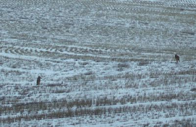
 Despite the cold and snow I did have some company.

These guys seemed perplexed but cautious at my presence

This pair wanted nothing to do with me when I hiked over the ridge
 
For the most part dry land wheat and scrub steppe back roads are fairly decent. They get graded and kept up in order to have truck and equipment access to fields or cattle gathering spots. But with deeper snow in spots, I opted to stop and walk versus losing the road or getting stuck in a hidden by snow gully.   
 
Time to start walking