Aerial views are part of my routine 'tool box' as a geologist. I use aerial photographs on a nearly daily basis for multiple reasons. Other aerial imagery is utilized as well - lidar, infrared and sometimes radar imagery. I enjoy this type of work and a there is a sense of discovery when viewing aerials.
I had previously seen the below feature when reviewing historic aerials for a project, and hence, when I got a view of it while flying out of Seattle knew exactly what it was.
Cedar Hills Landfill
The Cedar Hills Landfill serves King County.
While I do like to see the geology observable while flying, the human infrastructure also stands out. Some infrastructure has far reaching influence.
From right to left: Keechelus, Kaches, Cle Elum
Interstate 90 traverses along the left side of Keechelus
The Snoqulamie Pass ski areas are visible in the lower right
The three lakes are all part of the Yakima River watershed. There were natural lakes at all three locations associated with past ice age alpine glaciers that left depressions and moraines in the three valleys. Dams were erected at the outlets of all three to raise the water storage which is then metered out through the summer growing season in the Yakima Valley below. The dams should not be considered static features - they require ongoing maintenance and at times repair. All three dams are Federal dams managed and operated by the Bureau of Reclamation.
The western side of the Quincy Basin with the Columbia River to the right
The rocky ground with lakes are former spill ways from the large ice-age floods
(quincy-basin-plumbing). The Quincy Basin is a major agricultural area in central Washington with irrigation water supplied via water routed from the Grand Coulee Dam through the former routes of the ice-age floods. On the upper part of the picture an additional flood spill way can be seen plus a whiteish area. The upper whiteish area is a site of a diatomite mine. The ice-age floods plucked off enough basalt to expose old lake deposits containing diatoms that are now mined.
Moses Lake and Potholes Reservoir to the north
The east end of the Quincy Basin is drained through another ice-age flood route. Moses Lake is a natural lake formed in the deep flood water channels. Its depth and extent was slightly expanded by a small dam work at the outlet in 1911. Potholes Reservoir is formed by O'Sullivan Dam. The lakes receive natural water flow via Crab Creek, but the bulk of the water passing through now is via the water pumped into the upstream ice-age flood route of Grande Coulee and then routed via other reservoirs and canals to the Quincy Basin.
Potholes Reservoir
Potholes Reservoir is a critical junction in the Columbia Basin project. Water from this area is routed to project irrigation lands around Basin City (upper left in the picture), the Crab Creek valley (above the lake in the picture) and the Wahluke Slope (dark area above the Crab Creek area and separated from Crab Creek by the ridge of the Saddle Mountains).
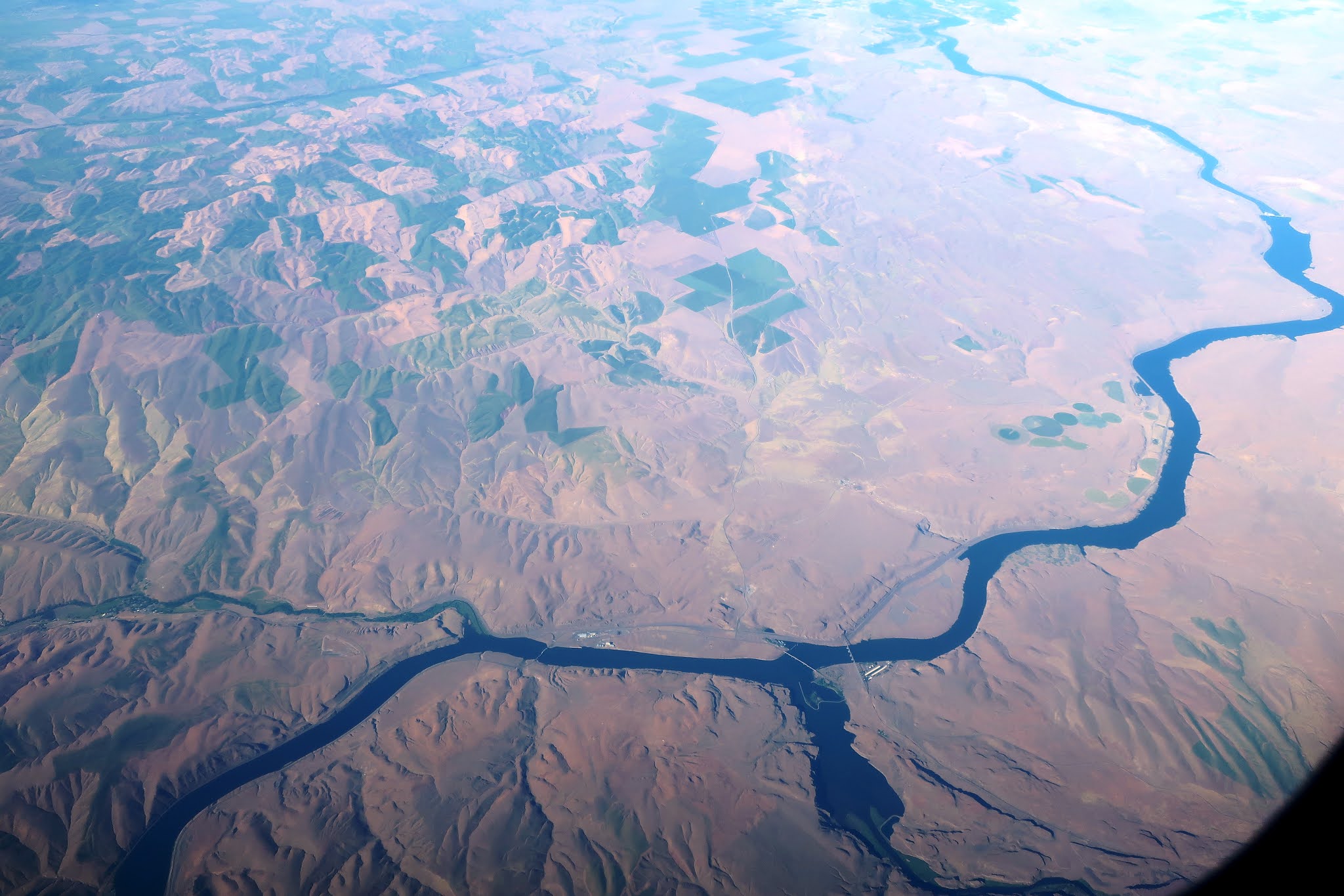
The lower Snake River
The lower Snake River is an area where infrastructure has generated some controversy. The lower Snake in Washington State has four dams that were the last of the big dams on Columbia-Snake system. These dams have led to the extinction of some salmon species and endangerment of additional salmon species. There is some irrigation near the lower Snake River. The big fields on the left are dry land wheat, but nearer the river above Ice Harbor Dam pumps in the backed up river and in wells near the river supply water to irrigated land. Part of the conflict over the lower Snake dams revolves around these irrigated lands --- if the dams are removed the irrigation works will need to be altered and water pumping costs may increase.
Lower Snake River passing through the Palouse
Most of the area along the lower Snake in Washington is not irrigated farm land as the river is a in a narrow steep rocky canyon for much of this river reach. The above image shows the slack water backed up by Lower Monumental Dam. The wide tributary is the Palouse River also backed up by the dam. The tributary on the left is the Tucannon River which drains out of the north side of the Blue Mountains.
The high Palouse and Blue Mountains
The further east position and higher elevation means wetter areas. In June the eastern Palouse and the Blue Mountains are very green landscapes. here the moisture levels are high enough that dry land winter wheat can be grown every year versus the every other year pattern in the areas to the west and at lower elevations. That switch over line can be seen on the right portion of the picture.
If you blow up the picture above or better the one below another newer infrastructure feature can be observed.
Rows of wind turbins line the upper ridges of the high Palouse in this area
One last infrastructure note beyond Washington Sate's borders:
Surface mines along mountain ridges in southeast Idaho.
Bear lake in northwest Utah is in the distance
Extensive open pit surface mining has been taking place in southeast Idaho over the past 50 plus years. The mines are phosphate mines. Some of that phosphate may end up shipped to Washington farm lands as a critical fertilizer. This particular mine is a JR Simplot Smoky Canyon Mine. The phosphate ore is mixed with water and pumped via pipeline for processing in Pocatello, ID. This was the best view I have had of the scale of the phosphate mining in this area. Its impressive on the ground, but more so from the air.