Tuesday, January 31, 2012

Charles Wilkes and the Mima Mounds

Mima Prairie

Charles Wilkes headed the U.S. Exploration Expedition that included a lengthy expedition and survey of Oregon Territory in 1841. Wilkes sailed into Puget Sound and then traveled overland from Fort Nisqually to Fort Vancouver. As such Wilkes provides an early description of the southwest Washington prairies as well as other important early observations of the area at the very earliest stages of American and English settlement

Fort Nisqually and Fort Vancouver were Hudson Bay Company forts. Fort Niscually was located near present day Dupont on the slope above and east of the Nisqually River delta. Fort Vancouver was the main Hudson Bay post on the Columbia River at present day Vancouver, Washington. Wilkes described the prairies around Fort Nisqually in very positive terms. Being there in May he had the pleasure of seeing the prairies in fine bloom.

On his overland journey south he noted that at one location the prairie was "covered with strawberries so tempting we were induced to dismount and feast upon them."

Wilkes also provides an account of the Mima Mounds, "We soon reached Butte Prairies, which are extensive, and covered with tumuli or small mounds, at regular distances asunder. As far as I could learn, there is no tradition among the natives relative to them. They are conical mounds, thirty feet in diameter, about six to seven feet high above the level, and many thousands in number. Being anxious as to ascertain if they contained relics, I subsequently visited these prairies and opened three of the mounds, but nothing was found in them but a pavement of round stones."

Hence, Wilkes conducted the first documented scientific investigation of the mounds. Wilkes surmised the mounds had been made by the Indians. His idea of a man made origin was likely influenced by the fact that very similar sized mounds are located in the Midwest and are man made. 

Monday, January 30, 2012

Prairies and the Puget Ice Lobe

A few Washington State our prairies

Scattered around various parts of western Washington Sate are prairies. Early English and American explorers noted large prairie areas in the low lands of Western Washington. There are prairies on Whidbey Island and the San Juan Islands, but the big prairie areas are in southwest Washington with a fair number in what is now Thurston County south of Olympia. I labeled the satellite image above with some of the prairies that are designated on USGS topographic maps. Except for two Fort Lewis prairies named for military divisions, all the above labeled prairies are in Thurston County. 

These Thurston County prairies are associated with glacial outwash from the Puget ice lobe. Large rivers of water flowed across these areas depositing gravel as the rivers flowed toward what is now the Chehalis River valley. Consider all the rivers coming off the west side of the Cascade range, all the rivers coming off the east side of the Olympic Range, and all the ice melt from the Puget ice lobe itself - that is a lot of water. The Geologic Map of the Maytown 7-5-minute Quadrangle, Thurston County, Washington (Logan, Walsh, Stanton and Sarikan, 2009) has a spectacular side map to help sort all the various water routes out - and that map only contains some of them channels.

Goldstein, Pringle and Futornick have noted that some of these water routes are associated with huge floods that are associated with volcanic mudflows coming off of Mount Rainier along some of the outwash channels http://www.centralia.edu/academics/earthscience/pringle/pubs/Tanwax_NWSA_poster2010.pdf.

I started thinking more about this area of our state when I had a project in the Black Hills southwest of Olympia and realized the outflow routes were a lot more complicated than I had realized. Lots of geologists have been working on figuring this area out and as can be seen LiDAR has clarified some of the water routes or pehaps made us realize how complicated the outwash channels that developed as the ice lob retreated from the area approximatley 17,000 years ago.

There are a lot to these prairie landscapes of southwest Washington State. The geology is a big part of the story for some of the prairies. But there is a lot more that I will be posting on over the next few weeks or months depending on my own interest and whims. In the meantime here is one of the prairie's from above and one of my favorite prairie songs.

Mima Prairie


Sunday, January 29, 2012

Erratic Bloggers

A bit of an inside joke. Given Dave Tucker has been the Erratic Guru http://nwgeology.wordpress.com/the-fieldtrips/glacial-erratic-field-trips/seattle-area-glacial-erratics/ I got a kick out of the prolific blogger Paul Krugman's latest post
http://krugman.blogs.nytimes.com/2012/01/29/erratic-blogging-ahead/.

Don't worry Dave, Krugman is not taking over your mantle as the Erratic Guru - I think your stuck with it.

Saturday, January 28, 2012

Chilly Day in the Field

I headed out into the field today. Typically I do not like to have snow obscure my views of the ground. But given the time constraints on the project and expected weather for the site, better now than later and the snow cover was just thin enough that I was able to figure out the ground once I got into the evergreen stands. Just wish the sleet had held off and then there was also an unexpected detour.

Traversing through the red alder forest

This beaver dam caused a bit of a detour

This steep slope is a result of a river down cutting into a huge landslide deposit.
Soils were full of angular chunks of rock

Friday, January 27, 2012

Memories of Short Sand Beach

Short Sands Beach, Oregon

Seeking aerial images of the sand burial site at Waldport, Oregon I posted on yesterday caused me to meander around and look at some other images of the Oregon coast. (Yes, this is not the Washington Landscape, but Washington used to be part of the same territory as Oregon up to 1853 and geologically we share with Oregon living on the same plate boundary with the Juan de Fucca Plate subducting beneath us.) 

One site I checked out was Short Sands Beach. I have visited this beach three times. All three times were in the winter and all three times were semi epic. The above picture is clearly taken in the summer - a nice wide sandy beach.

My first venture to this beach involved traversing the beach from south to north to check out the headlands to the north. On the return I noted a very large wave at the head of the small bay. Not sure why it caught my attention and I did not yet know the term rogue wave, but I suggested running for the woods would be a very good idea. My companion did not share my concern and decided that escaping the water could be accomplished by scrambling up onto a 6-foot diameter driftwood log at the top of the beach versus smashing through the jungle at the top of the beach. I turned around just in time to see the recognition on my companion's face that the wave was high enough that it was floating the log. A brief lumberjack act ensued before my friend tumbled off the log fortunately in the right direction as the wave began to pull back and rolled the entire massive log down the beach and into the sea with my friend not far behind. Another wave rolled in. The water was full of logs and the cobbles under foot were all rolling so foot purchase was minimal. I had tossed the backpack and went into this mess to try to assist and we stumbled back up into the woods out of reach of the waves and logs. A bit of a chilly hike out after our unexpected soak.

My second trip had a different result. I decided to camp along the coast during the winter despite the freezing rain as cold arctic air was pouring out of the Columbia River Gorge and reaching all the way to the coast during one of the coldest winters in Pacific Northwest history. But the real trouble was after setting up camp and realizing that a particularly virulent strain of the Asian flu that had been sweeping the nation had found me. By the time I hiked out, I gained an understanding of fever induced delirium I would prefer not to repeat anytime soon.

My third trip is still told with great enhancement by my brother Mike. We were staying a bit to the north at Cannon Beach and I suggested that Short Sands Beach was nice day hike. Being leery of the rogue wave issue we stuck to the forest trail. Only problem was that a major windstorm sometime since my last visit had obliterated the trail with downed massive trees. Hence we were compelled to climb and crawl over lots of large downed wood. Upon arrival at the headlands, none of my companions were impressed with the condition of what I had described as a trail on the exposed headland. A wave of cold rain and wind began to wrack us. On the trek back Lisa and Mike came up with the idea that I could start a tour group company called Odysseus Travels implying that survival was not part of the package. 

All said, Short Sands Beach looks like a great place. It has been a long time since I have been there; perhaps I will give it another try in the summer versus the middle of winter.    

Thursday, January 26, 2012

Sand Burial in Waldport

I routinely assess geology hazards: landslides, erosion, debris flows, channel migration, tsunami, soil liquefaction and even avalanches. Here's a geology hazard I have not dealt with: sand burial. This via Cliff Mass via Brad Smull and picture by Jason Durret.


The location is on the coast of Oregon at Waldport.


Not a particularly safe home site area on a sand spit. Throw in the tsunami risk, subduction quake subsidence risk and the long term prospects for these homes is not good. But in the short term a very wonderful sandy beach to live by - perhaps a little too much sand.

Tuesday, January 24, 2012

Nice Day on Orcas

I really appreciate the National Weather Service. The challenge of determining where and how much snow and freezing rain caused the forecasters a tough time last week. But the big picture was accurate and the forecast nailed Monday (yesterday) very well. A nice break in the weather that I took advantage of scheduling field work. Lovey day with sun and even a bit of warmth. Much better than today with wind and rain. So thumbs up to the National Weather Service for making my life so easy.

My field day was out on Orcas Island. First was looking at joint and fractures on a cliff slope.

Fractures and joints in Constitution Formation, Orcas Island

Had some nice early morning views on this project.

View down East Sound

Turtleback Mountain on Orcas Island from East Sound

I also came across my current favorite native tree - Gary Oak.


There were three oaks growing in the talus along the route I took. A few lonely outliers. I am sure there may be other oaks in the area, but these were the first I had seen on this part of Orcas Island. There is an extensive oak forest area on the southwest side of Turtleback Mountain that extends down to West Sound. This small group of oaks are taking advantage of the rocky dry slope. I noted that the Douglas fir on the same slope had burn marks from past fires and many had broken tops as this can be a very windy spot.  

Sunday, January 22, 2012

Digesting LAMIRDs (Wonky, Long and Local)

I have been digesting the Growth Management Hearing Board's ruling of invalidity on Whatcom County's rural planning http://www.gmhb.wa.gov/LoadDocument.aspx?did=2791. Its a long ruling and can only be loved by wonks. Perhaps this post can only be loved by wonks, but I will attempt to boil down the 177 page ruling. Wonky or not this digestive exercise has been very expensive to Whatcom County.

First invalidity means that the ordinance passed by the County Council last year is not valid. Second it is not as though everything the County Council passed was considered a violation of the State Growth Management Act (GMA); parts that were challenged were upheld. And lastly the challenge the County Council faced was inherited, but the County Council majority made changes to the original staff proposed plan that made the situation worse and then delved into making changes that had very little to do with the issue at hand.

A Little History

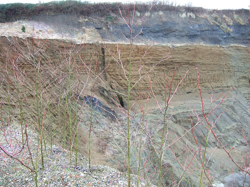
A couple of the major tenants of the GMA is to reduce sprawl and protect rural character among other things. After the act was passed it became clear that past growth planning had allowed lots of little and sometimes large scattered areas of development in rural areas. The lack of clarity on how to deal with these areas led to the passage of an amendment to the Gorwth Management Act in 1997 that laid out just how these pockets of more intense development in otherwise rural areas should be managed. Thus the creation of the term LAMIRDs (Limited Areas of More Intense Rural Development). Essentially LAMIRDs are areas that were already developed when the GMA passed in 1990. This created an odd situation in Whatcom County. Whatcom County had completed its rural planning per the GMA before the amendment became law. As such the county had not followed the amendment because the amendment did not exist. The County could have gone back and redid the LAMIRDs but chose not to.

Seven years passed and the county was required to update its rural planning per the GMA. The County administration's position was that because Whatcom County's 1997 rural plan had been upheld as valid, the County did not have to redo the LAMIRDs. So in 2004 the County Council passed a rural update without doing the LAMIRDs. The County had taken on a few LAMIRDs on a case by case basis and had greatly reduced some of the more egregiously large LAMIRDs. But the analyzing every LAMIRD for compliance with the GMA was challenged to the Hearings Board by Futurewise, a citizen GMA advocacy group. This challenge took some time. The Hearings Board rule for Futurewise. That ruling was challenged in Superior Court by a developer. The developer won. Futurewise challenged the ruling to the State Court of Appeals and won. The developer challenged the ruling to State Supreme Court. Futurewise won again.

Hence, Whatcom County started the process of reviewing all of the many LAMIRDs. A painful process of reviewing the outer boundaries of small unincorporated towns and hamlets and clumps of development scattered all over the rural areas of Whatcom County. Finally in 2010 after the County Council altered the staff recommendations substantially, the council passed a new rural plan. The new rural plan was challenged by Futurewise, the City of Bellingham, a group of local citizens and a property owner. On the basis of this challenge, the Board ruled the plan invalid.

Where the Council Went Sideways on the GMA

At the beginning of 2010 the County Council had in hand a complete rural plan that had been developed by the County Planning staff and many public hearings before the County Planning Commission. The County Council majority decided they did not like this plan and began their own hard work (along with County staff) to push the envelope in favor of less reduction in the size of the LAMIRDs. A tough situation as properties that developed over the last 20 years outside of the 1990 developed area boundary would become non conforming lots - a headache for a variety of reasons particularly for businesses.

Overall when it came to the areas of each the approximately 30 LAMIRDs the county did pretty well. A fair number of the LAMIRDs went unchallenged. Six of the challenged LAMIRDs were found by the Board as compliant with GMA. A few of the non compliant LAMIRDs will require very modest change to become compliant.

The LAMIRDs that were most problematic were the string of urban like business and industrial centers along the north-south highway between Bellingham and Lynden. The County Council left these areas too large. This particular development pattern is a formula for creating traffic problems and has very little to do with rural needs.

Another LAMIRD problem area were the LAMIRDs adjacent to Bellingham. Half developed areas become difficult areas to plan and expand urban growth and hence LAMIRDs are not looked well upon in these areas. Its a bit of a gray area in the GMA and the specifics are very complex and perhaps the County did not get complex enough to support the continued level of development in this semi suburb areas adjacent to Bellingham.

Where the County Council got really sideways was that they delved into areas that went beyond LAMIRDs. They created entire new rural zones and made some substantial changes to development rules in rural areas for businesses and industry. These new added ones and regulations that allow for expanded use within some the LAMIRDs well beyond what is currently allowed and well beyond what can reasonably considered rural.

Ruling on LAMIRDs

As noted above, many of the County LAMIRDs went unchallenged. Futurewise and citizen groups accepted that many of the LARMIRDs were well done. The hamlets of Glacier, Acme and many other scattered areas were well done. Several challenged areas the board found were in compliance. These included Sudden Valley, Cain Lake, Kendall, Nugents Corner and Point Roberts. A win for the County. It should be pointed out that the County had previously been through the equivalent of a LAMIRD review of Sudden Valley, Kendall and Point Roberts on a case by case basis.

The County also prevailed at Governors Point. Governors Point is a rocky peninsula south of Bellingham that the Council removed from more intensive development. Initially the Council majority wanted to keep this area in but in a rare show of interest in planning the County Executive stated he would veto the plan if Governors Point was left in.

The County lost on some minor boundary issues on a few LAMIRDs. And as noted above has to go back to the drawing board on the LARMIRDs around the periphery of Bellingham and out along the State Highway between Bellingahm and Lynden.

Ruling on Development Regulations and Zoning

Some of the rulings the County lost on and won on are minor technical issues of not a lot of consequence to the landscape. But where the County took a real beating was on the new zones and development regulations. The ruling on these matters can be summed with the following: "Failed to contain or control rural development", "Failed to reduce inappropriate conversion", Failed to protect visual compatibility". Creating zoning and development rules that made it wide open to build large commercial centers in rural areas did not sit well with the Board.

Ruling on Population in LAMIRDs and Rural Areas

The rural plan was also challenged on lack of consistency on population growth planning consistency and on impacts to sensitive areas.

Counties are required under GMA to establish plans consistent with future population growth. Whatcom County set a very lofty policy of trying to send most growth into urban areas in order to protect rural character and resource lands. This policy is very in line with the GMA. And it is a very hard policy to achieve much headway on because of past zoning that allowed thousands of lots to be created in the rural areas far beyond the projected growth policy the county has established for rural areas. By pushing so hard to keep zoning that allows larger LAMIRDs than allowed along with adding more liberal development regulations, the County opened up this issue to challenge. The challenge essentially pointed out in clear terms that the County's actions of allowing large LAMIRDs and the new added more intensive development zones were in direct conflict with County policy for rural areas - the County rural plan is not consistent with the zoning and development regulations that is passed. 

This part of the ruling is precedent setting. It is not entirely clear to me how the County will resolve this part of the ruling. But what does seem clear is that the ruling justifies a strict confining of LAMIRDs as well as not allowing other schemes to allow more rural development beyond what has already been created by thousands of rural lots created under very liberal subdivision rules that were in effect up until 2003.

Lake Whatcom

Lake Whatcom is the drinking water source for the City of Bellingham as well as a fair number of non city residences served by a water district that utilizes the lake and areas outside the city that are served by City water. Over a very long time period the City of Bellingham was not particularly protective of its drinking water source and allowed significant development to take place within its drinking watershed to the point that the lake has become degraded. And yes, I say the City of Bellingham because the City urbanized the northern end of the lake and relied heavily on others to protect the rest of their own drinking water source - a really bad idea and one most cities would never do. Decades of bad management of the watershed that both the current city and county governments have inherited.

The board ruled that the rural zoning the County applied to the Lake Whatcom watershed would fail to protect the lake. The current Council however, should be credited with the fact that despite the zoning passed they have maintained a subdivision moratorium in the watershed for 6 years in recognition that the lake is in trouble. This section of the ruling may be of very little consequence given the Council's consistent position of reducing potential development in the watershed since the mid 2000s. But that said the recognition the board gave to a sensitive environment should be a consideration for development in sensitive environments elsewhere, be it drinking water protection or some other factor.

Chuckanut

The Chuckanut Corridor is a significant wildlife habitat corridor that the County has identified as an area that needs to be protected. It is a corridor of forested low mountains that extends from the Northwest Cascades to the shores of the Salish Sea.

The zoning area in question within this corridor was relatively insignificant, but like the Lake Whatcom issue, the ruling indicates that the Board is persuaded by the need to protect particularly sensitive areas. And in this case the area that is considered sensitive was identified as so by Whatcom County.

In part the County won a significant ruling in their favor on Chuckanut. The County chose to leave out the Governors Point area from LAMIRD designation. This was appealed by the developer of the point and the Board upheld the County's position. A very big change in direction. And the development potential at the point would have significant impacts.

Final Notes

I wrote this up primarily as an exercise to digest what this ruling by the Growth Management Hearings Board meant. It is a challenging ruling to understand and cannot be readily summed up.

It should be noted that I am Board Member of the Whatcom County Chapter of Futurewise one of the appellants in the case. However, my involvement in the appeal was very limited. However, I did testify to the council prior to their decision regarding the increase of intensity of commercial and industrial development and reduction of buffers between LAMIRDs and agricultural land and suggested they follow a more simple solution for Lake Whatcom that did not confuse everyone so much.

The very hard work of individual citizens on their free volunteer time is amazing to me. They did a remarkable job ensuring that their local government follows state law. What is even more remarkable is that their opponent - their own local government spent likely somewhere in the order of $250,000 in staff time rewriting sections of the rural plan that for the most part got shot down. And then followed that with a $40,000 contract with an outside attorney in a case that they lost.

Much criticism will be directed at the County Council on this. Some may be fair. But perhaps to be fair the Council members are not professional planners. The County Executive could have put the brakes on the amateur planning the Council was dragging planning staff through. But he did not and in fact allowed an environment where the head of planning resigned. Likewise the County Prosecutor may need to put more effort into assuring that Council gets better legal advice and when the Council deviates from that advice make it clear that they are on their own. The passivity of the professionals does not serve the Council or the public well.

Friday, January 20, 2012

Classic Over-Running Event

Today is a classic over running event. A mild storm coming in from the west with southerly winds riding up over the pool of cold air in the Puget lowlands. At 10 in the morning in Bellingham its 29 F with north wind at 9 mph. But the clouds that I estimate at 2,500 feet are moving the opposite direction as the wind. South wind aloft and north wind at the surface. Its warm up above. Hence, snow and possible freezing rain then all rain.

With a series of rain storms through most of next week possible flooding and maybe even some slopes unraveling.

Thursday, January 19, 2012

Lopez Island Madrone and Midden Soil

Madrone on Lopez Island

Madrone trees are a favorite shoreline bluff tree along the bluffs of the Salish Sea. They certainly can grow elsewhere, but like the edge of bluffs where the soil gets dry in the summer. I have noted a relationship between some of the larger madrones and the soil in which they growing. When I first saw the majestic madrone above, I suspected that it might be growing out of midden - waste material deposited by past human inhabitants. Of course I was a bit predisposed to think this because of the overall setting.

Madrone and low shoreline bluff

Closer view of soil at top of bluff
Filled with organic material and shells

This certainly not the first time I have seen this relationship in the San Juan Islands crescent-beach-orcas-island-madrones. I often remind myself that people have been living longer in what is now Washington State than in my tribal homeland (Ireland). 14,000 years or longer of human occupation has impacts to ecosystems and to soil.  

Wednesday, January 18, 2012

Bellingham vs Southern Wisconsin

Both of our children moved to Wisconsin this year and are experiencing their first Midwest winter. I like to track the weather and have noted that Bellingham has generally been colder than southern Wisconsin thus far this winter. Today even though it has gotten cold in Wisconsin Bellingham is still colder with -2°F wind chill. But Bellingham and western Washington are slated to warm up by Friday or Saturday and that will not be the case for Raven and Will in Wisconsin.

Bellingham, Bellingham International Airport (KBLI)
Lat: 48.79944 Lon: -122.53917 Elev: 157
Last Update on 18 Jan 11:53 PST

Blowing Snow
16°F
(-9°C) Humidity: 70 %
Wind Speed: NNE 22 G 38 MPH
Barometer: 29.72 in (1007.70 mb)
Dewpoint: 8°F (-13°C)
Wind Chill:  (-19°C)
Visibility: 10.00 Miles


Janesville / Rock County
Lat: 42.62 Lon: -89.03 Elev: 807
Last Update on Jan 18, 1:45 pm CST

Mostly Cloudy
19 °F
(-7 °C) Humidity: 58 %
Wind Speed: S 12 MPH
Barometer: 30.05"
Dewpoint: 7 °F (-14 °C)
Wind Chill: 7 °F (-14 °C)
Visibility: 10.00 mi.


Milwaukee, General Mitchell International Airport
Lat: 42.96 Lon: -87.9 Elev: 630
Last Update on Jan 18, 1:52 pm CST

Mostly Cloudy
19 °F
(-7 °C) Humidity: 59 %
Wind Speed: SW 12 MPH
Barometer: 30.08" (1019.9 mb)
Dewpoint: 7 °F (-14 °C)
Wind Chill: 7 °F (-14 °C)
Visibility: 10.00 mi.

Tuesday, January 17, 2012

Temperature Gradient

In my earlier post today I noted the temperature gradient this morning between Bellingham and Abotsford British Columbia. Sam Crawford noted that most of the difference in temperature this morning was between Bellingham and Smith Road only a few miles north of town. Bellingham and Abotsford as of 9:25 pm this evening are now only 2 degrees apart now. But Bellingham and Mount Vernon 20 miles to the south of Bellingham are 17 degrees apart!

Abotsford 9F
Bellingham 11F
Mount Vernon 28F
Seattle 34F

This huge difference is the result of our mountains. Just north of the Washington State border is a big river - the Fraser. The Fraser extends deep into the interior of British Columbia to the northeast. When conditions are right cold continental air builds up in the interior and spills down the Fraser. Hence, Whatcom County has a winter mirco climate that brings us a taste of what it is like to live with real winter.

A final note. This has really been a tough time for the weather folks. Weather models were and to a degree still are having a difficult time with the unusual circumstance of a huge subtropical front and a modified Arctic air mass both heading towards Washington State at the same time.

Snow - Is Anyone Thinking About It?

A little exercise before work this morning
Stratum Group's snow free sidewalks

Not sure I could add much to the snow discussion. Sporadic and somewhat random snow showers over western Washington the past two days and that appears to be the case today. Snowed fairly hard last night in Bellingham. The big question is how far south will the warm subtropical stream of moisture from the southwest hit the coast and how will it mix with the colder air over western Washington. Presently the warm system is projected too far south for much snow in Seattle on north but a good dose for southwest Washington although it may be a mix of snow and freezing rain.

For Bellingham where I live we are getting ready for very cold wind out of the Fraser River Canyon as the associated low with the subtropical system pulls air out of the interior of British Columbia. The temperature gradients from Fraser outflow events always fascinates me. This morning it briefly warmed to 34 in Bellingham, but Abostford only 20 miles to the north was at 18 and Hope up in the Fraser valley another 30 miles was 11. Since then Bellingham has dropped down to 21 a few occasional flakes of snow and a brief bit of sun and then back to snow.

The weather models and the local models for this snowy stretch have really been a challenge for the weather folks. It is during these events that one develops an appreciation of how the Olympic Range influences weather.

That said a possible policy issue in Bellingham is sidewalks and snow. And perhaps this round of snowy weather will stir that issue a bit. Because western Washington doe not typically have extended periods of snow sidewalks are often left untouched when it snows. However, as this current snow situation plays out Bellingham's sidewalks will stay snow covered and get progressively icier as it very well may be a few more days of sub freezing weather.

Regardless of a lack of of regulations regarding clearing of sidewalks I cleared mine at home then walked to work and cleared the walks around our office.


Perhaps it is because I was born in New Hampshire and lived for a time in the Midwest that my attitude towards what one does when it snows is a bit different that most Bellinghamhasters. Last winter the walking got tough for a period. Lisa got me some snow cleats for Christmas. They worked well for the walk home yesterday and I suspect they will be handy this evening. Too bad one needs them to traverse downtown.


Monday, January 16, 2012

Summary of Lummi Quarry Issues

Update: I just received notice (1/19/12) that Whatcom County withdrew the SEPA determination of non significance (DNS) for the mining area designation for the quarry.

Nice chat with Joe Teeham on the radio this noon. The challenge of weighing need for aggregate and the fact that Whatcom County has tipped towards the remaining aggregate sources being located in either socially sensitive areas (near too many people), or in environmentally sensitive areas (next to the water and a natural resource conservation area), or in a site designated as forest resource land or agricultural resource land or too far from demand locations. Well done show that got the essence of the issues of aggregate mining.

The current hot mine issue is the proposal to expand a rock quarry on Lummi Island. This proposal will be located near people as there is a community immediately to the north. What is more this mine will require blasting and rock crushing and sorting. Lots of noise. The site also is immediately adjacent to the water. An advantage for shipping but the mine has already had a very hard time with stormwater. Most gravel mines are able to readily infiltrate stormwater. But in a quarry that is not so easily done. Another nagging issue is the mine apparently never got a permit to buid the pier it uses for loading barges. This proposal is also located in an environmentally sensitive area. And there are very legitimate concerns regarding long term stability of the rock cut slopes if the mine is allowed to expand.

Designation of this area as a mining area should come up for a vote by the Whatcom County Council sometime this next year. It is currently undergoing an environmental review under the State Environmental Policy Act (SEPA). However, the county has taken the position that detailed analysis of specific mine issues will be done during mine permitting versus designating the area as a mine area and has issued a determination of non significance. My comments submitted to the County:

Please accept these comments regarding the SEPA determination for the Lummi Island Quarry MRL expansion proposal. The SEPA analysis should an assessment of the entire MRL proposal area as though the area will be mined. The County Council is being asked to determine if the area adjacent to the mine should be protected as a future mining site and is being asked to make a determination of how mining in this area will impact other resource lands such as forestry, habitat and shorelines as well as nearby residences. The council can not do this with such a limited SEPA.

The dip slope of the bedrock in this area is oriented such that by mining to depth the dip slope of the bedrock will likely be undermined causing slopes above the mined area to be negatively impacted. This is a classic bedrock stability problem that if allowed to proceed will leave a long lasting slope stability problem that would render a large up slope areas much less stable than it currently is. It has been my experience assessing slope stability of Lummi Formation (the formation at the site) that the dip slopes are very uniform over large distances and thus subject to sliding when undercut because joint sets are perpendicular to the dip slope creating unstable blocks of bedrock if the dip slopes are cut.

There is no way to assess this possibility with the information provided in the SEPA checklist. And hence there will be no way that the council can determine if the source of rock is a viable source for designating. Designation of MRLs requires specific information about the quality of the material. Designations should also include specific information about the impacts of mining that material and the issue ought not to be deferred to some unspecific future date leaving parties including the County uncertain about the MRL.  

Lest one think that I am opposed to mining, I have assisted in permitting a number of aggregate mines in other counties. None of those mines had anywhere near the impacts the Lummi Quarry will have and all were substantially larger.

On the Joe Show

Joe Teehan asked me to join him on his show at KBAI-AM 930. I think we are going to talk about mining issues in Whatcom County. Geology and policy. Maybe it is because of this post http://washingtonlandscape.blogspot.com/2011/12/impressive-lummi-quarry-video.html

Sunday, January 15, 2012

Salal Traverse and Compacted Soil

Sam and I had to make a traverse through what I call old growth salal. Salal can be a dominant understory plant in the forest in areas that are droughtier - places that dry out in the summer. In this case we were in a drier part of western Washington in the rain shadow area of the Olympic Mountains. This stretch of salal was over 8 feet high in places but more typically 5 feet.

Old growth salal

I have a distinct advantage over Sam in these situations. I can see over the top of the salal so I know where I am going. Sam being rather short is entirely dependent on me knowing where I am going. Also I have learned that when I get too tangled up I just roll over the salal to disengage my legs. A skill Sam has not figured out. But one advantage of salal compared to some other understory plants is it has no thorns.

Sam was much relieved when we reached an old logging road.

Sam finds the road a much easier route

But note a few things about the logging road. The road is at least as old as the trees in the forest which I estimate to be 40 years to 50 years and has not been used for a very long time. The salal has not invaded the road and the road itself has sedges indicative of periodically saturated soils - a condition that salal does not care for.

The soil at this site consists of silty to clayey glacial drift. The upper soil is well enough drained to be a very good soil for salal. But where compacted the soil is poorly drained and forms a mini wetland or near wetland strip through an otherwise dry forest. Same soil just compacted makes a big difference in what will grow. In this particular case the soil is derived from weathered silty to clayey glacial marine drift.

Friday, January 13, 2012

A Few Work Notes from the "Field"

A mix of small field site visits this week. After really mild weather it felt a bit chilly in the morning. Not much detail on this post - just a sample of the stuff I did this week.

Sand and gravel deposit

Foreset beds at another pit

Another sand and gravel pit

I found the way rocks were accumulating at the base of the slope of this pit wall interesting. The bigger rocks with more momentum traveled further. Sometimes a fair distance further than the vast majority of the pebbles and cobbles. The funny thing is I realized that I more often seem to be at gravel pits in the winter when it has been cold and the pit wall just starts to thaw. Lots of rocks ravel out of the pit wall in that scenario.

Raveling pit wall

The opposite of sand and gravel - swamp. Got my feet wet on this project

I always enjoy seeing frost action at work. Ice lifting pebbles

Visited a dairy for some work on the environmental side

Manure waste lagoon

Had some time waiting for the Port Townsend ferry so checked out the beach nourishment

Dredge and barge from the ferry at Keystone

Tough going on steep slope

Fine view of container traffic in Admiralty Inlet with Mount Baker

Wednesday, January 11, 2012

Google and Steno

In case you did not notice, Google let us know that it is Steno's birthday. Steno can be viewed as the first published geologist. Steno's Principles are nicely demonstrated in the Google image and are taught in all introductory geology classes: law of superposition, principle of original horizontality, and principle of lateral continuity.

The shells in the Google image are fitting as well because Steno accurately solved the puzzle of seashells in rocks and determined that they must be fossils - former living animals. This was a hotly contested issue at the time both scientifically and philosophically. Steno certainly was not the first to propose that shells were formerly living animals, but what he did was state the beginnings of an entirely new science. Furthermore he understood the mineralogy of replacement and explained that shell or bone or wood could be replaced particle by particle by minerals precipitating out of liquid within sediments.  

The idea that shells in rocks in mountains posed a deep philosophical and religious problem because so many of the shells had no living counterpart. It raised the possibility of extinction of species. An issue that science and philosophy struggled with until Darwin. And for some still a terrible dilemma that they can not accept without their entire belief system crumbling.

Steno's principles and ideas on shells were not readily accepted by what was then the scientific community. However, those interested in mining and mineral surveys took up his principles right away. This was reflected by the fact that his thesis De solido was reprinted not only in Latin but in French as well. The non academic geology had been born and was being practiced.

Steno abandoned science shortly after he published his De solido. He took a vow of poverty and became a priest and served as a bishop. He was deeply devout and is being considered for sainthood by the Roman Catholic Church.

Steno showed his spiritual side even as a scientist when he stated:

               Beautiful is what we see.
               More beautiful is what we understand
               Most beautiful is what we do not comprehend

Tuesday, January 10, 2012

Wetlands and Farms: One Example at Panghorn Bog

The Washington State Court of Appeals recently ruled in favor of Whatcom County regarding the clearing of a wetland on a farm in the northern part of the county. The farm had been a dairy farm and had been acquired by a berry farm. A portion of the farm consisted of a forested wetland and the new berry farm cleared a 10 acre chunk of the forest for a new blue berry field. The clearing was done without a permit - a violation of the County Critical Areas Ordinance. The county required the wetland impacts be repaired. The farm abandoned the field, but apparently paused at the restoration that was required. The farm appealed first to the County Hearing Examiner, then then the Council, then to the Superior Court and finally to the State Court of Appeals all of which upheld the County wetland enforcement.

2005 satellite image

2009 satellite image

2011 satellite image

County's are required to protect wetlands under the State Growth Management Act. The wetland rules are also governed by the Army Corps of Engineers. Indeed this particular wetland is under Army Corps rules as well as the County.

This farmer had wanted to utilize more acreage and the wetland regulations preclude that use. A local farm leader was quoted by Bellingham Herald reporter Jared Paben "We tend to allow the critical area, the environmental concern, to trump the resource concern, and I don't think it should be that simple."  To some degree this conflict between two resource concerns is addressed in wetland rules. Buffers around wetlands are very greatly reduced for agriculture relative to other land uses. And it should be noted that in particular regard to water quantity wetland protection can be very important for agriculture. In this case the clearing and grading of a wetland area poses a drainage issue for other farmers. Water flow and drainage downstream from this wetland area could be potentially impact other farm fields. Hence, protection of the environment is in fact an important component of maintaining the hydrology of the streams and ditches in the area and farm fields as well. Higher stream flows due to drainage of wetland areas make it more difficult to maintain field drainage for farmers down steam.

An interesting note on this particular area is that the acreage in question was still forested in the first place. This area has been farmed for over 100 years. However, previous farmers had not drained or attempted to farm this acreage because it was too wet for traditional farming that had been done in the area. However, with the development of new blue berry varieties and new ways of processing blue berries as well as a high demand fields with organic rich muck soils such as this are attractive for blue berry farmers. Hence, land that had low value for many years is suddenly much higher value.

The extent of the organic rich muck soils can be seen in the satellite images and the soils map of the area delineates these organic rich muck soils as well.

Soil map with muck soil area highlighted in red

The area is located on a broad glacial outwash plain in northern Whatcom County. Most of the area is underlain by sand and gravel deposited by melt water streams when the glacial margin was located a short distance to the the north and east. Old channels and buried blocks of ice in the outwash left deep depressions that turned into peat bogs. The bog above is Panghorn Bog and was at one time mined for peat in the early 1900s.

Another resource conflict can be seen in the southeast portion of the satellite images. The outwash sand and gravel is excellent aggregate - pitting mining interests against agriculture.  

Sunday, January 8, 2012

Perplexing Behaviour Solved

Earlier this winter I was doing some geology work on Lopez Island. The geology maps of the area indicated "undifferentiated glacial deposits". This is a frequently seen map unit in areas where the late unconsolidated sediments (non rock) have not been figured out or the variety of units and map scale preclude designating more specific units on the map. I kind of like working in these areas because it means I get to try to figure it out on my own.

Geology aside, it was a cloudy, chilly mid week day in the San Juans. Not the height of the tourist season and a time when island population is low. I drove out to the very end of Sperry Road to access some exposures along the shore. The road actually does not end. It continues across a causeway constructed over tidal areas between Lopez Island and what is essentially a separate island.  However, the road at this point becomes a private road. This separate island was formerly a camp that was purchased by a wealthy Microsoft executive. 

End of public section of Sperry Road

The swimming pool

I expected the location at the end of the road to be very quiet on a cold cloudy midweek day. Unexpectedly for me cars would drive to the end of the road and park next to mine in the turn around area. No one would get out. They'd simply sit in their car for awhile and then drive away. One fellow was reading a newspaper. I was able to solve the geology puzzle, but I remained perplexed by the behavior of the Homo sapiens. It simply was not the kind of day where people would be out enjoying the shoreline and no one got out of their cars. Was it a security detail keeping an eye on that odd guy (me) walking the shoreline?

A wet land scientist I work with later explained to me the odd behavior. Turns out that the location is a spot where cell phone coverage is available. Its a bit spotty in the San Juan Islands so local residents drive to this spot to make calls or await calls.   

Saturday, January 7, 2012

Odd Mail Box


I came across this mail box while using a electric transmission line corridor to access a site. This mail box is a good mile and a half from the nearest public road. Initially I thought it was nuts to have a mail box this far from any reasonable mail route. It took me a bit to figure out it was a joke. But I did appreciate the effort.

Wednesday, January 4, 2012

Landslides and Screening Tools

Update: I made a few edits to this based on some comments I received as well as my own self editing. Thanks! Ought not to have called screening tools models.

I've been working on some landslide evaluation and forestry. A very large storm in December 2007 that brought sustained heavy rain to northwest Oregon and southwest Washington provided an opportunity to evaluate the performance of a couple of slope stability screening tools that the Washington State Department of Natural Resources has developed. Turns out that both tools performed very well.

One DNR tool was developed using digital elevation models (DEMs) and assigning high, medium and low instability dependent primarily on landform characteristics and broad assumptions regarding soil properties and other stability factors in one tool (SLPSTAB) and one tool (HAZONE) relies primarily on historic slides and projects to the known areas of geology instability. The three slides in the approximate middle of the above image all correspond to areas the SLPSTAB designated as high instability. There are are highly unstable areas designated both north and southwest of the three slides that are tree covered and they did not fail. Likely the water interception combined with root strength held the soils in place. The clear cut harvest area to the west of the slides across the creek was designated as a medium instability area and did not fail - that slope is a little less steep. 

The December 2007 storm and over one thousand landslides associated with that storm event has been keeping a few geologists busy as well as policy setters and lobbyists.

Washington’s Forest Practices Rules include site-specific prescriptions intended to prevent the increase in landsliding caused by forest practices beyond natural background rates and thus to reduce the impacts of landslides on aquatic species and public resources. That policy does not appear to have been met from the December 2007 storm. Big storms will cause landslides; however, the recurrence interval and magnitude of slides from the events like the December 2007 storm are higher than what would otherwise be expected.

The impacts to the fish bearing stream can be seen by comparing two Google Earth images from another area Kara Whittaker the lead author on the study evaluated.


Note that in the post slide image (3 years after the slides) the entire river valley is filled with new sediment and trees in the valley were removed by the debris flows that traveled down the river. The 1996 black and white image shows the river tree lined its entire length. The sediment loads into the river system from extensive landslides will have both short term and long term impacts on the river morphology and hence on fish species that live in this system.

Tracks in the Forest

I was traversing across a forested slope New Year Day taking advantage of a spell of good weather working on the holiday but enjoying warm temperatures and no rain or wind. One thing I look for are changes in the slope aspect. A level area or a sudden dip in the slope hints at a deep-seated landslide. And in this case I was working outside any areas that had LiDAR. I had to figure this out without a short cut.

Slope break in the forest

At first I suspected a large slide scarp and looked further down the slope to see if any additional steps or scarps were present. But the feature I was seeing (a bit hard to photograph in the forest and it was subtle) appeared linear. Made me suspect an old road instead. Some past skid road in the forest from previous timber harvest. But then I came across this:

Rail in the woods

This rail line was built in 1900 to get logs out of the valley on the Olympic Peninsula. Not much is left of this old line built for one purpose. Once the available logs were harvested from the valley, the whole thing was left behind and for some reason this rail didn't get removed.

Tuesday, January 3, 2012

Cloud Cap on Rainier

Rainier capped with a cloud

On my last trip across Puget Sound I had a nice view of Mount Rainier rising over 14,000 feet above me on the water. The mountain had a tell tale cap of cloud as air flowed up and over the mountain from an approaching warm front. A good predictor of coming weather sure enough it rained the next day. I enjoyed a rain free day even though it meant working on the weekend.  

In our modern era, we have satellite images, weather buoys, and sophisticated computer models among other things in our arsenal for weather predictions. I was reading about early cattle ranching in central Washington and a bad winter in the 1850s and a medicine dance by the Yakima Indians that apparently brought warm weather and acclaim to the local medicine man. The rancher could not read the clouds, but suspected the medicine man could. Very likely he saw a cloud cap form on Mount Adams and knew warm air was coming soon.

Monday, January 2, 2012

Tsunami - A New Year Resolution for Washington and Oregon?

Aionea, Japan (Y. Tsuji)

I have been giving some thought to the reports of tsunami generated debris that is heading towards the Pacific Northwest coast. More on that later. I did come across a couple of tsunami videos I had not previously seen. Both are associated with tsunami walls - a winner and a loser. Impressive. At least one town leader (the second video) had learned from previous experience. Have we in Washington State (and Oregon, northern California, B.C) acted on any lessons learned? Oh, and the picture above with the tsunami wall and the destruction behind the wall was taken in 1993. That tsunami generated 60-foot high waves.