Saturday, January 31, 2015

Beavers and Critical Areas

I am currently volunteering on the Whatcom County Critical Areas Regulations Technical Advisory Committee. The Growth Management Act requires periodic updates of the Critical Areas Regulations. Critical Areas Regulations include geologic hazard areas; hence my participation.

We have been slogging through the Administrative Provisions section and during our last meeting a thought provoking discussion regarding beavers took place. There is a section of the regulations that allows activities within critical areas as long as notification is provided to the County. One of the allowed activities is the "Alteration or removal of beaver-built structures two years old or less". There are some conditions that must be met first - namely a HPA (hydraulic permit approval) from the Washington State Department of Fish and Wildlife.

One of the principal goals of the critical areas regulations is no net loss of habitat and critical areas functions. Beavers present a rather complex challenge. The historic loss of beavers via trapping for the fur trade long before our landscape became even part of the United States has had a profound impact on streams and wetlands and corresponding habitat. The idea of allowing removal of beaver structures that are less than two years old would mean that no long term loss is taking place, but does suggest that the potential net gains might be dampened as beavers try to slowly make a comeback.

The consequences of beaver construction activity is far reaching and alas in some circumstances will be in direct conflict with human infrastructure and activities. A simple example would be a beaver dam in a culvert of a drainage ditch backing up water over a road or over acres of farm land. Coexistence with beavers may not be practical in some places.

While I understand that beaver recovery and the corresponding habitat is a good thing, the critical areas regulations may not be the best approach to recovery and the County should take a minimal regulatory approach. In part I think encouragement of notification is a good idea and tracking those notifications so that appropriate and successful habitat areas can be identified. And hopefully the two great construction mammals will be able to find places to coexist. And the positive aspects of beavers change to the landscape will provide returns by aiding the other species that have been harmed by the past decline of beavers.

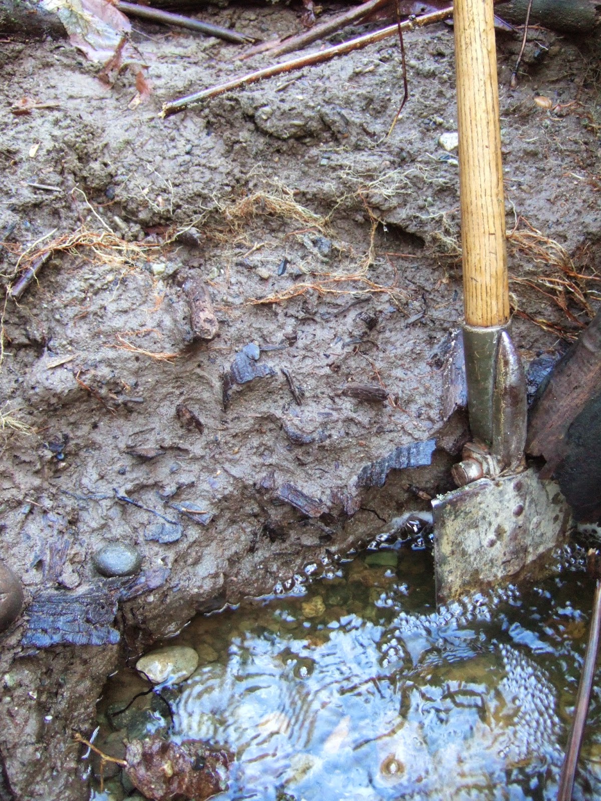
On a lighter note while beaver dam removal requires an HPA, beavers have been building dams without HPAs or without obtaining approved Ecology dam permits.

Thursday, January 29, 2015

Pond and Debris Flow: Beavers or Snow and Ice

This has been a week of contemplating beavers and the landscape. This first post is field work related. I hope to have another on a policy aspect of beavers later.
 
On Monday I ventured up a steep stream drainage in effort to assess the risk of debris flows that might come down the drainage. Assessing debris flow risk entails assessing the geomorphic features of the drainage - How stable are the slopes? What types of failures should be expected? How steep is the drainage? How much material can be incorporated in a debris flow coming down the creek? How large would the volume of water and debris that can become trapped with drainage blockages? 
 
This particular creek had a debris flow approximately 10 years ago. So another thing to look for was the source of that debris event. What caused the debris flow 10 years ago?
 
I had been told via very indirect sources that it was caused by a beaver dam failure. A causation that I was highly skeptical of given the steepness of the drainage and the numerous waterfalls. I made my way up the creek to points where there was no surface water flow including side drainages. No indications of beaver, but a few shallow surface slides.
 
However, at the very top of the ridge hundreds of feet above the uppermost stream flow was an unexpected nearly level area with a pool of water 200 feet long and 40 feet wide.
 
Pool of water and outlet lip at the end of the pool
 
Some subtle features indicated that the pool of water had formerly been deeper and other features suggested that on occasion the pool may overtop and flow via surface water flow across the slope towards the steep drainage below. Soil had been eroded off of the forest floor below the outlet area of the pool exposing tree roots on the slope between the pool and the upper drainage below suggesting that some time in the past a strong flow of water had coursed across the slope.

Bare roots exposed along swale below the pond

Bare roots of western red cedar along swale between pond and drainage

View of subtle swale with no current water flow

Area below the swale towards steep drainage with uprooted tree
Further down there were areas of soil stripped away down to the flowing stream below
 
Besides this toppled tree, we noted other crater like features on the slope suggestive of other root throw divots along this area where the trees long ago had rotted away.
 
I am still not convinced about the beavers being the cause. Lack of beaver cut trees is one bit of evidence I would need to see. An alternative explanation would be the pond filling with snow and freezing and then having ice and snow block the over flow outlet during a heavy rain on snow event and then suddenly releasing a surge of water.
 
Regardless, the pond appeared to be a good candidate for a large surge of water that would flush large wood accumulated in the drainage down the creek and onto the alluvial fan below. Outside of the pond, no landslide scars were present that were large enough to have generated the scale of the event from 10 years ago that flushed so much very large wood out of this creek
 
The piles of wood left by the event 10 years ago are still present although a bit hidden by the new growth of red alder covering much of the fan surface.
 
Woody debris pile from debris flow/flood

Typical stream flow could not have transported the wood that now lines part of the lower stream on the alluvial fan. Some of the logs were 4-foot in diameter.

Wednesday, January 28, 2015

January Woolly Bear Catepillar

Washington State is enjoying San Diego-like weather. This has been particularly true above the lowlands where cold air tends to settle. On Monday, Bob and I investigated a debris flow which entailed making our way up a steep drainage to a ridge summit at 2,800 feet. It was a very steep climb.
 
During a short break we found ourselves in a small cloud of mosquitos at 2,000 feet. Just below the summit ridge we came across this woolly bear caterpillar.
 
 
Bob noted the woolly myths/folk tales (http://www.crh.noaa.gov/arx/?n=woollybear). This particular woolly was traveling northward indicative of a mild winter and the color pattern suggests a cold first half of winter a warm spell and a late short cold bit. Of course another way to take this since this woolly is a January woolly. As such due to the northward travel direction the spring will be warm but the coloring indicates that the first half of spring will be cold.

Busted myths aside, seeing a caterpillar at 2,800 feet in January where normally there would be snow is rather remarkable.

Another side effect of the warm weather is how thirsty I became from sweating heavily in January without carting a bottle of water.
 

Tuesday, January 27, 2015

Sam Crawford to Leave Whatcom County Council


I saved this picture from a post Sam Crawford put up a bit over a year ago. It captures what being on the Whatcom County Council could be like. This particular meeting had a big turn out for folks on an issue that was not on the Council agenda. The picture also captures the scale of work that was on the agenda with the thick Council packet in the foreground.

Whatcom County has the only part-time legislative county government in the State. The part time nature of the work presents some challenges to work outside the County Council work. Sam apparently has a work opportunity that would not allow his continued staying on the Council so he is leaving the Council before his term ends.

I worked with Sam for eight years. While our views of land use regulations differed and Sam was a bit trapped like many County leaders by the Growth Management Act, I found Sam to be a very good council member. He provided outstanding and very insightful leadership on environmental issues outside of the regulatory and growth management realm. For example he was a steadfast supporter of the Lake Whatcom Reconveyance (one-of-reconveyance-heroes-sam-Crawford) and he took bold positions in supporting some critical services not normally expected from GOPers (whatcom-county-mental-health-back-story).  Those two positions alone were legacy type votes where he put political tribalism aside and made Whatcom County a better place.


Monday, January 26, 2015

Bicentenial of the Geologic Map

People have been studying geology in some form for a very long time. But 2015 marks the 200th year of what is now a standard of geologic practice: the geology map. I got a close look at the first geology map back in 2012 and thought the bicentennial of William Smith's breakthrough accomplishment is worth another look. http://washingtonlandscape.blogspot.com/2012/10/the-first-geology-map-surpise-at-tate.html

Sunday, January 25, 2015

Field Work: Incised Stream/Landslide Deposit

I recently spent some time slogging around a ravine with a small creek. The creek was incised down into a narrow channel with vertical sides of up to 5 feet over a 200-foot reach. Not a stable stream channel and thus suggesting  a change had taken place. 
 
Narrow stream with over steep banks

Stream has cut down under tree roots

Increased stream flow can cause this type of erosion, but in this case it is the stream breaking through a landslide deposit that had previously filled the ravine. The deep erosion channel was progressing up the stream from the lower end of the stream as the stream flowed down over the landslide deposit.


Buried wood in the landslide deposit exposed by stream erosion


Saturday, January 24, 2015

Deer Demographic Shifts

Our views of wild animals ranges widely. I will simply say that I was surprised when I saw this in an urban neighborhood.
 

The attraction to urban living for these two is evident. My understanding of deer biology is not deep enough to reach any conclusions as to feeding, but I will say my own personal values put my vegetable garden well above my tolerance for deer.

 My own anecdotal take is that the deer population in Bellingham has been increasing with deer presence in even the most urban locations including occasional passage through downtown. Deer are very common in Port Townsend (urban-herbivores). Orcas Island deer populations are having a visible impact on the landscape as the deer prefer Douglas fir to lodge pole pine (lodgepole-pine-on-orcas-island) (deer-doing-bonsai).

Elsewhere around the United States deer populations have surged in populated areas. A few communities have begun culling programs as deer populations within urban areas were exceeding the tolerance of the humans. For example the sand dune areas of northern Indiana had deer populations exceeding 300 per square mile. Remarkable change given that the deer population had been completely eliminated in the early 1900s.

Regardless of ones personal or scientific view of feeding deer, the deer population change is a reminder that nature is not static. While I noted the deer pressure on Douglas fir seedlings on Orcas, the presence of high deer populations in areas where they were not formerly present will likely lead to other changes.  

Wednesday, January 21, 2015

Risk-Based Land Use Canada

New Westminster, BC and the Fraser River

I'm presenting a short talk on lessons learned or not on landslides at a Risk-Based Land Use Workshop. The workshop is associated with a Risk-based Land-use Guide: Safe Use of Land, Based on Hazard Risk Assessment (Geologic Survey of Canada Open File 7772). Being non Canadian, I am coming at this as a bit of an outsider which means I am learning a lot.

As for lessons I am pushing: landslide run out and LiDAR.

Debris flow run out, Whatcom County, Washington

LiDAR generated DEM of river valley and landslide deposit
 

Tuesday, January 20, 2015

Deer Wrap Timber Sale Put on Hold

Yesterday's post HERE was in part to provide a wider context to the Seattle Times article (Timber sale on hold) on the proposed Deer Wrap timber sale that I knew was coming.

The article confirmed that the timber sale was put on hold pending further review. As I noted yesterday it is not possible to assess the potential landslide risk of the slide areas that appear in the LiDAR. That will take some on the ground work. It is not clear how much of that has or has not been done. The forest practice application did not include any geology reports.


The DNR does have some flexibility in this case. As the applicant DNR can easily decide to hold back a forest practice pending further review. In this case the public oversite has helped. Possibly the mark up of the LiDAR by a geologist helped.

Monday, January 19, 2015

Glacial Deep-Seated Landslides and Forest Parctice: One Example Near Index, Washington

The Washington State Department of Natural Resources (DNR) issued a mitigated determination of non significance (MDNS) for the Deer Wrap timber sale on January 12, 2015. The proposed timber sale is on DNR managed trust lands and the sale would, if a high enough bid comes forward, generate revenue to the state and local governments (Snohomish County in this case). The proposed timber sale area is presented on the map below and this map and related documents including the MDNS can be found at http://www.dnr.wa.gov/ResearchScience/Topics/SEPATimberSales/Pages/amp_sepa_nw_ts_deerwrao_feb.aspx.


The City of Index and the Forest Law Center submitted some comments during the SEPA (State Environmental Policy Act) comment period. The comment period on these proposals is rather short. In this case DNR responded to the comments and then issued the MDNS.

One of the concerns raised was that the DNR's own geology maps included a large landslide feature just below a portion of the proposed harvest area. The Forest Practices Board very recently passed new Forest Practice Guidance for timber harvests in areas that are considered groundwater recharge areas to deep-seated glacial landslide areas. This was in part and certainly sped by the Oso/Hazel Landslide.

The DNR geology map appears to be based on the Skykomish 1:100,000 Geologic map by Tabor and others (1993). I marked up the Skykomish map to illustrate a few pertinent features: the proposed harvest, the mapped landslide area, the edge of the Puget ice lobe which blocked the Skykomish River forming a lake, the location of the lake outflow, and the location of a nasty landslide that took place last winter, as well as a personal life note.
 
Part of Skykomish Map (Tabor and others, 1993) marked up
A few units: 
Ql = landslides
Qvr = glacial recessional outwash
Qvgl = glacial lake sediments
Qa = alluvial
other units are bedrock

The Skykomish Map included previous work by Booth (1990) on Quaternary deposits and land forms. That earlier work provided a detailed mapping effort that better mapped the drainage impacts of the Puget ice lobe on the mountain front on the west side of the Cascades between the Skykomish River and the Snohomish River. The Booth map shows the same landslide area but a bit more detail on the glacial units.

Part of the geologic map by Booth (1990)

Booth (1990) mapped and described how the Puget ice lobe blocked the Skykomish River and the outlet to the river flowed through now abandoned river valleys south to the Snoqualmie River. The Puget ice lobe flowed up the Skykomish and blocked the river near Index and the outlet to the river as well as lots of water flowing around the margin of the ice lobe flowed south through the pass marked on the Tabor and others (1993) map above.

Below is a marked up DEM showing how that blockage might have looked.


Booth (1990) indicated that a portion of the outlet flow along the ice margin would have been below the ice and during the maximum ice extent that is most likely to have been true based on DEMs of the area.

Booth (1990) mapped the area without the aid of LiDAR. The more recent LiDAR imagery has provided even better resolution and reveals a more refined image of the landforms in the vicinity of the proposed Deer Wrap timber sale. Kara provided me a LiDAR image of the mapped landslide area.

The landslide area based on the DNR map is outlined in orange. Based on the LiDAR it appears that the slide area is not a single landslide but multiple deep-seated landslide features of smaller scale than a single massive landslide covering the whole area.

I marked up an outcrop of bedrock that cuts across the slope. The LiDAR suggests that a layer of glacial outwash sediments overlies the bedrock on the steep slopes. The scalloped terrain above the bedrock outcrops suggests a number of convergent landslide scarps that extend to the top of the steep slope. The fluted landscape above the landslide area appears to be a river flow path which would be consistent with water flowing around the margin of the Puget ice lobe. Booth mapped the area to the west as being underlain by glacial moraine, and the LiDAR imagery appears consistent with that interpretation.

It is not possible to assess the potential landslide risk of the slide areas that appear in the LiDAR. That will take some on the ground work. It is not clear how much of that has or has not been done. The forest practice application did not include any geology reports.

The new Forest Practice guidelines for these types of slide areas suggests that geologic assessment evaluation should be provided in regards to potential impacts from increasing the groundwater flow to the slide area(s) as a result of loss of tree canopy and water interception and transpiration. It is my understanding that the DNR may have withdrawn the sale and is reevaluating or will provide a more detailed assessment of this area.  

Friday, January 16, 2015

Tree Rings Again

Another post on tree rings. A comparison of Douglas fir from a sandy east facing slope near sea level and one from an overall southwest aspect but a flat location shows marked difference in growth rate. I estimate the trunks to be about the same but I did not nail the size and the hands for scale are from different humans.  

Douglas fir - sandy soil on Camano Island

Douglas fir - bedrock on Orcas Island

Tuesday, January 13, 2015

A Madrone Forest and other Orcas Island Observations

I did some more tree ring counting notes-on-tree-rings-and-old-forests and again on Orcas Island. This rather modest diameter Douglas fir trunk on the southwest side of Mount Constitution had approximately 100 rings.  


The small diameter but old age does cause me to wonder about the age of stands of large Douglas firs that are scattered about the island.

Old growth Douglas fir

The more interesting aspect of my ventures was finding myself in a forest stand where the predominant tree was Arbutus menziesii.   


Mount Constitution is not a dry spot. While it shares the alignment of other dry areas in the Olympic Mountains rain shadow, it is a bit too down wind and subject to weather events approaching from elsewhere. Its sharp rise above sea level also enhances rainfall locally. However, soils are very thin with shallow bedrock and hence water retention is limited creating a bit of a dry like habitat despite the 40+ inches of rain on parts of the peak. Being on a southwest facing slope added to the dryness. Good habitat for the madrone.

But this forest stand of  Arbutus menziesii also benefitted from anthropogenic forces.

Douglas fir stump

I suspect that the madrones were present prior to logging, but post logging allowed the madrones to flourish over a larger area.

The appeal of this tree is sometimes easy to see. Or perhaps the appeal is simply that its bark habit is so contrary to most trees.

The tree was well established with lots of seedlings.

Arbutus menziesii and lodge pole pine seedling

Of course my purpose was geology so I had to check out the slopes and the bedrock. This is an area of Orcas where the geologic formations are a bit chaotic as units are shuffled in a series of thrust faults. In this case the bedrock was mostly Turtleback Complex with a bit of East Sound Group. Alas, despite the large number of outcrops the exact contact was obscured.


Sunday, January 11, 2015

Homefield Advantage: Negative Gravity Wave

This time of year there is a routine of measuring anthropogenic seismic events in Seattle. Another home field advantage appears to be episodic negative gravity waves.
 

Saturday, January 10, 2015

Anderson Glacier is Gone

Mauri Pelto notes that Anderson Glacier in the Olympic Mountains has melted away anderson-glacier-olympic-mountains-washington-disappears/.
 
Olympic National Park has an interactive glacier page showing various glaciers in the park over time http://www.nps.gov/olym/naturescience/interactive-glacier-map.htm. The disappearance of the Anderson Glacier has been rather dramatic. The 1960 to 2010 comparison shows a sharp contrast between Anderson Glacier and the nearby Linsley's Glacier. Particularly striking is the Linsley's Glacier as well as nearby snow fields are essentially identical in the 1960 and 2010 images.
The 1936 image of Anderson Glacier shows that Anderson Glacier was not a small glacier.

A note on the 1936 photograph. Ashel Curtis was Edward Curtis' brother and his work in the mountains and in Seattle has and continues to be of importance for understanding the changes to Washington State.

Anderson Mountain had three glaciers. The other two glaciers are still in tact. The Eel Glacier is oriented to the north and its accumulation area is higher than the former Anderson Glacier. The Linsley Glacier is oriented to the south but also has a higher elevation accumulation area than the former Anderson Glacier. The few hundred feet has made a considerable difference as the climate warmed.


Friday, January 9, 2015

2014 Was #1

A bit of a lag as folks crunch and verify numbers, but Japan's Meteorological Agency has 2014 as the warmest. I was never very impressed with the "pause" arguments. Getting worked up about steep increases or declines after large peaks looses site of the long term trend line. We do not need drama to plot out a steady trend line and one year ought not to make much difference.


But people do like extremes and 2014 looks like it is going down as Number 1. From a public dialog perhaps it will put to rest the spin that it has been cooling since 1998. I do suspect there will be new fascinating creative spin on what 2014's record means from deniers. And the anti alarmists will get upset with those that will blame every weather event on the new global year record. Regardless, the trend of warming is continuing towards more consequences that await.

And do not forget that much of the global heat budget goes into the oceans (greater than 90% http://www.climatechange2013.org/images/report/WG1AR5_Chapter03_FINAL.pdf). Good thing Earth has all that water or we would be getting toasty fast. Of coarse a fair bit of CO2 goes into the oceans as well - and yes, calling it acidification is OK; although that might not fully capture carbonate content consequences ocean-co2-yes-it-is-alarming.

Thursday, January 8, 2015

Technical Upgrades and the Old Days

I am going through some technical upgrades at work. The march of software upgrades and new systems always catches up with me if enough time goes by and it was time to change my ways.   
 
A friend recently had an old electronic tool die. I remember once lusting after various calculators and it brought back memories of various points in time and how things were done.  
 

My first calculator was identical to the one below. It was heavily used for many years but eventually I abandoned it due to a technical advances which are present in the upper calculator. The back breaker was the shift to a lower energy display. The old one needed frequent battery replacement and eventually the lower costs of calculators made replacement a cheaper option than the frequent purchase of batteries.


Tuesday, January 6, 2015

How to get Geology of the San Juan Islands by Ned Brown

I previously posted on Ned Brown's Geology of the San Juan Islands geology-of-san-juan-islands. While the book is locally available in Bellingham and in the San Juan Islands, it is now available to more distant readers can get the book via Village Books by ordering :http://www.villagebooks.com/book/9780989289139.

Anyone interested in accretion tectonics or global plate movements over 100s of millions of years should have a copy of this book.  

Thursday, January 1, 2015

Arbutus menziesii 223 years after Menzies

Archibald Menzies was the ship naturalist on the Vancouver Expedition aboard the ship Discovery.  
After the ship anchored at the north end of what was later named Port Discovery in May 1792, Menzies was part of the crew that rowed to the south, upper end of the bay. There he landed and made numerous observations and notes, including describing trees:
 
"Besides a variety of Pines we here saw the Sycamore Maple (big leaf maple) - American Aldar (red alder) - a species of Crab & the Oriental Strawberry Tree (Pacific madrone), this last grows to a small Tree & was at this time (May) a peculiar ornament to the Forest by its large clusters of white flowers & ever green leaves, but its peculiar smooth bark of reddish brown colour will at all times attract Notice of the most superficial observer."
 
Menzies was already familiar with the tree as the "strawberry tree". Juan Crespi described the tree in his diaries during the first Spanish land exploration of what is now California in 1769. Crespi is credited with the term madrone as he called the tree a madrona and noted its similarity to the strawberry tree of his childhood in Spain. (Crespi later was aboard a Spanish Ship that sailed and explored the west coast of North America including Vancouver Island and observed and described the glacier clad slopes of Mount Olympus on the Olympic Peninsula.)
 
Menzies recognized the tree as an Arbutus and later the tree was named after him with its official name Arbutus menziesii.

Having recently been reading Menzies' journals it was fun to see Arbutus menziesii clinging to the bluff edges above the shores of Discovery Bay where Menzies first described it.

Arbutus menziesii on bluff edge

Arbutus menziesii on bluff edge
 
This is not a madrone, but it was my "tree of the day"
 A red alder clinging to scarp edge of landslide scarp
 
Port Discovery's location on the northwest rain shadow side of the Olympics provides an ideal habitat for Arbutus. There are a few places in the area where the tree is the dominant species in small patches of forest. The tree does well on the edges of steep slopes where it can get sun and slides have taken out the competing Douglas firs. The red alder shown above likes the some what wetter silt/clays on the bluff slopes.