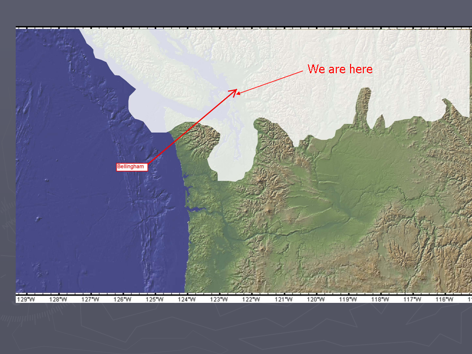
I gave this talk on Samish Island this past week.
Geology map of the Bellinghan 1:100,000 Quad (Lapen, 2000)
Note that I was a bit hesitant to discuss the Jurassic on Samish because it is very complex and there are still a fair bit of story that is not understood. But really old stories tend to have a lot of missing information.
Jurassic formations in the interior of North America and desert areas are structurally simpler than the Jurassic formations in northwest Washington. There is however a lot missing in the geology story shown in the picture. Erosion has removed millions of years of sediment and multiple formations that were formerly above these Jurassic age formations.
Jurassic formation in northwest Washington
This study also provides a good summary of the Darrington Formation on Samish and also gets into details regarding the metamorphic fabrics and kink fold development in the phyllite
Impress your friends by pointing out kink folds
Ned Brown (2017) provided this figure for the depositional setting of the Darrington Phyllite.
Getting this story out of the Easton Suite took years of work by Ned and many of his grad students.
There are still unanswered questions and more work to be done.
This map shows San Juan - Northwest Cascades accreted terranes as well as some of the accreted blocks to the east (Brown and Dragovich, 2003). The Easton Suite is the green with hatched areas indicating Darrington Phyllite added by Dunham (2010)
View of Blanchard Mountain from Samish
Darrington Phyllite and other rocks in the Easton Suite can be viewed along Chuckanut Drive along the base of Blanchard from the Samish Flats to just past Oyster Creek.
Map is from Dragovich and others (2002) showing a simplified map of northwest Washington.
Most of the units shown on the map area accreted terranes.
Large swaths of northern Washington State nearly to the Idaho border consist of accreted terranes added onto the western edge of North America.
Some of the terranes including the Easton likely were accreted well to the south and then were displaced northward to their current position. This multiple process of accretion and then displacement resulted in the very many deformational fabrics in the Darrington Phyllite that is found on the west end of Samish Island.
Note that if people were present along the coastal areas of North America during the last glacial period, those occupation sites are now under water.
Map from Greenburg and Haugerud video.
As glacial ice approached Puget Sound sea level was lower and what is now Puget Sound may not have existed at that time but may have been filled in plain of rivers (more on that later)
A modern model of the Puget/Juan de Fuca ice. A large tongue of ice flowing off the high ice sheet to the coast of Greenland.
First slide of isostatic loading.
The thick ice (5,000 feet) pushed the local land surface down hundreds of feet.
Note the depressed area in front of the ice.
Another Greenland analog. Large volumes of sediment entering the water from rivers of water that flowing under the ice.
The sediment that was in the rivers flowing out the ice front and deposited can be seen along the south bluff and north bluffs on Samish Island. The lower silt was in a lake setting when the ice was still far away. As the ice got closer the shorter flow distance results in sand and in this case gravel. The large angular piece embedded in the gravel is a rip up clast of mud ripped up by the fast moving water.
This is from the bluff on the north side of the island northwest of the Wharf Street access.
The same scenario, but this material is very dense and hard and I suspect that it is from an earlier ice age.
Eroding bluff on the south side. Note the forest n the bluff. The bluff is underlain by sand and gravel and faces south and Samish is at least partially within the rain shadow of the Olympics. This forest is a a relatively rare forest in this area.
The forest is mostly oak
This is a glacial sediment that most of the upland Samish folks are familiar with.
Dense and hard silt and clay with rocks. Glacial till deposited directly by glacial ice.
Working the glacial till soil is difficult
Extent of ice during last maximum
Note that glacial ice is flowing up the valleys
Glacial ice in the alpine areas may have shrunk back due to the drier local climate as the large Puget ice lobe advanced south.
Another Greenland analog
Dirty ice with water pooled on the ice sheet.
Where does that meltwater go?
Water flowing out of the Puget ice lobe flowed out of multiple channels and carved the Chehalis River valley. But note too that the water flowing under the ice was a powerful erosion force, The subglacial water flow excavated out ay of the deep waterways of Puget Sound and the Salish Sea.
This shows that the ice lobe blocked off the Skagit River and the Stillaguamish. Glacial ice that flowed over the North Cascades from the north eventually made it down the Skagit and Stilly. The lake deposits from this period were and are eroded by the rivers and have resulted in large landslides. Oso being the most recent.
Not a Samish Island feature but nearby on Whidbey Island.
As the ice melted out of Puget Sound the ice margin was stationary for a length of time at Coupeville leaving behind a moraine and a bunch of pits (kettles) in the ground.
Modern analog from coastal Alaska
Note that ther are trees growing on the glacier. As the ice melts under them pits form.
View of Whidbey Island. The depression on the bluff is where the bluff intersects one of the kettles
Kettles in Whatcom County
Note that there are no kettles on Samish
Reminder about the 5,000 feet of ice pushing the land down
When the ice thinned and melted away from the Samish Island area Samish Island was below sea level. The thick ice had pushed the land down and sea water then covered the area. There may have been floating ice over the sea at that time.
Glacial ice lingered longer in Whatcom County. Note that the ice in Whatcom County blocks the Nooksack and Chilliwack Rivers sending water (blue arrows) south along the South Fork Nooksack drainage valley and into the Samish.
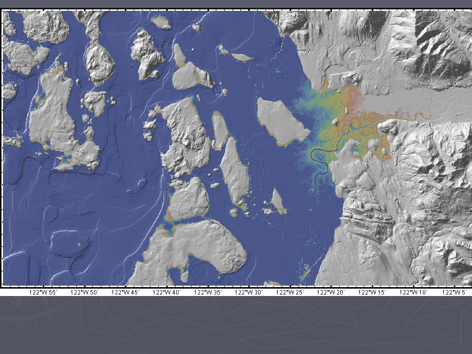
DEM of Samish River valley just east of I-5
The water directed into the Samish was a big river. The present day Samish did not form this big valley.
Lidar image of part of Samish Island, Post ice age, the land rebounded from the ice loaded and Samish Island rose up out of the sea becoming an island. As the land emerged very subtle shoreline strands were formed on the land surface.
Initially Samish Island was well out in the water. Sediment from the Skagit River has and still is resulting in the Skagit delta growing out.
DEM of the delta today. Orange and yellow show the thickening sediment deposited by the river on the delta as the river has shifted discharge locations over time. Blue areas are part of the distal parts of the delta and are below high tides except that the dikes around the outer edge of the delta hold teh water out.
Sediment inputs from the various rivers into the southern Salish Sea (USGS). Note that the Skagit is the biggest sediment supply, but also note that the smallish Nooksack also has a large supply. Why are these two rivers dumping so much sediment. Both are flowing of of areas with lots of glaciers but there is also another big source in the Skagit.
Glacier Peak viewed from Whidbey Island
Well up the in the Skagit watershed is a large volcano. I like to call it the sneaky volcano because it does not stand out like the other volcanos because it is back in the range with other high peaks obscuring the view from the lowlands.
Lahar hazard map for Glacier peak.
Mud flows associated with eruptions on Glacier Peak have sent large flows of mud down the Skagit and Stillaguamish. One mud flow in what is now the Stillaguamish resulted in the Sauk River changing course and instead of flowing down the Stilly valley now flows into the Skagit. Sediment from past mudflows from Glacier Peak underlie areas west of Mount Vernon and on the delta.
A future large eruption of Glacier Peak will result is some interesting challenges on the delta.
DEM of Samish Flats. Old Skagit channel heading towards Joe Leary Slough can be seen. Blue areas are low areas that would be inundated by tide water if not for dikes.
Those low areas are also susceptible to flooding when the river dikes break or are overtopped.
Samish Island on occasion becomes more island like.
The delta that is crossed to get to Samish Island is excellent farm land as long as the tide water can be kept out and the soils drained earlier enough to work the fields.
Blueberry fields on the delta
I love the credit that geology gets in shaping civilization, but think that if we understand the geology better we realize that there is plenty of notice. Perhaps a new quote could be be derived from how well does a civilization respond the the notices.
A couple of recent notices.
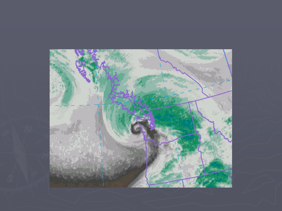
Low pressure approaching the Strait of Juan de Fuca with intense winds circulating around the low.
Vapor image of low near the entrance of the Strait of Juan de Fuca
Storm surge tide (green) compared to predicted tide (blue) at Port Townsend. Storm added 2.5feet to the tide elevation.
The December 27, 2022 storm surge at Port Townsend.
This storm coincided with a very high astronomical tide (king tide).
Seawater flowing over the dike east and road on Samish Island Road on December 27, 2022
In addition to tide surge, the relative sea level of the area is expected to increase. Chart derived from Lavin and others (2019) reflects the local relative sea level rise chances. The table takes into account local tectonic uplift, but it might not reflect the localized delta changes.
Shore erosion and slides working up the slope below Samish Island Road
Tsunami inundation map from DNR showing talk site inundation of 4.5 feet.
Per a request I have two pictures of landslides resulting from yard waste placed on the top of steep bluff slopes.