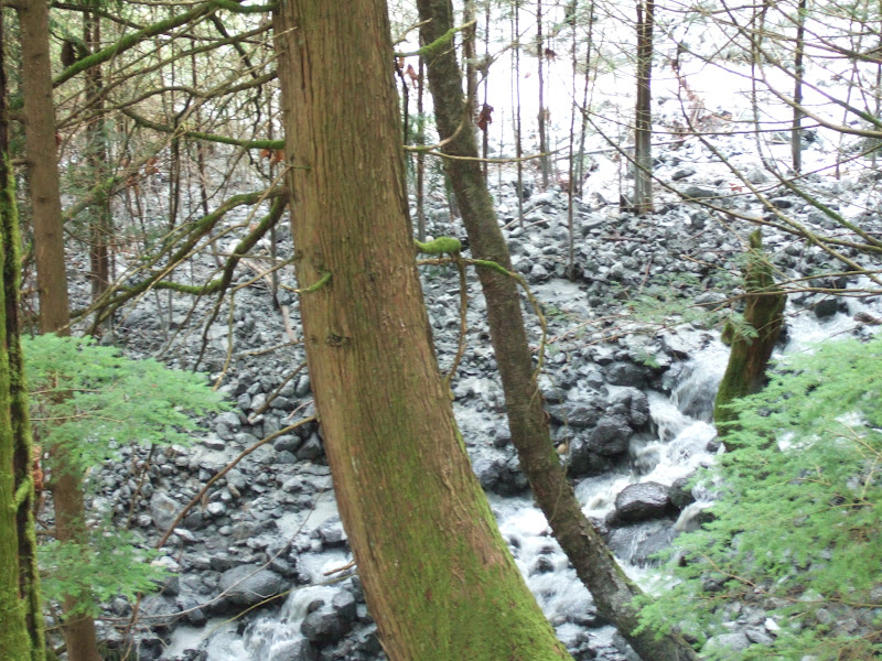
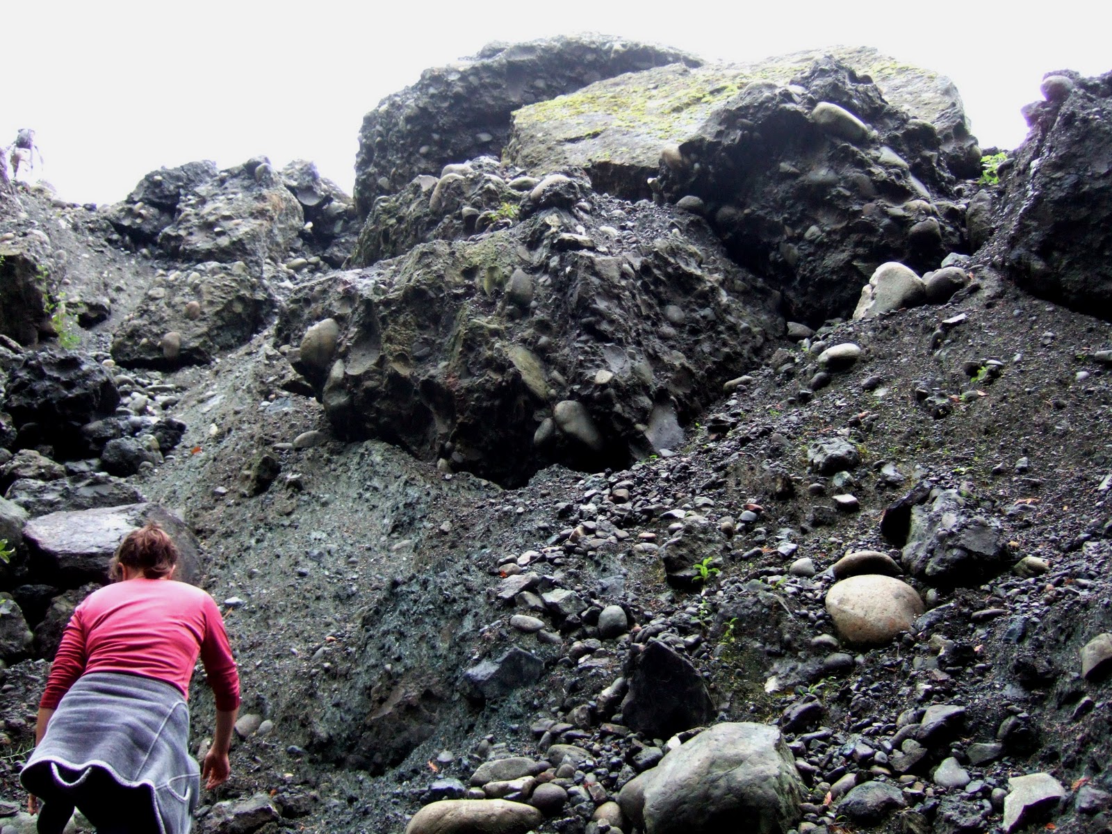
Showing posts with label Swift Creek. Show all posts

Saturday, April 8, 2017

Swift Creek Landslide and Creek Update

The Swift Creek landslide  continues to present challenges to Whatcom County Public Works (Click on the tag at the bottom of this post to get all the previous posts). The bridge at Oat Coles Road has been removed. The bridge was removed to prevent it from being damaged and to minimize the flooding that would be caused by the bridge causing a blockage of the sediment filled creek. The County is planning to put a one lane bridge with a control light to allow access for local traffic.


Flood waters can cause problems, but at Swift Creek the problem is even worse because the sediment carried by the creek contains asbestos form minerals. Hence, the effort to minimize the flood potential. The bridge is located nearly 2 miles from the landslide.

Swift Creek with landslide area outlined in red

Dredge spoils on both sides of the creek viewed from the north

It is hard to capture the scale of this problem. And it is a problem that will not be going away. The slide shows little sign of stopping. Linneman (2016) estimates that the main body of the slide is moving at 2 to 4 meters/year.

The Washington State Senate has included $5.5 in its current budget for Swift Creek. Two years ago the money was in that State Budget proposal but got pulled at the last minute by the local State Senator Doug Ericksen in favor of directing money elsewhere. The budget process is not over for the state, but for Whatcom County the news is so far good.   

Friday, September 11, 2015

The Swift Creek Fix: Maybe Next Year Mr. Ericksen?

Ralph Schwartz did an article (bellinghamherald.com/news/local/article) on the Swift Creek funding issue and State Senator Doug Ericksen. I had been critical of Washington State Senator Doug Ericksen (washington-state-senator-doug-ericksen) and his failure to keep funding for Swift Creek project in the last state budget (click on the Swift Creek tag to read up on the Swift Creek problem). In my post I put forward that Mr. Ericksen failed his district very badly and intentionally during the last legislative session.

Ralph Schwartz gave Senator Ericksen  a chance to explain. Mr. Ericksen is a very good politician and did a brilliant job. He dismissed my criticism "as an attack from the political left". This is a good approach particularly in his district which is very heavily GOP. He further explained that funding of the Swift Creek project got bumped in favor of a potential fix to the City of Lynden's water rights troubles (I should add that he also added funding for a project in the City of Bellingham that the City of Bellingham did not actually seek). This position of priority to Lynden is also politically smart as far more people live in Lynden than the sparsely populated farmland along Swift Creek, and Lynden was clearly seeking Mr. Erickson's help. Politically giving Lynden priority is the smart political thing to do. Whatcom County was also clearly seeking help with Swift Creek. Mr. Ericksen had to make a tough political calculation and he picked Lynden (that is assuming that it truly was an either or situation). One could speculate that he does not want to help out the County politicians - Whatcom County Council are not of his party and he lost an election for County Executive to the current County Executive.

I by no means am being critical of Mr. Ericksen's political decisions. Politics is not easy and I actually admire Mr. Ericksen's skill. He is far better at it than I ever was. That said, part of being an activist is trying to make your political leaders bend to your way of thinking. Easier if you are in their political tribe. Difficult if you are of the other tribe. In this case I am clearly in Mr. Ericksen's mind of the Left Tribe and so my purpose must have been to attack him. However, it was not as an attack from the left but as a mean to simply say "Hey Doug, Why was the Swift Creek project funding removed from the proposed budget?"  

I will still suggest that Doug Ericksen got this issue wrong. I would note that Lynden has yet to design or begin permitting the pipe so the chances of the project using money in 2015-2016 is very very low. In the mean time the Swift Creek project was and is ready to go. Lynden has a variety of resources to solve the potential water rights problem they are in. State funding of one solution certainly is a big help. However, the property owners, farmers, businesses and the City of Nooksack (and potentially the  City of Sumas) along Swift Creek and the Sumas River downstream of the Swift Creek confluence really do absolutely need outside help. Federal regulations regarding asbestos have severely limited what can be done and is an unexpected changed condition with terrible consequences for those impacted. This is the single largest threat to farmland in Whatcom County.

I can only hope that Doug Ericksen will be true to what he said in the article and continue to work on solving this problem. The problem is politically simple: Don't alter the Governor's and State House budgets regarding Swift Creek in favor of other projects. Maybe next year?      

Saturday, August 8, 2015

Washington State Senator Doug Ericksen Fails to Protect Farms and Businesses

State Senator Doug Ericksen represents the 42nd Legislative District. The district covers most of Whatcom County minus a big chunk of Bellingham. The district is a mix of small towns with the largest area of farmland in western Washington as well as mountain slopes covered with forest land. Mr. Ericksen failed his district very badly and intentionally during the last legislative session.

Threats to farmland and timberland are often equated with development. However, by far the largest threat to farmland acreage in Whatcom County at the moment is the Swift Creek landslide. I've posted about the slide numerous times and even gave it its own label if you want to see all the posts.

The big problem with the Swift Creek landslide can be summed up with a few images:

Asbestos form minerals from within the landslide material
 
The landslide failure is within deeply weathered serpentinized bedrock that is full of asbestos form minerals. And there is a lot of landslide material sliding down the west slope of Sumas Mountain.
 
Lower end of Swift Creek landslide

View across the lower end of the slide

One estimate on the volume of sediment being delivered to the base of the mountain by this ongoing landslide is the equivalent of one football field buried 100 feet deep every year.

Swift Creek flowing across the Sumas Valley floor
 
The problem below the slide is that the low stream gradients on the valley floor cause Swift Creek's channel to become plugged with sediment. This presents a problem at stream crossings.

Swift Creek at Goodwin Road

And on farmland.
Dredge piles along the banks of Swift Creek

The above image can only partially capture the problem. So much sediment has accumulated that the creek bed is elevated above the surrounding farm fields.

There is another issue besides the asbestos. The sediment is derived from fractured serpentine rocks. This rock type has some unique chemistry and is well known wherever it occurs to be very hard on most plants. The metals ratio of calcium and magnesium cause plants to have problems, the pH is elevated and there is a lack of phosphate bearing minerals, phosphorus being an element essential to life.

Note the bare sediment piles in the images above. Nothing can grown on these piles. So besides the asbestos problem as a health risk issue, the sediment is essentially toxic to farmland soils. Notes on USDA soil mapping of the area mark areas that have been impacted by Swift Creek sediment from past floods caused by sediment filling the channel of the creek. With nothing being able to grow the sediment is subject to being blown about as dust containing asbestos fibers.

The extent of the problem is partially shown in this Google earth image:

 
Swift Creek empties into the Sumas River. The Sumas River itself is a slow stream flowing through an area of low gradients and the added sediment is causing reaches of the Sumas to fill with sediment. Flooding on Swift Creek and the Sumas River spreads sediment that is essentially hostile to life as well as full as asbestos fibers over farm fields, and where the Sumas River flows through Nooksack and further downstream through Sumas onto residential properties. 
 
For a period of time the county dredged the creek at no small expense and sediment from the piles was hauled off by locals for use as fill, for surfacing driveways and roads and in at least one case as a fill for a state highway embankment. A sawmill property on the north side of the creek became concerned about flooding and began a routine dredging operation to maintain the channel away from the mill site.
 
All that asbestos containing material being dug up and moved around eventually got the EPA's attention which led to the Army Corp of Engineers no longer issuing permits for dredging the creek. Permits have been issued on an emergency basis as there are major roads that would be closed and uncontrolled flooding and sediment deposition has been recognized as a major problem that would also pose a significant threat.  
 
This is where Doug Ericksen comes in. Whatcom County, the EPA and the Washington State Department of Ecology all recognize that the Swift Creek sediment needs to be managed. Allowing continued flooding and Swift Creek to flow unmanaged over large swaths of land poses a huge health risk and a huge economic loss to farms, businesses and property values. The old way of dredging and allowing the sediment to be spread with no controls is simply not acceptable under current federal law. After a lot of hard work and study an approach to managing the sediment was figured out and the governor put the funding in the State budget proposal to the state legislators. The budget item passed in the house with support by both 42nd house members Vince Buys and Luanne Van Werven.
 
Doug Ericksen is a high ranking State Senator with substantial authority. This should have been a no brainer, but the budget item for supporting the sediment management of Swift Creek was removed from the budget. Doug Ericksen did that and in that regard has intentionally failed his constituents. Whatcom County is left with a huge expense to maintain the creek flowing under the bridges and not burying large swaths of farmland. Several square miles of farm land are now at substantial risk of being lost. A saw mill on the north side of the creek will be at risk. A mushroom farm south of the creek is at risk. Those two businesses alone are over 100 jobs. The towns of Nooksack and Sumas are at risk and their growth plans now face uncertainty. Property owners face substantial loss in value of their land.   
 
I can only speculate on Doug Ericksen's motives. Perhaps he has allowed his ideology regarding environmental regulation to cloud his judgment. He presumes that the EPA rules on risks from asbestos are groundless and is willing to allow farmland, businesses, two small towns and property owners to suffer the consequences. Or he has simply been too taken up with his position of power at the State level to bother getting his head around a very real and major problem within his own district.
 
Regardless of the speculation as to Mr. Ericksen's motives or reasoning, he has very badly failed the citizens and businesses of a significant portion of the district he represents.    

Saturday, June 27, 2015

Swift Creek above Goodwin Road and Short Update

I stopped by Swift Creek in northern Whatcom County a couple weeks ago while heading elsewhere. I have several posts on Swift Creek that can be found by clicking on the label I assigned it. Whatcom County has a set of reports for those that want more info: http://www.whatcomcounty.us/513/Swift-Creek. 
 
I took a short walk along the creek upstream of Goodwin Road. This reach like essentially all reaches of the creek has been agrading from the huge sediment load from the active landslide in the watershed and stream excavations have taken place to keep the stream passing under the Goodwin Road crossing as well as the Oats Cole Road crossing further downstream.
 
Sediment piles on bank  

Cobble of serpentinezed mafic rock starting to crumble as veins expand from wetting and drying

More sediment removal stockpiles.

The reach above Goodwin Road is gravel and sand but there are pockets of fine sediment deposition.
This is the bad stuff: fine grained and thus subject to getting in the air and full of asbestos form minerals as well as poor chemistry for plant growth. 

Whatcom County has been doing extensive planning on mitigating this natural slow disaster that has broad land use impacts. A proposal has been developed for building sediment capture basins. That scheme has funding in the Governor's budget and was funded in the State House budget. Funding was not in the Senate budget in May, but I have not been able to confirm if that still is the case. 

Wednesday, April 16, 2014

A Few Deep-Seated Bedrock Landslides in Whatcom County

Shortly after the Oso/Hazel slide John Stark with the Bellingham Herald contacted me and asked if Whatcom County has any comparable landslide risks. In terms of likely imminent threat, there are no sites in Whatcom County that are directly comparable to the Hazel Slide in terms of size and pending risk. The Clay Banks (nooksack-river-temporarily-blocked-by-landslide, nooksack-river-blocking-landslide-notes, further-update-on-nooksack-river/clay-banks-via-DT, and more-on-clay-banksnooksack-landslide) has been the location of the largest slides along the Nooksack River, but its height is less than the Oso Slide and has more cohesion and is at least partially compacted.
 
That said, the steep mountain slopes of the more easterly part of Whatcom County hold plenty of potential smaller but still very hazardous landslide and debris flow risks. 
 
And then there is the fact that even bedrock mountain slopes do fail, and the Northwest Cascades of Whatcom County have had plenty of deep-seated bedrock landslides. While the risk of a large catastrophic bedrock failure event taking place anytime soon is low, the extent of the slide deposition area does warrant some long term planning considerations.
 
So a bit of LiDAR to illustrate a just a few.  

South end of Sumas Mountain

Sumas Mountain has very large deep seated bedrock failures on all sides. The one above is perched just above confluences of the three forks of the Nooksack River. Clearly there has been some major shifting and block movement, but thus far no valley filling collapse. The bedrock is Chuckanut Formation sandstone and siltstone.

Large slide west of Kendal

This slide has been well know as it shape is clear even without LiDAR on topographic maps with its spectacular lobe protruding out onto the former glacial river outwash plain clearing showing it is a post ice-age landslide. This slide is on the east side of Sumas Mountain within Chilliwack metasedimentary rocks.


There are numerous landslides on this particular Mountain. The deposit of landslide debris is clearly post glacial and covers the lowest youngest part of the North Fork Nooksack River valley. This slide in Chuckanut Formation rock is one over several that have come off of the aptly named Slide Mountain.

Slide west of Glacier, Washington

This slide is also within Chuckanut Formation. Unlike the previous shown landslides, this one does not show up on the geologic maps. Its lower end blends together with a much large landslide deposit from Church Mountain. The North Fork Nooksack flood plan is incised into the valley floor with a elevated terrace covering the southern half of the valley floor. That terrace is a huge landslide deposit from 2,000 year old Church Mountain (fieldtrips/the-church-mountain-landslide).

The above shown deep-seated bedrock failures are all pre historic. But there are few examples of deep-seated historic bedrock failures in recent years in Whatcom County.

One of the more pressing problem slides even stars in a movie: WWULandslide/landslideCamTimeLapse.

Thursday, March 6, 2014

Congratulations to Scott Linneman with Clip of Scott at Swift Creek

Congratulations to Scott Linneman for his Carnegie Award as Professor of the Year. One of the percs of living in a university town is the chance to get some excellent continuing education. Scott has contributed to my being a better geologist.

The video is a nice clip of Scott and his students at one of my favorite natural disasters, the Swift Creek Landslide (go to labels on the side bar of this blog and click Swift Creek).


Thursday, May 17, 2012

Swift Creek Landslide Workshop


Swift Creek with dredge sediment along bank

Yesterday was spent at the University of British Columbia at the 3rd Annual Asbestos Workshop: Scientific Issues Associated with the Swift Creek Landslide and it impact on the Sumas River Watershed System.

First a few notes: the Swift Creek Landslide is a huge problem for the local county government, Whatcom County, its a huge problem for the land owners in the vicinity of the slide and is a major threat to the most intensive agricultural land in Canada. Lots of angles to this problems and the information at the workshop leaves a great deal to digest.

Still Considering the Source: Another Year of Morphometry at the Swift Creek Landslide.
Scott  Linneman,  Prof. Dept. Geology, Western Washington University
Scott Linnemann started us off with the current conditions on the slide and the questions he has been working on regrading the slide activity and monitoring. Based on his work the overall slide movement rate of the entire slide mass is on the order of 3 meters per year. Check out the movie landscapeobservatory/landslideCamTimeLapse
Preliminary sediment load and concentrations estimates from the Sumas River, April 2011 - April 2012. Chris Magirl, Research Hydrologist, U.S. Geological Survey, Tacoma WA.  
Chris Magril presented the struggles of estimating sediment loads from the slide at downstream locations. Measurements estimate 16,000 metric tons per year passing down the Sumas River. However, he noted capturing the extreme peak loads of turbidity has been difficult. He has also measured pH in Swift Creek of 9.1 with one reading this past April reaching 9.47.

Attempts to quantify Sediment Loads in Swift Creek.
Paul Pittman,  Earth Sci. Manager, Element Solutions, Bellingham
Paul Pittman presented his struggles with estimating sediment loads in the upper alluvial fan below the slide area. His work is an attempt to quantify the sediment loads both as turbid and sand, gravel and cobbles for sizing possible sediment capture basins. I visited his sampling site in April and observed the rocks bouncing through the constructed weir.
Sediment sampling weir at Swift Creek

Spatial & Temporal Changes in Water, Bed-Sediments, Suspended Sediments and Biofilms in the Swift Creek/Sumas River System.
Hans Schreier, and Julie Wilson, Faculty of Land & Food Systems, UBC.
This presentation had an intriguing observation that discharge on the Sumas River has been steadily increasing since the 1950s even though rainfall amounts have been very even and shown no increase. Schreier and Wilson also noted that the settling rate of the very fine sediment decreasing further downstream and that the pH decreases and Ca% decrease. We also learned about the challenges of testing biofilm development in a dynamic sediment environment and got an explanation of what those plate like features were that some us had observed in the creek.

How to measure Zeta-potential in sediment.
Beini Xu, Dept. Environmental Engineering, UBC
Beini Xu introduced us to zeta-potential in sediment. Presenting how polar like charges develop along the outer edges of
Beini Xu introduced us to zeta-potential and its role in brucite formation, one of the asbestos form minerals in the Swift Creek sediments. Understanding zeta potential is fundamental in understanding how and why the bructie develops along a curved spiral as well as an understanding of flocculation and brucite alteration.

Surface Characteristics of Asbestos fibers and Flocculation.
Les Lavkulich, & Hans Schreier. Profs. Faculty of Land & Food Systems, UBC
With our basics of zeta potential Les Lavkulich and Hans Schreier helped us through an understanding of the asbestos type fibers most common in the Swift Creek sediment. But more importantly some of the basics on controls for flocculation rates and noted that there are chemical/biologic controls as the sediment moves through different parts of the watershed.

Surface chemical properties of Chrysotile in the Sumas Watershed, before and after treatment with organic acids.
Emma Holmes, MSc. Candidate, Land & Food Systems, UBC
Emma Holmes gave us a bit of an overview of some of the mechanics at a molecular level that makes asbestos in the lungs such a nasty business. She also noted that chrysotile asbestos has a relatively short half life relative to amphibole asbestos 0.3 to 11 days compared to 500 days. After organic acid treatment, her studies indicated that the magnesium was heavily stripped from the outer layer of the brucite. Her work suggests that there may be some methods to reduce the toxicity of the fibers.

Organic acids and mixing zone

Progress in accelerating carbon sequestration within serpentine-rich materials. 
Ian  Power and  Prof. Gregg Dipple, Dept. of Geological Sciences, UBC
Ian Power has been evaluating CO2 sequestration at mine tailing sites rich in serpentine-rich sediments. Again the focus is on the controlling factors. For example Are there ways that to design mine tailing piles that will absorb CO2 more rapidly? Kind of nice to think of the Swift Creek landslide as a great CO2 sink. He and coworkers estimate that the mine tailings at Clinton Creek, BC have absorbed 160,000 tons of CO2. 

Comparison of methods assessing asbestos levels in soils at the Sumas Mountain                                    Asbestos Site.
The sequestration of CO2 by the reaction Mg2SiO4 (Mg Olivine) (or one could you ather Magnesium silicates such as brucite) + 2CO2 ---> 2MgCO3 (magnesite) + SiO2.  See Danae and others (2009) for an over view of site selection and Koukouzas and others (2009) for a bench study.  
Bill Barrett , US-EPA Cincinnati and Julie Wroble,US_EPA, Seattle.
Julie Wroble noted that activity based asbestos air sampling is very expensive and discussed other sampling methods to equate soil asbestos levels to the risk of air route impacts to people. The testing was done on a residential property recently purchased by Whatcom County adjacent to the creek.

One of the testing sites used

All in all a very informative mix of science coming at all sorts of angles.
One final note, everyone was greatly appreciative of Tom Westergreen. Without Tom access to the site would have very limited and complicated. His cooperation and support of many of the study efforts by allowing easy access to the site has made progress on the challenge possible, but he also puts a human face on the challenges that the Swift Creek landslide and creek presents to the public. Part of the plus of this gathering was the discussions in the van on the way up to UBC and back that included lots of interetsing forest and Sumas Mountain history from Tom. 

Thursday, May 10, 2012

Asbestos Sediment Piles at Swift Creek

I was out in the Everson/Nooksack area and stopped by the lower reach of Swift Creek. Whatcom County recently purchased a property adjacent to the creek in part to have a location to place dredged sediment from the creek in an effort to keep a road open. The following picture is the view of the most recent sediment pile from the former home site.

Dredged sediment near Swift Creek east of Nooksack, WA

The juxtaposition of the swing set and a large pile of asbestos containing silt and sand suggests that this purchase of land avoided more than simply a county stream crossing problem.

The volume of asbestos laden sediment that has been pile up along the creek the past few years is at a remarkable scale. The sediment will continue to come down the creek. 

Ridges of dredged sediment along Swift Creek viewed from South Pass Road

Swift Creek from Oat Cole Road bridge 

Cloudy water from very fine grained clay

Not all of the sediment is deposited and then dredged from the creek. Fine silt and clay continues to be carried downstream into the very slow meandering Sumas River. The Sumas flows north into Canada where the silt and clay poses problems to drainage in the farm land of the lower Sumas valley. The Canadian section of the Sumas River was formerly a lake and the maintenance of that lake requires pumping. The sediment loads cause problems for the pumps as well as the overall drainage systems of this high quality farm land.

View of Swift Creek and Sumas Mountain, the source of the asbestos sediment within the Swift Creek landslide


Monday, April 23, 2012

April 2012 Swift Creek Landslide Visit and Swift Creek the Movie

A surge of mud was reported at Swift Creek last week after a heavy spring rain Thursday. I joined Western Washington University geologists Scott Linneman, Doug Clark and Chris Suczek to check it out.
Our first stop was at the Goodwin Road bridge over Swift Creek. 


This reach of Swift Creek is agrading due to the huge sediment load from the landslide. The very milky stream is from finely ground rock from the landslide. This light colored clay sized material in suspension is full of asbestos fibers. Hence, maintaining the bridge has become a problem. The asbestos is natural, but legally becomes a hazard once handled. The asbestos laws did not anticipate anything like Swift Creek.

Our next stop was at a concrete weir that that was constructed near the outlet from the mountain front through which the creek flows through. 

The weir was built it monitor stream flow levels and also to monitor turbidity. The log in the picture has a laser that measures the height of the water and a turbidity meter is located within the stream. While the stream is very cloudy with clay to very fine sand, we noted that golf ball sized cobbles were bouncing through the weir during our visit.

From the weir we headed up to the end of the end of the gravel road and started our walk up the cobble and boulder lined creek towards the toe of the landslide. The cobbles and boulders in this stream will strain any petrologist or mineralogist. I have made this walk several times and it hurts my brain to think about not only all the mineralogy I have forgotten, but stuff I have never seen as well. The cobbles contain a diverse mix from the melanged slices of faulted deep crustal rocks that are part of this big bedrock failure, strange ancient soil horizon mineralogy that formed over the deeply weathered ultramafite rocks, various cobbles and boulders derived from the overlying Huntingdon Formation that is collapsing onto the slide, and various glacial erratics all jumbled together.

One of the first cobbles I observed is one that is familiar, a dark greenish to black ultramafite cobble with an orange weathered rind. This nearly identical unit of ultramafite underlies the steep slopes of the inner gorge of the next drainage to the south on Sumas Mounatin. It is a great example of just because a rock is hard does not mean that it will not disintegrate when exposed on the surface to weather.
After rolling and bouncing down the stream channel this cobble of hard rock has sat on the surface for a couple of years. I gave this rock a bit of a kick with my foot.


The cobble easily broke. Other boulders of the same rock type that rolled and bounced down the stream as coherent boulders can be torn apart with bare hands after only a year or two of being exposed to wetting and drying and freeze and thaw. A close look at the rock shows it shot full of veins of a white mineral. This is a classic serpentinized ultramafite only in this case the serpentine veins have been partially altered to a clay that readily breaks the rock apart.


While I have some familiarity with the above unit, I am not so sure about a fair bit of the other rock types out of the ultramafite. This rocks get a bit weird and includes white garnet and blue talc along with some very unusual magmatic differentiation. 


The ultramafite bedrock that is the unit causing the big Swift Creek landslide is Jurassic in age (145 to 200 million years). The ultramfic rock is overlain by a conglomerate unit of the Huntingdon Formation, an approximately 40 million year old sedimentary unit deposited directly on top of deeply weathered ultramafite at the Swift Creek site.

Outcrop of Huntingdon Formation adjacent to the very milky Swift Creek

We arrived at the toe of the landslide and I took the picture below from a location very nearly the same as the location as one in October 2011 (included for comparison).

Swift Creek slide, April 2012
One challenge of viewing this image is the stream of water flowing down the middle of the slide.
The stream is so turbid is blends into the adjoining soil.

Toe of Swift Creek Slide, October 2011 with no stream on slide surface

The shape of the toe was not hugely different between the April 2012 and October 2011 visits; however, a bit of the toe has gone missing - washed out and down the creek to the low lands below. A more noticeable difference was the material deposited across the forest floor to the south of the main creek channel. This deposit is a new deposit since my October 2011 visit and while there was one stream channel at that time there are currently multiple channels.


After our visit to the toe of the landslide, we headed up to the overlook. The trail up is very steep. Scott pointed out the trail down the cliffy forest including ropes to a platform site used to shoot ground based LiDAR imagery of the slide.
Trail to LiDAR platform
Scott Linneman looks out over the toe of the slide at remote camera site

This remote camera site takes pictures of the slide and has helped greatly in understanding this beast of a slide. See the movie HERE.

Wednesday, October 12, 2011

City of Nooksack Considers Swift Creek Asbestos Impacts

Back in July 2010 I posted on a proposal by Nooksack and Sumas to expand their growth areas into flood plain areas along the Sumas River floods-and-urban-landscapesl. Besides the flood risks there was also the fact that sediments deposited by floods on the Sumas River contain asbestos. I submitted comments and spoke at the County Council public hearing about this issue as well as few other urban growth issues.

After that public hearing both Nooksack and Sumas withdrew their request for larger growth areas and this week settled their dispute with the County by agreeing that they will work with the county on new plans for growth that will consider some of the concerns the two cities have regarding their growth boundaries.

Within in the concerns incorporated in the resolution stating the agreements was this for the City of Nooksack:

"Review of areas potentially impacted by Swift Creek sediment and associated risks, and consideration of proposed measures to manage or mitigate such risks."

and this very wonky issue:

Whatcom County Land Capacity Analysis Detailed Methodology to consider incorporating areas documented by Nooksack as being impacted by sediment from Swift Creek potentially containing naturally occurring asbestos (NOA) into the critical areas/sensitive environmental areas subtraction component of the land capacity analysis.

It is great to see the City of Nooksack is taking the Swift Creek issue seriously and will be be planning accordingly. Pretty great for such a small community.

Sunday, October 9, 2011

Swift Creek Landslide: Density Sampling at a Growing Problem

Thursday morning I ventured out to the active Swift Creek landslide. I have not developed a ranking system for landslides, but I am fairly certain that if one was devised, the Swift Creek slide would rank as one of the worst slides in Washington State. The Swift Creek slide is an act in progress and the situation and potential costs continue to get worse. The lower portion of the slide below the bedrock failure area has been moving progressively down the mountain slope in the Swift Creek drainage. I have called this badlands area whatcom-countys-desert in a previous post describing the slide and have posted a few other times regarding a number of big landslides on Sumas Mountain lidar-sumas-moutain. The slide has been and continues to slide down the mountain side in the Swift Creek drainage. The slide is now pressing well into a narrow canyon section of the creek and the unraveled broken up area continues to expand.

View of slide from the northwest flank of the slide toe area

View of lower toe area of the slide looking down toward Swift Creek
Kim Ninnemann and Scott Linneman contemplate the route ahead

View across the toe area of the slide
Scott Linneman and Ben Ferreira contemplate sampling sites

Southwest flank of toe area pushing into forest on the south valley wall
Kim Ninneman and Ben Ferreira traversing the slope

Part of Thursday's effort was to gather bulk density data on the slide. So we scrambled around to fresh exposures of the upper newly failing area and then the highly broken up sediment on the lower slide. Very dense blocks of bedrock within the slide are shot full of veins of asbestos form minerals and once the rock breaks out onto the slope it readily crumbles and weathers. In addition some of the "rock" has been completely altered to clay. It still looks like rock and retains many of the features of the original rock structure but is now clay.

Classic block of ultramafite crumbling apart

Breaking a block of ultramafite weathered to clay
Circle above hammer is a brass ring pressed into the "rock" for bulk density measurement

Highly fractured slide surface
Samples here were also relatively very low density 

The landscape of the surface of the lower slide really is a strange and different place to be on the side of a mountain slope in western Washington. It was though I was back in the bad lands of western North Dakota. Fortunately it was early enough in the wet season to be able to traverse the slope without getting stuck in the mud if one stayed alert to avoid wet areas. I only sunk into the mud to my ankles a couple of times. Numerous milky springs are located on the slide surface. The milk is suspended sediment that consists primarily of asbestos.

Milky white spring
extremely fine sediment coloring water is mostly asbestos

Longer asbestos form minerals picked up on the slide surface

Blocks of Huntingdon basal conglomerate collapsed onto the slide surface
The conglomerate was deposited directly onto the weathered ultramifite approximately 50 million years ago

At the very lower end of the slide, trouble brewing. The slide already contributes huge sediment loads Swift Creek, but the slide toe area has changed considerably since I was last up on the slide four years ago. The slide has moved down into a narrow restricted portion of the canyon and is pressing into trees. A pool of water has formed on the toe area behind a large block of rock. The slide toe area has not eroded, the toe area immediately above the narrows is very steep and the slide is beginning to deflect the creek to within a few feet of a potential new channel route poses a significant risk of a large debris flow which will send a large surge of sediment and debris down the stream.  

Pending problem on lower toe as water pools within landslide area at a constriction in the valley
This site is a potential debris flow trigger with lots of loose material blocked up behind the pool of water

View looking up slide from pool pictured above
Kim Ninneman and Scott Linneman contemplate pooled water with slide area above them

Slide pushing into the forest has pushed stream (not visible) into the forest

I plan to do a follow up on the downstream impacts to Swift Creek and the land around Swift Creek on a future post.