Showing posts with label policy. Show all posts

Wednesday, November 26, 2025

Blue River and Rare Earths in British Columbia

Flying back to home I recognized the small British Columbia town of Blue River through a break in the clouds. 

Blue River (town) and Mud Lake

I recognized this location because of some recent literature research I was doing on carbonatites combined with a bit of Google Earth viewing to find the locations of carbonatite claims so I could do some comparative geology. I had looked careful at this area and read numerous reports on the carbonatites found in the area so easily recognized the lake and town through the break in the clouds. Carbonatites are igneous rocks containing predominantly carbonate minerals. Carbonatites have been a focus of exploration in British Columbia and there have been several claims with associated exploration sampling in the Blue River area. The carbonatites occur within an area of alkaline igneous rocks that intrude the Paleozoic strata west of the Rocky Mountains in the eastern part of the Omineca Belt.

The interest in these rocks is that carbonatites can be enriched with rare earth elements. A hot topic in geopolitics. With a long and ongoing mining history as well as mineral processing, BC may be well positioned to exploit these resources if it proves feasible. The thick forest and rugged terrain do present a challenge relative to the well exposed deposits in China. China also has had the advantage of a longer period of figuring out processing the ores - an underappreciated aspect of the minerals industry. 

The Canadian federal government has been supporting some of the exploration as well as mineral processing.  

https://www.canada.ca/en/campaign/critical-minerals-in-canada/federal-support-for-critical-mineral-projects-and-value-chains/critical-minerals-geoscience-and-data-initiative.html

Friday, April 4, 2025

The Apple State and Tariff Talking Points

Washington State grows a lot of apples.

Washington State apple growers grows far more apples than we can possibly eat. Washington State exports a lot of apples. I watched the the Whitehouse discussion of tariffs. Apple exports to India was one of the talking points about tariffs: Misinfomed about apples and India (just past 7:40 miniutes) (thanks Don for the link). Mr.Jamieson, the United States Trade Representive stated that India charges 50% tariff on apples as a talking point about unfair trade. The talking point is not true (after-indias-tariffs-eased-washington-state-apple-exports-improved) (washingindia-ends-apple-tariffs) I would note that the talking point  right befoer apples about rice and Japan was aslo very misleading.

It will be interesting how Washington State Representaive Dan Newhouse responds to this issue. And in Washington State it is more than just appples. The State exports include wheat, lentils, chick peas and livestock feed, all a big part of Mr. Newhouse's district.    

Tuesday, January 21, 2025

My Forest Enemy: Ilex aquifofium

While doing field work I come across what I have decided is a personal enemy on regular basis.

Eglish Holly (Ilex aquifolium)

I was able to pull this one out by the roots.

I at times visuzlize the Pacific Northwest forests in 10,000 years being a forest of holly. The holly shown above was in an old growth forest. I have come across holly in old forest areas ranging in elevation from the inland coastal areas to as much as 3500 feet in the Cascade Range. I have been digging it out of my own forest stand on regular basis, and when I can, I yank it out of the ground and stick it into a spot above the ground while traversing through the forest during a field ventures.  .

KUOW covered recent efforts to get this plant listed as a noxiuos weed (kuow.org/have-a-holly-noxious-christmas). The issue strikes me as a state government and ethics failure.  

Sunday, April 28, 2024

Notes on the Permian Basin

I recently had some ventures in the Permian Basin. The Permian Basin looms large in geology lore and American/global policy. The basin extends from southeast New Mexico trough a wide swath of western Texas. The sediments that were deposited in the basin span much of the Cambrian and were capped by a massive carbonate reef building period during the Permian, The long geologic history recorded in the basin rocks and the massive reef building is a subject in many geology text books in a large part because the Permian Basin has garnered a lot of geologic attention - it is the largest oil producing basin in the United States. Hence, the basin subsurface geology has been well explored and there are very good exposures of the basin rocks along the steep slopes of the Guadalupe Mountains on the western edge of the basin where uplift along a steep set of faults provides good cross sectional views of the Capitan Reef.

View of the El Capitan, the Permian Basin and west Texas from Guadalupe Peak  

The trail up to the summit of Guadalupe Peak is about a 2,750-foot rocky trail with lots of big steps. It draws an eclectic crowd as it is the highest point in Texas and the hike is hard enough that anyone completing it should feel good about their accomplishment. 

I was a bit time constrained starting at around 2 in the afternoon so I really did not have a lot of time to inspect the geology in detail, but did pause on occasion to inspect fossils and noted how much I have forgotten about them and the Permian Capitan Reef. 

The oil and gas production in the basin is going through boom period with directional drilling and hydraulic fracturing reinvigorating old fields and opening up new fields. The attractive prices for oil is playing a significant role and investment must be assuming that the price for oil will be worth the expansion in production capacity. 

The evidence of the boom is readily apparent out in the high dry plains above the basin sediments.

Drill tower in northwest Texas

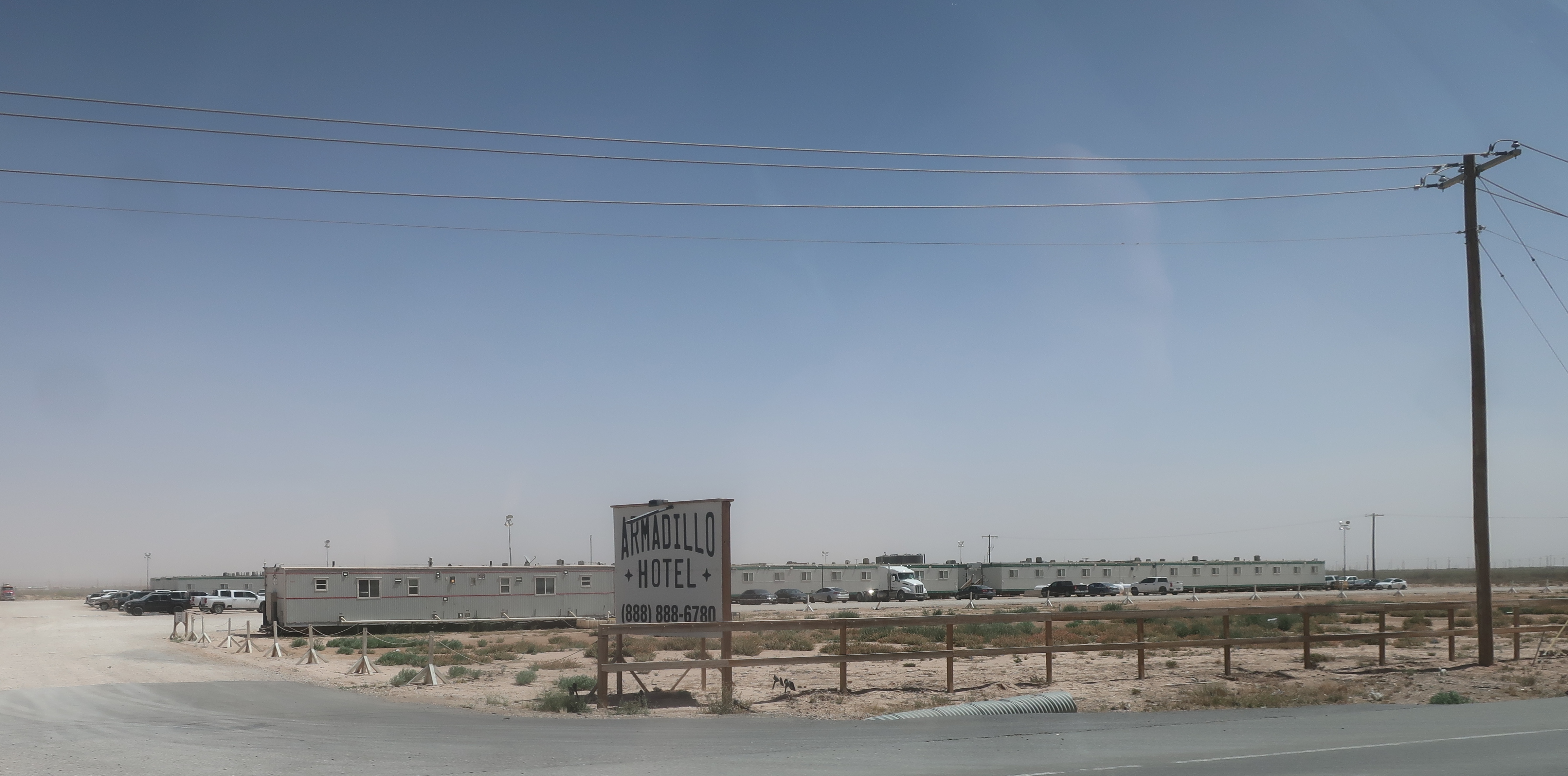
I was struck by the response to housing needs in the fields. Perhaps the same logistics regarding housing could be applied elsewhere.

Portable apartment housing for workers in the oil fields

Canopies for shade for workers with campers

Portable hotel

I did not stay at any of the above but did stay at a smaller portable motel. Comfortable bed, a good shower, desk, refrigerator and microwave made for all I needed.

There is subject of some policy debate. The rapid expansion of oil production also produces a lot of methane. While oil is profitable, the natural gas prices are low and therefore flaring, burning off the gas, has increased.

The natural gas production is exceeding the pipeline capacity and some oil producers are opting to flare the gas instead of delaying oil production. This same scenario took place in the ramping up of the Bakken oil 15 years ago. The financial incentives of resource extraction do not always align with limiting wasting resources.    

There has been an effort to track the methane emissions (PermianMAPFinalReport.pdf). If you do dig into the details it is interesting to see the range of limiting methane emissions by various companies is broad. Most of the big oil companies do better than the smaller operations, but there is an exception. It is a complex issue scientificamerican.com/MethaneLeak.

The National Park Service does have a nice overview of the Permian Basin geology: nps.gov/GuadalupeountainsGeology.

Monday, May 29, 2023

Former Giant Western Red Cedars above Lake Cavanaugh

I have had numerous ventures up the north slope of Frailey Mountain south of Lake Cavanaugh in Skagit County. The slopes are steep and streams on the mountain have had a history of debris flows; hence, I have had numerous ventures assessing the geology risks of the area. 

The forest on the lower sloes is predominantly western hemlock. It is one of the easier forest areas to walk through as there is very little understory brush as the hemlocks shade out just about everything. But amongst the hemlocks are big(!) hints of the past.   

Western red cedar stump amongst the western hemlocks 

Large cedar stump and if you look carefully an even bigger one back in the trees

The western hemlock forest is about 80 years old. The Lake Cavanaugh area was nearly devoid of trees by 1940. There is a small remnant patch of old trees on the steepest upper slopes that were either too hard to log or poor quality timber. 

1941 aerial view of area

The big stumps are a reminder that the forests we see today are not static. Given the age of the forests around Lake Cavanaugh area, there has been significant logging in the area the past few years. As noted in a previous post (HERE), the trees that were left are habitat for marbled murrlets and hence some of the forest is protected. And some of the slopes may be precluded from logging due to potential landslides and debris flow hazards. I say 'may' because that can be a geology judgement call clear cut logging has been permitted on active alluvial fan areas.     
 

Saturday, January 29, 2022

Pickleball on Both Sides of the Cascades

A bill introduced this Washington Sate Legislative session would make Pickleball the State Sport: leg.wa.gov/SB5615.  Pickleball was invented on Bainbridge Island (pickleball.com/History-birth-of-pickleball). Driving through Omak it seems clear that the sport has crossed the Cascade Divide.


Wednesday, January 5, 2022

Mail Problems on Decatur

Decatur Island has a mail problem: islandssounder.com Decatur Mail Challenge and sanjuanjournal: Mail issues on Decatur.

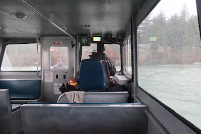
Only four of the San Juan Islands are served by Washington State Ferries: Shaw, Lopez, San Juan and Orcas. Getting to and from the other islands varies. Several including Decatur have air strips. Water "taxi" chartered boats mostly from Anacortes also routinely provide service to the non ferry islands. The charter boats pull up to docks and land on beaches to pick up and drop people off. Given their ability to 'land' at a wide range of sites, the charter service is pretty great and I have used it to get to Decatur and a few other islands.

Approaching an island beach on an Island Express Charter
 
The mail problem on Decatur seems to have partially evolved due to the increased amount of mail as more seasonal use of the island has morphed into more year round long term residences. With access to internet and good cell phone coverage more people have taken up living year round on the island. The demand for mail packages has increased and hence the controversy of an island without a post office. I would note as well that the charter boats also deliver groceries and other goods.  

Monday, January 3, 2022

Northwest Arkansas Appeals to Seattle

Billboard in Seattle

I have a soft spot for northwest Arkansas - Van Burien County specifically. In a different era I rode my bike through northwest Arkansas. It was pleasant change of scenery after miles of being on the plains. It is a landscape that would appeal to western Washington folks - mountains, forest and lakes. 

In a later era I wrote a draft resolution supporting an amendment to the Secure Schools Funding Act supporting an amendment that allowed for consideration of environmental values for National Forest projects under the Act. Other than Whatcom County, not one county in Washington State (including King County) supported my effort. Several Washington State Counties sent letters in opposition and the State Association of Counties called me to let me know my position was contrary to that of the State Association. 

But Van Burien County Arkansas quickly passed the resolution as written and sent a letter of thanks. They valued the environmental benefits of their National Forests more than most of the local governments in Washington State. So the appeal to Washington residents with similar values is sincere.

Sunday, November 7, 2021

Political Sunday: Snake River Dam Editorials and Sports Radio Goes Political

Snake River Dams Opinion Pieces:

Over the years various newspapers across the Pacific Northwest have put out editorial opinions on the lower four dams on the Snake River and printed guest opinion columns (disclosure - I wrote a guest opinion piece for the Bellingham Herald on the Snake River dams 20 years ago). The Columbian out of Vancouver, Washington published an editorial on the lower four dams (in-our-view-new-approach-is-needed-to-save-iconic-salmon). The editorial suggests breaching the dams "warrants serious consideration". The Columbian included a quote from another newspaper editorial from the Walla Walla Union Bulletin. Part of the quote stated "The water from a free-flowing Snake would flood farms, roadways, homes and even cities." 

Since the initial Walla Walla Union Bulletin editorial, the Union Bulletin corrected the Editorial and has a correction statement at the end stating "The Snake River dams do not provide flood control as previously stated."  

My take-away is that the Columbia Editors do not have a good understanding of the lower Snake River dams, otherwise they would have readily noted that the Walla Walla Union Bulletin statement about flooding made no sense. The Columbian error is somewhat forgivable; the Snake River is far upstream from Vancouver, Washington and one might assume that the nearby by Walla Walla paper would have a better understanding of the lower Snake River. Alas proximity to the dams may be a hinderance to understanding them, and the Union Bulletin editors credibility on this issue should be greatly diminished.    

Fall Back:

Note - I live just a bit south of the 49th parallel and pretty far west in the time zone.  

In my work I drive a fair bit to field sites. I listen to NPR, CBC and sports radio depending on where I am and the time of day or evening. The sports radio folks (KIRO) are generally pretty good at navigating through that political wickets. One of the conversations I heard on sports radio this past week was introduced as a political subject that all red and blue folks could support: a proposed bipartisan bill to allow states to remain on daylight savings sponsored by Washington Senator Patty Murray and Florida Senator Marco Rubio. The radio host was fully supportive of the bill. I support it as well. 

My rationale is that every fall I ease into getting up in the dark as the days grow shorter and sunrise slowly moves later into the morning. By the end of October I am getting up in complete darkness. I am not a fan of getting up in complete darkness, but I got used to it. With falling back an hour I have to restart the process or simply get up earlier (the same time by ignoring the clock all together). All in all getting up in the dark in the winter is not that big of a deal, but the sudden darkness at 5:00 pm is the part of the time switch I find to be very undesirable, and as the winter moves on, the late darkness moves to 4:00. I am on the west side of the time zone - it is even worse for those on the east side. 

Saturday, November 6, 2021

Debris Flows, Logging and Marbled Murrlets - Lake Cavanaugh

Lake Cavanaugh is located within the northwest Cascades near the southern Edge of Skagit County. The 2.75 mile long lake was formed by continental glacial ice that flowed eastward from the northern portions of the Puget ice lobe into the North Cascades. 

Lidar bare earth imagery of Lake Cavanaugh area

Blues arrows indicate ice flow direction with the arrow on the left being the main flow path of the Puget ice lobe and the blue arrow across the top indicating the ice flow from the Puget lobe up into the North Cascades. 

Lake Cavanaugh may have been an area of weaker fractured rock as it is aligned with the Darrington-Devils Mountain Fault zone.   

The south shore area of the lake consists or a series of alluvial fans associated with steep creek drainages coming off the north side of Frailey Mountain. Frailey Mountain is a steep ridge that rises about 2,000 feet above the lake. The bedrock on the mountain is mostly metamorphosed ocean floor basalts of the Eastern Melange Belt, a tectonic terrain. Sandstone and conglomerate of the Oligocene age Bolson Creek Formation underlies some of the mountain as well and there are areas of glacial sediment on the lower slopes.

Due to the steep slopes and narrow drainages the small creeks on Frailey Mounatin are subject to periodic debris flows.

Debris flow on one of the unnamed creeks in 2016.
There are some policy issues associated with these creeks but that will be another post. 

Lake Cavanaugh area was heavy logged in the past.  Bob and I came across this stump while heading up the slope to assess a potential debris flow source area.


The 1941 aerial image looks a lot like a lidar bare earth image. The clear cut logging throughout the area was very intense.   
  
1941

Note that there was a stand of trees left on some of the steeper upper slopes (but not the ridge line) in the 1941aerial. As the forest grew back the old trees are still evident in 1974 aerial. 

1974

They are not as apparent in the 2017 aerial, but logging in the area has started up again as the second growth is now merchantable and logging in the area has been intensive over the past 10 to 15 years. 

2017 - old tree stand circled in red

But the old trees remain. This remnant stand of old trees provides nesting habitat for marbled murrelet, an endangered sea bird that nests within old forest stands. A buffer around this habitat area is required for forest practices (proposed harvest). An added benefit is that bird's nesting presence and protection also reduces the potential for the very steep slopes from being damaged by tree harvest and has limited some of the recent proposed harvest on the north slope of Frailey Mountain.   

Saturday, July 17, 2021

Flood Plain Hazards of Open Pit Mines

I missed the historic heatwave in the Pacific Northwest as I am currently in Germany. I am not in the zone that has been impacted and terrible floods, but the event is 'close to home' so to speak. Dave Petley (HERE) noted a river in the west of Germany that broke out of its course and flowed into an open pit coal mine in Inden. 


Dave noted the river course into the mine followed an old channel. That channel was the former river channel up until about 15 years ago. The channel was blocked and the river was rerouted in a long circuitous route around the mine.

Blue line shows river route around open pit coal mine

Blue line showing most recent river route and red line showing former path

Although the flooding of the coal mine was impressive, a more dangerous flood into an open pit mine took place a few miles away at Blessem. NPR led their story on the flooding with an image that had a caption about an entire field collapsing due to flooding (npr.org/germany-belgium-flooding). 

  (picture alliance/dpa/Rhein-Erft-Kreis | Rhein-Erft-Kreis) The image shows very rapid headward erosion as floodwaters drain off the flood plain down a steep gradient. The source of that gradient was and open pit sand and gravel mine. 

Same site looking toward the mine  (picture alliance/dpa/Rhein-Erft-Kreis | Rhein-Erft-Kreis)

Red line is approximate extent of area eroded. The yellow line is my measurement of the headward erosion distance of 850 feet.

The headward erosion continued after the above image and expanded into the town taking out a number of buildings. 
 

In this case it appears that flood waters on the flood plain began to flow rapidly towards the pit as the water drained towards the low area of the sand and gravel mine. While gentle slope wide flood plains have flood risk and potential hazards associated with channel movement. The rapid erosion associated with flood water flows into open pit mines is well demonstrated at this site.    

Sunday, June 20, 2021

Foster Creek Beaver Analogs

Foster Creek drains the north side of the Waterville Plateau. The creek has three forks that join together a few miles south of Bridgeport before discharging to the Columbia River just below Chief Joseph Dam and just east of Bridgeport. State Highway 17 follows the East Fork up to the glacier scoured upper northern part of the plateau. As the creek descends down for the glacial scoured upper plateau it descends through an area of glacial lake sediments deposited in the valley from the ice dammed Columbia River Martin (2001). The fine silts are subject to rapid erosion and over a stretch of the valley has formed a badland area (mini-badland-southeast-of-bridgeport).

When the creek reaches the glacial lake sediments, the creek is subject to forming deeply incised arroyos. Blanton (2004) discusses the complexity of arroyo development and riparian management along the West Fork of Foster Creek. 

One of the issues of arroyo development is the deeply incised stream lowers the water table along the creek except in the bottom of the arroyo. That reduces the width of the riparian zone and the beneficial habitat (note that the arroyo banks have beneficial habitats as well such as burrows for cliff swallows). The lower water table and narrowed stream channel also impacts down stream sections of the creek. More intense peak flows during storm events or snow melts can be one result or the reverse: a loss of storage in the areas of the lowered water table may mean lower flows in the dry periods. 

An approach to back up the water is to copy something that has been missing in the watershed. Jay guided me to a project on Foster Creek that is being used throughout the west -- a beaver dam analog.

Beaver dam analog
Stakes driven into the ground with woody debris weaved through them

Saturday, June 5, 2021

Skagit County Mine Woes

Complex of quarries that supply a community

Quarries for aggregate go through various phases on a local basis. Once a group of quarries gets established and the market supply is being met there is a period of stasis. But eventually the quarries exhaust the resource and new supplies must be found. Skagit County is going through one of those supply shifts and the disruption that goes with that change goskagit.com/opposition-continues-over-skagit-county-mining-proposals. The three proposed mine sites each has particular issues and regulatory status with the issues described in the article. Besides the three mines in the article another mine is proposed to expand, but apparently no significant objections have arisen yet and a fifth mine is in the early stages of the permit process. 

The State Growth Management Act includes language regarding resource land protection. Resource lands typically include farm land, forest land and mineral resources. The approach that counties have taken on resource land protection varies. For mineral lands, the protection limits the land use that can take place on the or near the areas of mineral resources with the idea avoiding loosing the resource to being covered homes. 

An example of an excellent source of sand and gravel lost to use is Mercer Island in Lake Washington smack in the middle of an area of high demand in King County.

Mercer Island

Obviously when Mercer Island was initially developed there were plenty of resources elsewhere and development of the island proceeded and one could argue that delaying development of the island so a big chunk of it could be mined would not be an ideal scenario. 

Skagit County took a very broad approach that utilized mostly geology to designate large areas of the county for mineral resource protection. There was some consideration of preexisting conflict so that some areas were pulled out of the protection zone. However, when mine sites enter actual permitting, it is very clear that conflicts are still present or issues still require attention. Just because an area is designated for protection does not mean a guarantee to be permitted to mine. 

And there have been Skagit property owners that have sought to do the opposite of getting a mine permit, getting the property removed from designation as a mineral area. This can be done by demonstrating that the site is underlain by sand and gravel or that other issues would preclude ever being permitted to mine. One site was removed after the Planning Commission agreed that the site could not be mined due to the presence of high voltage electric transmission lines and a large volume natural gas pipeline. I would note further that the site was also underlain by a thick layer glacial till that was mostly silt and clay.       


Tuesday, December 29, 2020

Geoducks

I have spent a fair bit of time on the high bluffs along the east side of Port Discovery. During some of those ventures a small boat has been off shore in a stationary position with the sound of engines running. At other times the boat is simply anchored near the end of an unpaved road adjacent to a cuspate shore form.  

Landslide complex with cuspate shore form in distance and anchored boat

Port Discovery with Olympic Range in the distance

The boat is used by divers for harvesting a lease tract subtidal geoducks. Dave Williams has an excellent write up of the history and management of the resource (pugetsound.org/geoduck-clams). The shellfish can be harvested during very low tides without diving.  (b-roll:-geoduck-beach-harvesting-aquaculture). However, a fair bit of the harvest is via dive boats at lease sites (youtube.com Geoduck Diving Harvest). The geoduck fishery is managed by Washington State Fish and Wildlife as well as the owner of the subtidal lands, Washington State (dnr.wa.gov/wild-geoduck-fishery)

The first time I tried geoduck was via a gift from shellfish business I did some geology work for. I have since dug for them a few times during very low tides. They are a fun prize to pull up out of the sand. One big goeduck is more than enough for a meal. But those big geoducks take many years to grow. As their value has increased management of the resource has become more important.    

Sunday, November 29, 2020

Political Sunday: Remembering Malden and Pine City Okanogan Valley


Malden Post Office before the fire

NPR did a brief story on Malden, Washington and the lack of a National Major Disaster Declaration after the wildfires in Washington State in early September (HERE). The wildfires in early September burned nearly all of the town including the town hall, post office, food bank, library and fire station. Pine City, a few miles away also was badly burned and one fire burned across 60 miles of Okanogan County and into Douglas County including burning into the City of Bridgeport. 

The NPR story provided no explanation as to why a National Major Disaster Declaration has not been issued. One theory is politics because Washington State votes Democrat of late and the President does not care for the governor; however, Malden is located within a US Congressional District represented by Cathy McMorris-Rodgers, a Republican. The Okanogan area is represented by another Republican, Dan Newhouse. Malden voted 2 to 1 for Donald Trump for President over Joe Biden. So if the reason is politics, it is doubly unfair. Ms. McMorris-Rodgers stated shortly after the fire "I will be working with and supporting state and local officials and doing everything I can on the federal level to ensure our communities have the resources they need to rebuild." She, did sign along with the entire Washington US congressional delegation a letter to Mr. Trump in support of Declaring a Major Disaster (murray.senate.gov/letter).

So far Malden does not have the resources to rebuild. The town had an early burst of development when the railroad came to this location with a rail stop in 1906. After the railroad pulled out their facilities in the 1920s, the town declined. There is no commercial activity remaining, but with over 80 homes destroyed, Malden will have a hard time bringing their community back without help.


Friday, August 28, 2020

Point Roberts in the Time of Covid

I had a project along the West Bluff of Point Roberts. The West Bluff continues to the Canadian border with the bluff near the border called Boundary Bluff. All in all a nice beach walk.

Boundary Bluff and the shoreline along the west side of Point Roberts

Point Roberts is a high bluff point of land that sicks down south of the 49th Parallel from the lower mainland of British Columbia. The point of land is part of the United States. Walking north there was nothing on the beach indicating the border with the exception of a battered sign facing north warning about the border and laws. 


A navigation marker denoting the border is located well out in the tidelands. 


While Boundary Bluff is a fairly natural setting, there are two 4,000 feet+ causeways on the Canadian side of the border extending out to deep water. Both are visible in the above picture. The near causeway leads to the Tawwassen ferry terminal with sailings to Vancouver Island and the Gulf Islands. The larger causeway terminal is more visible with a large container transfer facility that transfers containers from ships and trains as well as coal export facility. 

The top of Boundary Bluff is accessed via a road, Roosevelt Way, that is just on the south side of the border with the back yards of Canadians on the north side of the border.  


A trip to Point Roberts and back requires four border crossings: into Canada at Peace Arch, then into the U.S. at Point Roberts and then back again. With Covid travel restrictions the border is closed for all non essential travel including between the main part of the U.S. and Point Roberts. Assessing geology hazards for a project is deemed essential, and I was allowed entrance into Canada with no stops. So I had to pass on a stop at Tim Horton's. The above said and knowing that the border was mostly closed it was still a shock to be the only car crossing at the typically backed up Peace Arch crossing. 


Tuesday, April 7, 2020

Voting in the Time of COVID-19

 The State of Wisconsin is trying to run an election at the same time as a pandemic that requires social distancing to stop the spread of the virus. The difficulty of running an election with social distancing is beyond possible. The election offices have had a huge number of absentee ballot requests as voters try to social distance and poll workers decline to expose themselves to virus pathways.

The State of Wisconsin's attempt to modify the election process by having greater flexibility with  absentee ballots be sent out, received and returned during a pandemic was over ruled by a 5-4 Supreme Court descion https://www.supremecourt.gov/opinions/19pdf/19a1016_o759.pdf.

The majority opinion reference COVID-19 one time near the end

"The Court’s decision on the narrow question before the Court should not be viewed as expressing an opinion on the broader question of whether to hold the election, or whether other reforms or modifications in election procedures in light of COVID–19 are appropriate".

While the majority argues this is case was a narrow question, I suspect all " other reforms or modifications" would also be ruled on in a narrow manner. Further, while the majority mentions COVID-19 once, the ruling was otherwise oblivious to the consequence of the pandemic and alterations that must be done to stop the spread of the virus.

During the time of COVID-19 Washington State can be grateful that we have vote by mail (You can also simply drop your ballot off at ballot drop off stations). It is a much safer approach. 

In a different era (the early 2000s), I was on a county council that looked at our various voting options under new federal law passed after the 2000 presidential election. The new law eliminated punch card voting. Our County Auditor brought forward a preferred option - vote by mail.

The alternatives were far more expensive - costs of new voting machines, cost of software associated with new machines, cost of storing the machines and the costs of simply running polling stations all over a sprawling county with a city, small cities and low density farming and forest communities including parts of the county that required leaving the county to get to (Newhalem) or leaving the country (Point Roberts). The cost disparity was so great that the choice of vote-by-mail was by far the superior approach.

As I recall we were the second county to follow this route and now the entire state votes this way. Yes, we have to wait a bit to know election results. Election night, early returned ballots that have been processed (signatures verified) are counted. All ballots post marked election day or earlier are counted. In close elections it may be about a week before the final result is known, but it is now simply part of how elections go in Washington State. No more staying up late while exhausted election workers process ballots being delivered from the far reaches of the county.

Alas changing to vote-by-mail is politically fraught elsewhere in the Country with the debate having more to do with political power than voting efficiency and fairness. The very fact that the voting issue in Wisconsin ended up in the Supreme Court suggests as much as well.   

Tuesday, March 24, 2020

Covid Nonpharmaceutical Intervention -Lessons from 100 Years ago

Vox News (coronavirus-social-distancing-economy-deaths) notes the consequence ending school closures and banning public events too soon. The article is a take on a 2007 JAMA paper that analyzed data from the 1918-1919 influenza pandemic (Nonpharmaceutical interventions implemented by US cities during the 1918-1919 influenza). Informative regarding methods to tamp down pandemics that were used 100 years ago and still apply today. And a cautionary story of ending interventions too soon. And perhaps suggests that the CDC guidance as well as state health decisions should lean towards closures to 3 or 4 months or more depending on how this pandemic proceeds.       

A chart showing St. Louis’s flu deaths during social distancing measures.


Saturday, March 21, 2020

You can be a COVID hero -- from your own home

I have a loved one in Illinois and found this message on sheltering in place worth sharing.


I am fortunate that in my work avoiding social contact is an easy task. It is very rare that I meet clients or attend meetings. What meetings may take place are easy to avoid. For others this virus is a much harder dilemma.

Maybe this chart and vox article will add some perspective. I know that when I saw this chart a few weeks ago I started to isolate as much as I could.


Be healthy and be a hero.

Tuesday, February 25, 2020

Roosevelt Elk Shaped Land Use Policy on Olympic Peninsula

On a trip up the Hoh River valley to examine a potential large deep-seated landslide I got to take in the elk herd that occupies the valley.


This herd was one of two I observed just west of and outside of Olympic National Park. The herd is one of the few "unmanaged" elk herds. The elk on the Olympic Peninsula are on the large side compared to other elk. These elk played a significant role in the land management history of the Olympic Peninsula. 

C. Hart Merriam, head of the USDA Division of Economic Ornithology and Mammalogy named the Olympic elk (Cervus canadensis Roosevelti). The name was in part to honor then Assistant Naval Secretary Theodore Roosevelt (theodorerooseveltcenter.org/Research/Digital-Library). Merriam recalled the detail which Roosevelt pointed out regarding an specimen.

Theodore Roosevelt was an avid hunter and conservationist. As a hunter he became interested in protecting his name sake elk and attempted to create a reserve for the elk in the Olympics, but was blocked by Congress. He later used the Antiquities Act in 1909 to create Mount Olympus National Monument.


Three decades later Franklin Roosevelt pushed for the creation of Olympic National Park further protecting the elk range.