Apologies to Norman Maclean for the play on words in the post title. A venture up the Skagit River valley took me across a swampy forest with occasional stream channels. This venture and a little historic research demonstrates the dynamic nature of the Skagit River.


These channels will fill with water during flood events on the river. The soils in this area are silts and fine sand suggesting that water flow through this forest, when it does happen, is slow. Hence the channels are slowly becoming filled in by overflow river deposits.
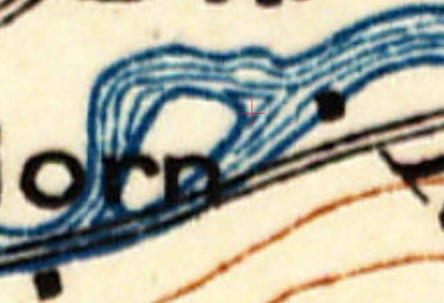
These channels are located in an area where the main channel formerly flowed. The 1881 survey map shows the river formed and island in the river.

An island was still present in 1915.
By 1937 the island was no more but the channel was still evident.

By today the channels are filled in with only a slight appearance in tree type indicating the old channel, but at the far end the old channel remains as a lake as it has not filled as much with sediment.


2 comments:
Great job using the historic survey plats and maps. One of the best chronologies I've seen using these type of data. BTW, what was the source of the 1915 map?
Geoff: http://historicalmaps.arcgis.com/usgs/
Post a Comment