
Grand Coulee Dam. Note bridge which was built during Lacey Murrow's (other-murrow-brother) time as Director of Highways

Just downstream of the dam is a short side road off of State Highway 174 to Crown Point State Park.
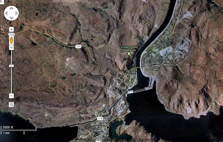
Crown Point State Park (Google Maps)
Crown Point perched on granite cliffs provides a great view of the dam as well as the surrounding landscape. I like the green oasis of the town of Grande Coulee tucked into the rocky landscape above the west bank of the river. The granite at the Point is Eocene to Paleocene Keller Butte Pluton. This granitic rock is the foundation rock the dam is anchored into. Grande Coulee is located in an area where some crustal extension with associated grabben formation (down dropped blocks forming valleys) and volcanic activity took place during the Eocene, and various intrusions of granite and associated volcanics from that period extend to the north. South of the dam almost all of these rocks are covered by younger Columbia River Basalt Group basalt lava flows.
The downstream view gives one the sense of this powerful but controlled river. A huge force of water that surges through the dams turbines. One massive hydroelectric source.

A powerful river flowing northward at this location before it bends first west and then back to the south.
Note the distinct terrace in the distance along the valley side.
The Grand Coulee dam was not the first dam at this location. During the ice age, the Okanogan ice lobe blocked the Columbia River in the same area. At that time a much larger lake formed than the current Lake Roosevelt. This lake backed all the way up to the Spokane area. The terraces pictured above were from later, smaller versions of the lake as the ice lobe progressively retreated to the north. The level terraces are remnants of the former lake bottoms that remain along the sides of the valley.
Evidence of the past presence of ice at Grand Coulee Dam can be seen on the striated granitic surfaces around the Crown Point viewing area. Just be careful not to fall off some of the cliffs!

Striated granite slab at Crown Point, Grand Coulee Dam


No comments:
Post a Comment