Sunday, October 17, 2010

Across the Columbia Crest from Prosser (Part III and Final)


After crossing the crest of the Horse Heaven Hills just south of Prosser on Highway 221 one enters the Horse Heaven Vinticultural Area. Unless you live in the immediate area there are two reasons fro driving this road: 1) an alternative route to take a few miles off of a trip to northeast Oregon or 2) as part of a wine quest. So after enjoying the view HERE and the Ellensburg Formation HERE one heads south into the Horse Heaven Hills Vinticultural Area. The upper area may not appear very promising as a wine growing area, but as one heads south down the gentle side of the Horse Heaven anticline towards the Columbia River, the agriculture changes from dry land winter wheat to large scale irrigated farm land with a variety of crops including grapes and wineries. (of course if your heading north everything is reversed)

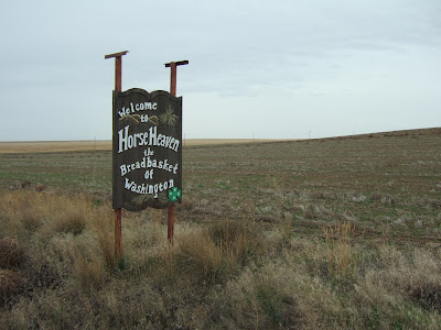
As noted in an earlier Blog, the Horse Heaven Hills also contain a large population of wild horses. However, do not expect to see any wild horses in this area as the horses live well to the west in a large but remote area of the Yakima Indian Reservation. Besides the sign welcoming travelers to the Horse Heaven Vinticultural Area another nearby sign celebrates the wheat land production of the initial farm land.


This year's winter wheat appears to be off to a good start. In this area the fields are left fallow for a year. This allows for the stubble to break down and the field to be worked prior to seeding and moisture buildup may play a role as well. The fields are generally seeded in September and early fall rains are a great help as it allows for some good growth going before cold weather. Some wet weather has already arrived in late September and additional rain arrived the last time I drove through on October 8. Hence the new crop is off to a good start. 


Friday, October 15, 2010

Across the Columbia Crest from Prosser (Part II)

Besides the views of the Yakima Valley, possible exploration of the old landslides and a great sense of the geometry of the Horse Heaven Hills anticline there is a great exposure of the underlying formations along the crest of the fold along the highway just below (north side) the crest of the hill.

Geology exposure along Highway 221 south of Prosser, Washington.
The units are clay, diatomite, and sandstone with a minor offset.

Elephant Mountain member basalt capping a member of the Ellensburg Formation

The Ellensburg Formation are the non basalt basalt units in between the various Columbia River Basalt Group lava flows. In this case the exposed outcrop is capped by the Elephant Mountain member of the Saddle Mountains Basalts - one of the youngest lava flows of the Columbia River Basalt Group. The member designations of the Ellensburg Formation are derived from the age of the basalt flows above and below them. On this basis the unit would be the Rattlesnake Ridge member. Laval (1956) mapped this area and proposed Prosser member for a unit containing diatomite. 
A number of distinct units can be seen within the Ellensburg Formation at this site: 1) a green-gray clay that likely highly altered volcanic ash, 2) bright white layers of diatomite, 3) cross bedded sands and silts with a mix of diatomite and volcanic ash and 4) a volcanic ash or tuff deposit.


Diatomite layers over clay and under sands. Diatomite is formed by the accumulation of diatoms, a single-celled organism with a silica structure. Diatomite signifies a quiet lake environment will little sediment input as it takes a long time for the diatoms to accumulate.
Volcanic ash overlaid by basalt of the Elephant Mountain member


Thursday, October 14, 2010

Across the Columbia Crest from Prosser (Part I)

A drive south up over the Horse Heaven Hills south of Prosser on State Highway 221 provides great views of the Yakima Valley, a short cut for those driving on Interstate 82 towards Oregon, and a direct route from the Yakima Valley, Rattlesnake Hills, Red Mountain and Snipes Mountain Viticultural Areas to the Horse Heaven Hills Viticultural Area. Just below the crest of the steep north facing anticline is an outstanding geology exposure (a future post) in the road cut as well as a great view. There is also a nice pull out just beyond the road cut if your heading south or just before the cut if your heading north.

Highway 221 heading south of Prosser, Washington

View from the crest of the ridge towards Prosser and the Yakima Valley
The lumpy area in the foreground is a old landslide feature.

Old landslides are a common feature along the steep north facing slopes of this ridge. There are several reasons: 1) the slope is steep often over 45 degrees, 2) The north steep side of the anticlines on the Yakima fold belt are tightly folded and fractured with some minor faulting thus creating lots of fractured broken rock blocks, 3) Basalt is the predominant rock type and vertical columnar jointing provides weak plains in the rock and allows water to readily infiltrate, 4) sedimentary units between some of the basalt flows are clay rich and some of the more fractured basalt has altered to clay, and 5) the lower portion of the slope was rapidly eroded during the Missoula Floods - flood waters reached an elevation of approximately 1,250 feet well up the sides of the lower slopes.

The highway curves around this old landslide feature and cuts across the steep slope just above the slide area. Other possible slide areas are easily observed along Interstate 82 below the slope or from above by continuing along a gravel road along the crest of the ridge or by a tour of Google earth. I suspect that most of the lumpy topography is the result of old landslides; however, secondary folds, faults and aseismic deformation features are present in these areas as well (Reidel and Fecht, 1994 and Reidel, Campbell, Fecht and Lindsey, 1994) and some of the lumpiness may be a combination of these features along with slide areas.

Lumpy areas outlined in red are potential old landslide areas.


Tuesday, October 12, 2010

It Does Not Take an Eruption to Wipe Out a Village

Mount Baker from Penn Cove

A number of years ago I was working on an environmental impact statement where I put in a few lines about the impacts of mud flows on flooding on a river system and that the mud flows very often take place without an eruption. This information was a bit of a shock to some folks. If your a Bellingham person or want to visit Bellingham Thursday you can find out a lot more about mud flows and Mount Baker by going to a talk on Mount Baker by David Tucker Thursday evening October 14 at the Whatcom Museum - see nwgeology.

In 1983 I did some mapping work with Chuck Ziegler east of Mount Baker. Our interest was in much older metamorphic rocks of the Northwest Cascades Complex and Mount Baker was in the way. Lava flows and eruptive centers covering up the metamorphic rocks. But we did see some interesting volcanics and Dave Tucker will explain it all (mostly).

Monday, October 11, 2010

Gates of Lodore and My First Snow Storm of the Fall

I have returned from a week and half in the east part of the western U.S. My route back from the high plains took me through northwest Colorado where I ventured to the gates of Lodore and Brown's Hole. The Gates of Lodore is a narrow canyon where the Green River cuts through a high anticline. The canyon is located within Dinosaur National Monument. The name of the canyon was coined in 1869 by Andrew Hall a member of John Wesley Powell's expedition that traveled down the Green River and is from the poem the Cataract of Lodore by Robert Southey.
Green River flowing towards the Gates of Lodore

The Gates of Lodore marks the south end of Brown's Hole. Holes in this context are relatively lower areas in the terrain within the mountains. Holes in the mountains. Jackson Hole being the most famous and one people are most familiar with. These areas were areas to hunker down in the winter as they tend to be drier and milder relative to the surrounding high country. First Nation people used them and cattle herders and sheep herders used them later. They were also a place where outlaws would lay low. Brown's Hole was frequented by Butch Cassidy. The Columbia Basin in Washington State can be thought of as an especially large hole in the mountains as it is surrounded by mountains and was used in a similar manner.   

Brown's Hole now more commonly called Brown's Park is made up of a National Wildlife Refuge, Bureau of Land Management lands, a scattering of ranches and a few National Historic Landmarks in an effort to protect some of the historic structures. 
Old cabin and morning fog in Brown's Hole

I was really struck by this grave marker at the small cemetery. It appeared many graves were unmarked and at least half of the marked graves had no birth year.

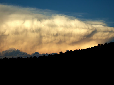
I also ventured into the north Wasatch Range in Utah. My timing could have been better as the weather took a rather abrupt turn as can be seen by the view I had of the approaching cold front that brought my first snow fall experience of the fall.

Approaching cold front

This storm would have launched my tent if I had not stayed in it and gave me a great noise and light show that lasted a good five hours. And it made for a chilly hike the next day over the 9,000 foot plus summit ridge.

Summit ridge on the way back to the trail head. The bedrock is limestone.

Tricky footing and route finding
  

Wednesday, October 6, 2010

R&R at a Different Latitude and Altitude

I am having some R&R in Fort Collins, Colorado. I have been struck by the trees not having turned yet with the exception of a few with just a hint of yellow. This despite the fact that I am at over 5,000 feet. The difference of a few degrees of latitude and a more continental climate. In Bellingham with a north Pacific marine climate and more northern latitude, many trees including the maples behind my office have lost leaves. But it will not be long before it gets colder here than western Washington.

The other impressive difference is the tree line in the mountains. Yesterday I was at 10,000 feet and still in forest. The tree line in western Washington is not straight forward. The shear volume of snow limits tree growth versus the cold that creates a sharp tree line in the Rockies of Colorado. The only area in Washington State with a true tree line is the northeast portion of the North Cascades with a tree line around 8,000 feet. Given the lack of area above 8,000 feet it amounts to a small area.

My other note worthy observation is the take over of the Estes Park golf course (a town) by herds of elk. I find the adjustments animals make to human induced habitat change fascinating. And of course humans have made adjustments as well. A little less late season golfing. 

Sunday, October 3, 2010

Riding the High Plains

I have spent the last few days riding my red stallion (1991 tercel) on the high plains. Cool rocks, my favorite animal (pronghorns) and my usual odd observations - It appears that stimulus money was used to shore up a lot of snow fences along the highways.
In regards to the Washington landscape I figured out one can drive over Snoqualmie Pass without being on the interstate. A very nice detour from the usual. Exit at Denny Creek and drive in the woods including some old growth.