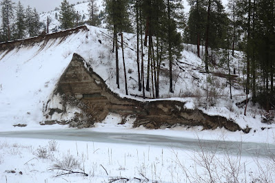
The Sanpoil River flows south from the central Okanogan highlands to the Columbia River. During the last glacial period, the Columbia was blocked by the Okanogan ice lobe to the west forming a large lake, Glacial Lake Columbia. That lake inundated the lower Sanpoil River Valley. The sediment deposited in that lake records the history of the lake including the repeated large floods that surged into the lake from the east when Glacial Lake Missoula repeatedly abruptly drained when the ice lobe that formed lake Missoula collapsed. The former lake sediments exposed in the lower reaches of the Sanpoil River Valley have a story to tell (Atwater,1986).
Driving down the Sanpoil River Valley, I got a glimpse of one of the lake sediment sections.
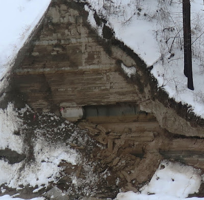
This section corresponds with Atwater's Ranger Station site, the uppermost lake sediment sequence. The thicker beds are sand deposits associated with the surges of flood waters. The finer layers are thin beds of lake sediments that record annual lake sediment cycles. The annual varve layers are not visible in the picture above due to distance. Altogether Atwater counted 89 flood events impacting the Sanpoil lake sediments and utilizing the annual varve layers the frequency of the Missoula Floods could be estimated as well.


No comments:
Post a Comment