Whatcom County Council wants to start a dialog on landslide hazards and I was asked to make a presentation. The following are the images from the presentation with just a few notes. John Thompson, geologist with Whatcom County Public Works River and Flood and Natural Resources will present some information as well. A strength Whatcom County has had has been staff geologists that have played a role in reducing hazard risks.
I decided to start the talk with a brief overview of the Oso/Hazel Landslide with some emphasis on the fact that this slide risk was well known by geologists and was foreseeable.


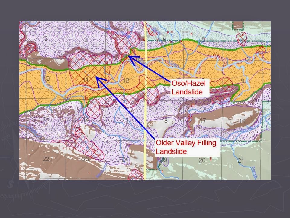
Snohomish County Geohazard Map

LiDAR of Oso area landslides showing age relationships of past large slides

State DNR checked the slide after a storm event in 2009

Most comparable Whatcom County slide to Hazel is the Clay Banks

Recent river blocking slide at Clay Banks

Block of clay showing run out extended beyond current river

LiDAR of Clay Banks and Nooksack River impingement

Aerial of Clay Banks area
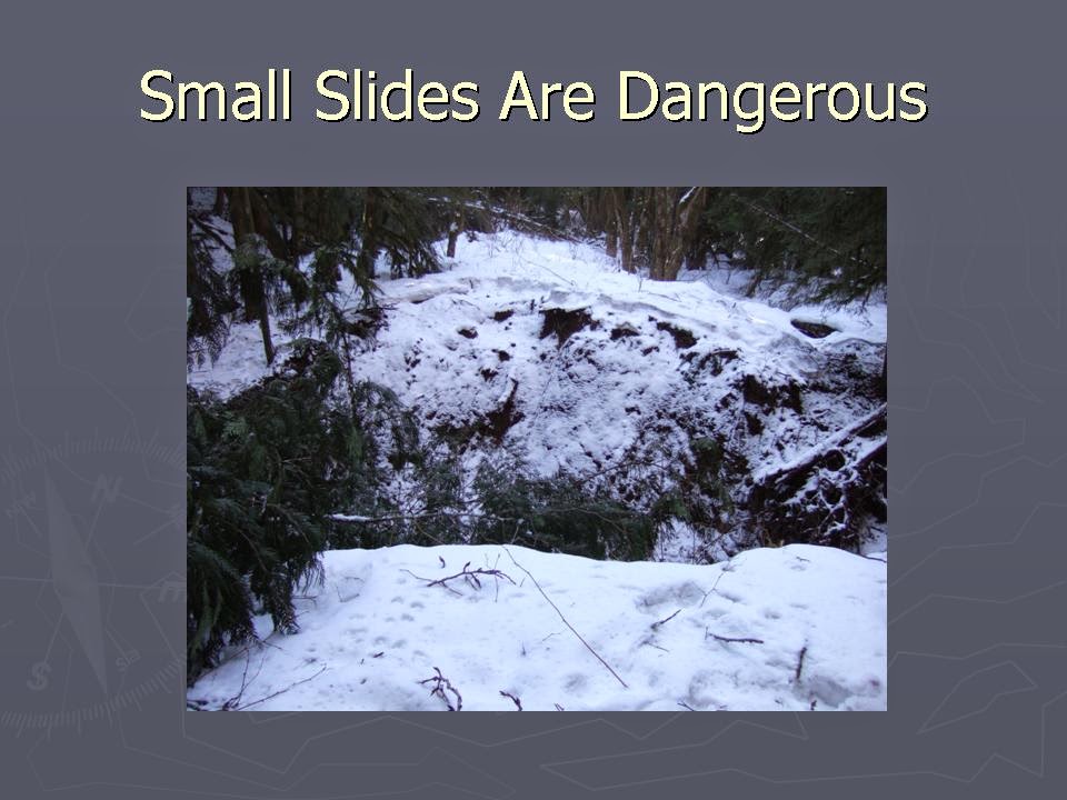
This small collapse of an old logging road traveled over one mile

Bark stripped off tree at upper end of failure

Slide mobilized large boulders and wood in debris flow

Home damaged by debris flow/flood

Boulders, logs and mud from debris flow

Small shallow slide in big leaf maple dominated forest

Damaged home from slide

Another slide down small stream

Directly aimed at home

Lifted from Dart's paper on rock failure in New Zealand

Rock failure above the Skagit River in Whatcom County

Damaged truck and dock

Swift Creek Landslide

Fracture scarp on upper Swift Creek Landslide

Bald Mountain Slide in Canyon Creek watershed includes most of the forested slope
Picture taken from a vantage point on another deep-seated landslide

LiDAR of lower Canyon Creek

Bedrock deep-seated failure in Jones Creek above the town of Acme

Upper part of slide with trees on slide

Assessing the passage of a debris flow on Jones Creek

DEM of massive Church Mountain Landslide
Slide is approximately 2,000 years old
Town of Glacier is built on slide

Bedrock landslide on unknown age near Kendal

Staring point of conversation
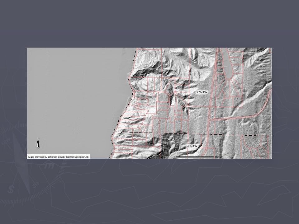
LiDAR and property lots from Jefferson County Parcel Search web page

Potential landslide risk hazard maps

Screen shot

A popular quote for geohazard types


3 comments:
Outstanding presentation! Hope this leads to a meaningful discussion about realistic options. Not only recognizing slides, but the runout zones has to be part of this discussion
I am curious about the cliff side in the Lily Point Marine Park in Point Roberts. I have seen in excess of 20 people hanging out below this cliff that seems to be slowly collapsing. Is this at risk for a bigger landslide?
https://www.whatcomcounty.us/parks/lily-point/index.jsp
Showhank - there are hundreds of miles of steep shore bluffs with that risk. But the odds at any given time are very, very low.
I have a series of four posts on Lily Point starting with this one:
http://washingtonlandscape.blogspot.com/2012/04/lilly-point-point-roberts-part-i.html
Post a Comment