Saturday, June 25, 2011

Lake Whatcom and a Special Thanks to Dennis Jones

Setting good policy and its impact on the land is about people. If we only looked at land and policy setting from a strict land perspective, it would be easy to develop smart sensible land use policies. But people are part of setting policy as well.

Lake Whatcom is the drinking water source for half of Whatcom County and the entirety of Bellingham. Unfortunately at one time the land around the lake was nearly all privately owned so protecting the lake has involved people - a lot of people with a lot of different interests. Over the past 20 years significant land use policies and decisions have come up on Lake Whatcom: Land transfers, zoning changes that reduced development potential, land purchases, development regulations, lake specific forest regulations for the public land, and rules for motorized boats. Many of these tasks were exceedingly difficult and I found myself in the middle of them as a member of the County Council and as a geologist.

No matter what the specific policy issue on the Lake, Dennis Jones was there to testify. He was always positive even with County Council members that were obstructive or with city officials that were passive. And had great follow through. After a policy was voted on and he would often be at the next meeting to say thanks. Due what I felt were severe problems on the lake I proposed a development moratorium for the lake until the Council could complete development of appropriate stormwater and development regulations. This was not a popular move, but it passed. I was invited to a meeting with a fairly hostile crowd to answer questions and take my required beating. Dennis Jones was there. He mellowed the crowd out better than anyone else could have. It was brave but also a kind thing to do and I will always appreciate what he did and said at that meeting. It made a huge difference to not only me but the public and in the end for much better policy.

Dennis certainly did not come across as a fighter, but the last time a Lake Whatcom issue was before the Council, he was there. He was clearly ill. He was a greater fighter for the lake. He symbolized about as well as anyone I have ever know what good land use policy is about people. Thanks Dennis.

Dennis R. Jones, 66, passed away peacefully at home on June 20, 2011. He was born April 9, 1945 in Burbank, Calif., to Reynard and Helen "Jerry" (McGowan) Jones. High school sweethearts Dennis and Heidi married on August 20, 1966, in Los Altos, Calif. Dennis was a loving husband, father, and grandfather. He was a teacher and a business owner, and spent the last decade of his life as a community activist. A passionate man, Dennis' pursuits included soccer, sailing, and working to better his community, especially in his efforts to preserve the water quality of Lake Whatcom. Dennis is survived by his loving wife of 44 years, Heidi, daughter Dianna (husband Daniel) Murray of Seattle and their children Alek, Clark, Miki, and Kyler, son Eric (wife Jocelyn) Jones of Olympia and daughters Spirit and Teagan, son Simon (wife Tahney) Jones of Seattle and their son Alex, son Stefan Jones of Seattle, and sister Teresa (husband Neal) Cabrinha of Saratoga, Calif. In recognition of their compassionate care for Dennis, memorials may be made to Whatcom Hospice. A celebration of Dennis' life will be held at Westford Funeral Home at 2 p.m. on Sunday, June 26, followed by a reception across the street at Westford's Broadway Hall. You may view photos of Dennis' life and share memories with the family at http://www.westfordfuneralhome.com/ Westford Family Funeral Home & Cremation

Thursday, June 23, 2011

Sick's Stadium, Lowe's and Rainier Valley Redevelopment

Lowe's store on Rainier Avenue, Seattle

I was in Seattle earlier this week and heard a bit of buz about a proposal to rezone the Lowe's home supply store on Rainier Avenue in the southeast part of the city. The rezone proposal is apparently coming from the city as part of a plan to increase development density in this part of the city. Large box stores are more typically seen in suburbs and freeway interchange areas on the margins of cities, but this Lowe's store is in an urban neighborhood and . This is an area of Seattle where a significant amount of redevelopment has been taking place in part because Sound Transit has built commuter rail in the area, improvements to Rainier Avenue particularly to the north of this area towards downtown and the relatively affordable homes and apartments combined with less expensive and shorter commutes. Beyond that there area a number of urban centers that that are very appealing that have redeveloped along Rainier Avenue.   

There is a concern by residents of the area about losing an important anchor store. I know from living part time in a different part of Seattle a few years ago caused me to have to adjust my shopping habits as ready access to a variety of stores was limited and getting certain items could be very time consuming driving through urban traffic.

Sick's Stadium (Seattle Archives)

In addition this site has some significant history for Seattle. The site occupied by the Lowe's store was the former site of Sick's Stadium or Sicks' Stadium depending on the year. The stadium was used for many years by Seattle's minor league baseball team and for one year was the home of a major league baseball team, the Seattle Pilots. The Seattle Pilots single season in Seattle was a disaster. The stadium was too small and had inadequate facilities. By the end of games the water pressure was so low that visiting teams had to return to their hotels to shower. In addition the weather was terrible with many drizzly, cool cloudy days that were not conducive to baseball. Jim Bouton, a pitcher for the team chronicled the season in the famous book Ball Four. Reading the book revealed lots of problems with the team.  The team failed and the next year they were in Milwaukee as the Milwaukee Brewers

Wednesday, June 22, 2011

Columbus, Washington and Wood for Steam Boats on the Columbia River

Former Columbus, Washington

Just north of the Highway 97 Columbia River crossing and below Maryhill is a stretch of orchards and farm fields along the river shore. This area was settled before the arrival of Sam Hill and the construction of Maryhill. For one thing this low bench above the river area would have been an ideal location for First Nations settlement. When the Lewis and Lewis and Clark Expedition passed this area they noted many villages along the river as the river provided abundant fish for food. At that time (1805) there were probably significantly more people living along the river than today. One challenge the expedition had in this area was the lack of wood available for cooking purposes and on occasion they were obliged to purchase wood from the First Nations villages that they came across.

A small post First Nation community called Columbus was located at this site in as early as 1880. This small community traded in the very product that the Lewis and Clark Expedition found wanting in the area - wood. Steam powered ships moved goods up the Columbia all the way to Lewiston, Idaho on the Snake River. These low draft ships needed wood for firing their boilers. A trip from Columbus to Lewiston required 170 cords of wood. Not far downstream of this site was Celio Falls which effectively blocked ship passage and importing wood via ship from the more forested areas to the west. To the east there is no forest so this was the spot to get wood. Oxen teams would haul wood from the forests near Goldendale located to the north down the steep road to Columbus. 

Over time this operation probably pushed the forest edge around Goldendale back. The forest near Goldendale is a mix of oak and ponderosa pine with Douglas fir and a variety of other trees at higher altitude to the north.

With the arrival of rail, the steamboat shipping began to decline. What steamboats remained were then able to get coal from rail shipments to the area and the wood trade at Columbus came to an end. The timber harvest in the high country near Goldendale did not end, but the end use of the wood products shifted to lumber products.  

Tuesday, June 21, 2011

Sam Hill and "Where the rain meets the sun"

When I first moved to Washington State On the way to my new home in eastern Washington (DT pointed out he thought I moved) my first good look at my new landscape included a bit of Sam Hill's legacy in Washington State. We had driven down into the Columbia Gorge meeting the river at Biggs, Oregon. Looking across the big river at my new home state I was struck by the huge size of the Columbia River, the treeless hills, and expansive fields of golden wheat stubble. We also spotted Sam Hill's Maryhill mansion on the bluff across the river.

Sam Hill's path to financial fortune started in Wisconsin where he routinely sued the newly built railroads for killing farmers' cows and over eminent domain claims. James Hill, the president of the Great Northern Railroad (no relation at the time) asked Sam if he would be interested in working for the railroad. Sam declined but said he would like to work with the railroad thus getting a piece of ownership at a time when railroads made a group of people very wealthy and Sam indeed became very wealthy. Sam Hill later married James Hill's daughter Mary.

Sam Hill fell in love with the Columbia River Gorge and in particular loved the setting "Where the rain meets the sun". He had big dreams for the site and began building his mansion. Unfortunately his wife was not so keen on the idea and the utopia he envisioned was never completed. However, Hill left a lasting legacy in the Columbia River Gorge. The old mansion houses his art collection including a collection of Rodin sculptures gifted from the Queen of Romania. After a period of mismanagement and lack of funds in the 1980s, the mansion has been fixed up and is a frequent stop for tourists that are now also attracted to the new wineries in the vicinity. 

Hill also built a Stonehenge replica as a memorial to Klickitat County soldiers killed in World War I. He also spearheaded the construction of the first highway in the lower gorge helping make the gorge a famous tourist attraction. This attraction later led to the area being designated a National Scenic Area. However, Maryhill is outside the Scenic Area and hence the wind turbines on the sides and ridges of gorge in this area. Hill had a fair bit of impact on my current home area in Whatcom County with the construction of the Peace Arch at the Canada-U.S. border crossing in Blaine and as a primary investor in Seattle Gas and Electric - a company that for a time mined coal from the Blue Canyon area at south Lake Whatcom  park-store.

Sam Hill was a bit eccentric and eclectic in his tastes and visions and Sam Hill: The Prince of Castle Nowhere John Tuhy (1983) suggests that he was manic-depressive as an explanation of a number of odd projects Hill pursued and abandoned. Maryhill can be easily viewed as a monument of folly standing alone in an empty landscape. I sometimes think that Hill may have fallen in love with the place on a rare calm day and it may have taken awhile before he realized the problem with the location: it is very very windy. But for those of us that lived in the treeless windy expanses of eastern Washington, the fact that a wealthy tycoon of the early 20th Century viewed eastern Washington as a possible utopia always gave us some satisfaction.     

Sam Hill Memorial Bridge

The Peach Beach area and former townsite of Columbus below Maryhill

Monday, June 20, 2011

The Columbia Gorge and Wind Power

Wind turbines on the high plains of north central Oregon.
A line of turbines can be seen on the distant horizon along the the Horse Heaven Hills in Washington State  

Crane working on a turbine. The green field is winter wheat that will be harvested in August

On my last trip east of the Cascade Range I got a close look at the new wind farms east of the Columbia River Gorge. The Columbia River has carved a gap through the Cascade Mountains. The general flow of air in Washington State is from west to east. The gap created by the Columbia River allows for an area of concentrated air flow through the gorge to eastern Washington and eastern Oregon. This flow of air is further enhanced during sunny weather. As the warm sun heats the dry air in eastern Oregon and Washington the air rises creating a strong pressure gradient from west to east through the Columbia River Gorge. The gorge is famous for its high winds and an entire culture of wind lovers in the form of wind surfers has developed in the gorge communities. The town of Hood River is the center of this activity and spin offs such as Full Sail Ale have developed.

The gorge is designated as a National Scenic Area and wind turbines are not allowed as they would diminish the scenic value of the gorge. But just outside of the Scenic Area hundreds of wind turbines have been constructed. The Scenic Area ends just east of Wishram, Washington. On the high bluffs east of Wishram is the area where the wind turbines begin. Due to the topography and wind flow there are more turbines on the Oregon side of the river. But turbines are located on the Washington side of the river and follow the ridge line of the Horse Heaven Hills nearly to Walla Walla. A wind farm has been proposed just north of the gorge near Hood River on a ridge just outside the Scenic Area.

Columbia River at Biggs Junction and the Highway 97 Bridge. Note white caps on the river.
The cliffs in the foreground and across the river were formed during the Missoula Floods that filled the entire gorge in this area. 

With high water levels in the Columbia River system this year, the wind farms have been having trouble getting the electric energy generated to buyers. The hyrdo power turbines on the dam systems have been running at near full generation capacity to keep the rivers low and not to spill water. Although passing through the turbines is hard on small salmon, the nitrogen saturation of the water when spilling water over the dams is hard on the fish as well. When I crossed the river last week I observed that John Day dam was spilling water. The result is the demand for electricity is being more than met by the hydro dams at least for the time being and the wind farms are not able to sell all their power particularly during low demand periods.

Turbines on the Washington side of the river upstream of Biggs Junction

Spinning turbine from behind a ridge

I got a chance to listen to a turbine. Noise issues have been raised with wind turbines. For my simple experiment I was mostly out of the wind on the back slope below a spinning turbine. There was still some noise from the wind blowing at about 30 mile per hour. There was a very faint hum and swish from the turbine from about 400 feet away. I could not hear it when in the car. But noise propagation can be tricky and my single experiment is purely anecdotal.

Sunday, June 19, 2011

Demographic Shifts - York Neighborhhod and North Central Oregon

My neighborhood went through a bit of a demographic shift last week. A number of years ago we had a block birthday party for the six 6-year olds on the block. It is not quite the same mix but we saw six graduates last week. This group combined with other kids that have grown up in the hood and recently left means our summers won't be filled with the noise of children playing through the yards. A new infusion of kids will likely come along, but for the time being the children population in the immediate hood has declined significantly over the past few years.

The Grant Street 6

Lined up on a glacial scoured ridge of Chuckanut Sandstone in Bellingham's York Neighborhood

John hands out coupons for York Neighborhood apparel at Nelson's Market

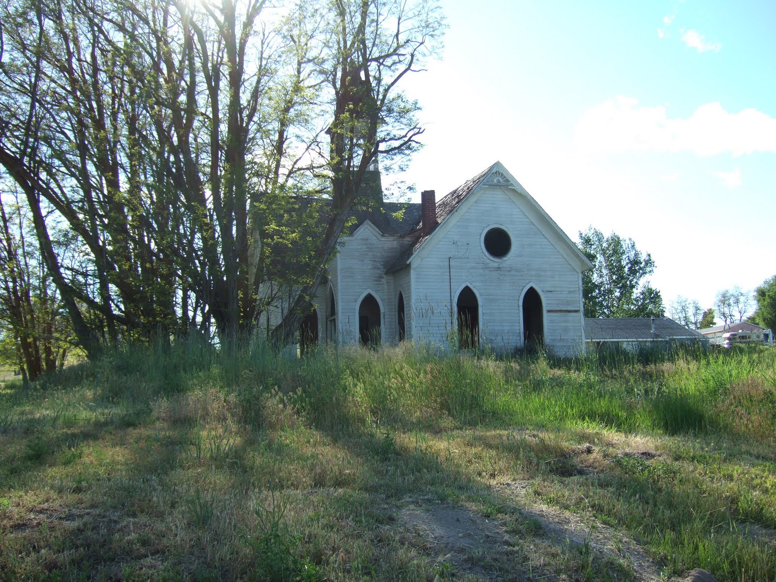
After first hand watching the demographic shift in my own neighborhood I traveled to the east side of the Cascade Mountains and pondered demographic shifts as I passed through various communities. Certainly there has been large influxes of population in in some towns and cities, but not all. Several towns that once served a significantly more populated area than today have declined in population. Demographic shifts in small communities are more obvious than in cities and in the dry climate east of the Cascade Range old buildings remain long after the populations they once served have left. 

Abandoned school

Abandoned church

The hotel and cafe in Shaniko, Oregon are vacant and for sale 

Old Shaniko Post Office

I will note that Shaniko looked better than I recalled from past trips. A labor of love by people trying to maintain the buildings of the old town. Someone had fixed up the old hotel and cafe. The small communities in north central Oregon are not short of money. Wind farms, regional landfills and high wheat prices have been a boom for the local economies and tax rolls.

New fire equipment at Grass Valley, Oregon

Saturday, June 18, 2011

Follow up on Port of Bellingham Disproportionate Cost Analysis

I previously posted a modified chart used by the Port of Bellingham for costs of the cleanup alternatives bellingham-bay-cleanup. In that post I noted that if additional analysis or information indicated my adjustments were substantially off the mark, I would modify my modifications. This effort was to do a quick Disproportionate Cost Analysis was in response to the Port and Department of Ecology's so far declining to do the analysis at least officially. I did receive some comments from a Port official that pointed out that the cost for dealing with the dioxin tainted sediments would be increased for not just the preferred alternatives. That comment is correct so here is my adjusted modified chart with an explanation below.  


Amended cleanup showing dioxin tainted sediment dredging areas

The volume of sediment in Area 1A and 1B (outer waterway) is 113,000 cubic yards. This new cost will need to be added to Alternatives 5 through 8 equally. I do not think the added cost to Alternative 4 will be as high as the material would not require the effort of burial beneath the marina but simply used as additional fill in the ASB. An assumption but I will assume the added cost to alternative 4 is $5 million versus $50. There will be no impact to costs of alternatives 1 through 3 as Puget Sound Disposal was never contemplated in these alternatives.

Area 5B (ASB shoulder) will impact alternatives 3 through 7. For 3 and 4 the impact will be very modest as both 3 and 4 can simply use the material as fill in the ASB. Alternative 8 is not impacted as this area was proposed for dredging and landfill disposal already so the increase to Alternative 8 will be less than the assumed (for now) $50 million increase.

It should be noted that there are other sites that require dredging that are not part of this cleanup. The Port is proposing dredging part of the existing marina and these sediments contain dioxins as well at levels that exceed standards for Puget Sound disposal and the levels even exceed soil cleanup levels for unrestricted use on upland property. The Port is proposing placing that sediment as a cover over an existing municipal garbage landfill area along the south shore of the aerial image above as a means of controlling water infiltration into the garbage material. Other work on the landfill will be required at some future date.