Saturday, March 26, 2022

False Bay, San Juan Island

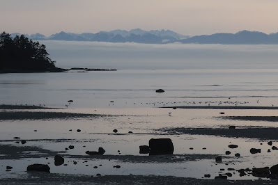
False Bay, San Juan Island, looking towards the head of the bay

False Bay viewed from the head of the bay looking towards the bay entrance
 from the Strait of Juan de Fuca

False Bay is an oval shaped bay on the south shore of San Juan Island. The bay is very shallow and much of it nearly empties during low tides; hence the name. The bay faces the Strait of Juan de Fuca. The day of my last visit was high overcast so the jagged skyline of the Olympic Mountains could be seen across the Strait rising above a band of low stratus. 

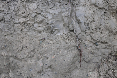
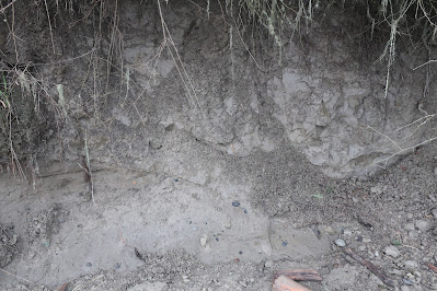
Portions of the bay are bedrock shorelines, but most of the bay shore is lined silt/clay bluffs of glacial drift. The drift consists both of glacial till and glacial marine drift. The till was deposited directly by glacial ice when a few thousand feet of ice covered the area approximately 18,000 to 14,000 years ago. When the ice thinned the area was inundated by sea water with ice floating on the surface. The mass of thick ice had pushed the land surface downward hundreds of feet. The melting glacial ice floating on the sea dropped sediment onto the sea floor. After the land rebounded from the ice load, the former muddy sea floor emerged and is now exposed along the low bluffs along much of the shore of False Bay. 
Glacial drift on bluff slope
The glacial till is on the lower part of the picture
Glacial marine drift with desiccation fractures in the marine drift   

Subtle contact between the glacial till and glacial marine drift

The glacial marine drift is susceptible to large landslides due to the weakness in the unit from the desiccation fractures. 

The glacial drift in this area is mostly clay and silt, but there are some cobbles and boulders embedded in the silt/clay. This silt/clay sediment source has created extensive mud flats with scattered boulders throughout much of the bay with a few areas where bedrock rises as islands or tidal submerged outcrops. Shifting tidal currents and waves have winnowed the gravel and sand from the mud forming sandbars and gravel bars that are exposed on the tide flats when the tide recedes.
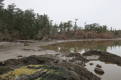
Muddy tidelands with bedrock outcrops 

The bedrock is mapped as Orcas Chert along the south portion of the bay and Constitution on the north (Schasse, 2003). It is not a good bay for ships to venture into seeking safe harbor. While not so good for ships, the mix of muddy tidal flats with sand and gravel tidal areas, boulders, bedrock outcrops and freshwater streams flowing into the bay makes for a very complex estuary with a range of habitats. The bay tidal land is owned by the University of Washington and is managed as a biological preserve. The wide variety of tidal habitats is a great study area.

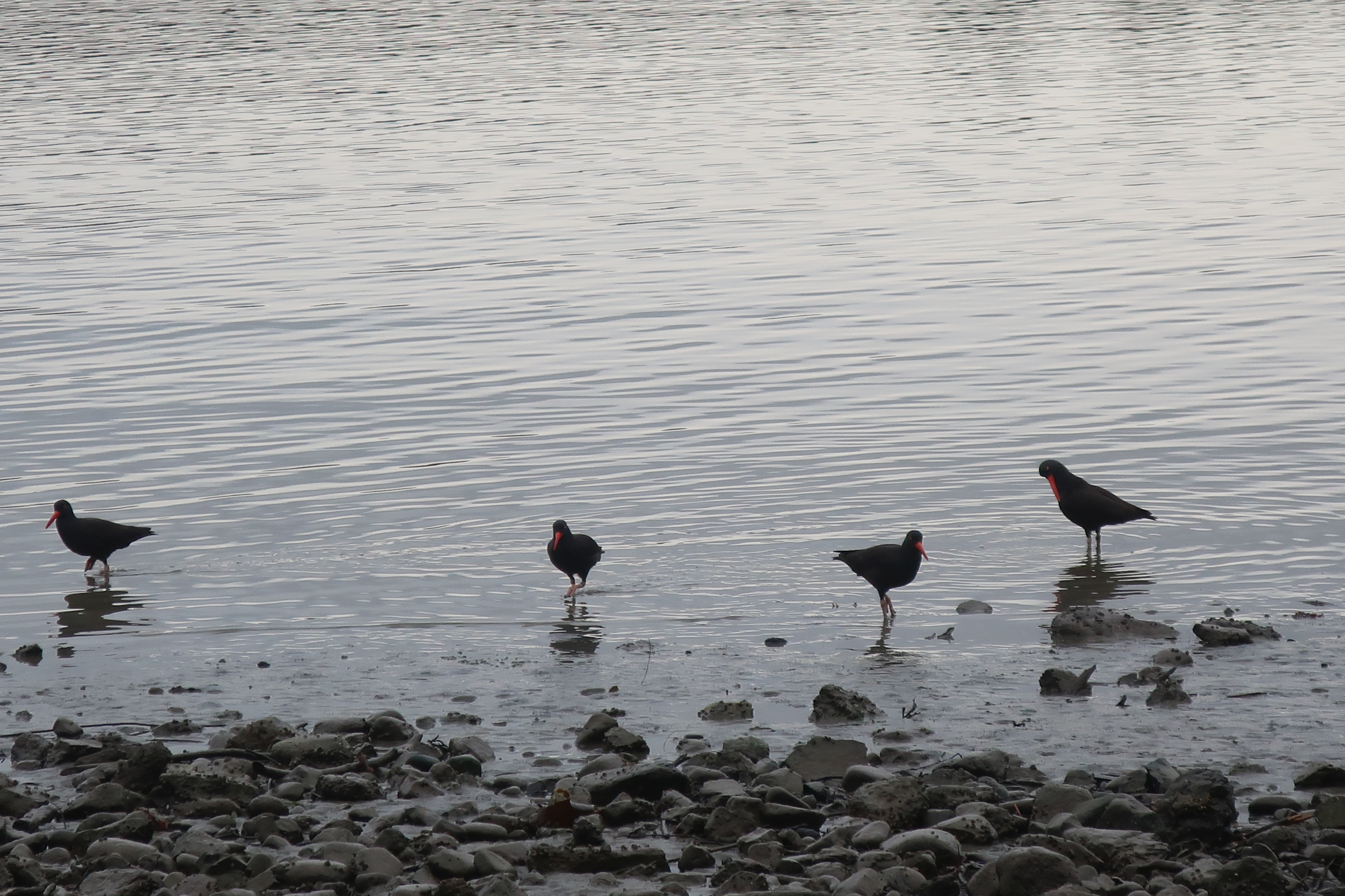
Oyster catchers eat what they study


Sunday, January 30, 2022

Rose of Lima in Keller

 Near my stop at the Sanpoil River cut bank exposing Glacial Lake Columbia sediments (rhythmites-and-varves-at-lower-sanpoil) is a small Catholic Church. 

Church and turkeys


Saint Rose de Lima suggests a Spanish origin. Wikipedia provides a bit on who Rose_of_Lima was. She was the first Catholic in the Americas to be declared a saint, and  hence, is a the patroness of indigenous American Catholics. The church is located on the Colville Reservation, but there are at least two other Rose de Lima parishes in Washington State.

Saturday, January 29, 2022

Pickleball on Both Sides of the Cascades

A bill introduced this Washington Sate Legislative session would make Pickleball the State Sport: leg.wa.gov/SB5615.  Pickleball was invented on Bainbridge Island (pickleball.com/History-birth-of-pickleball). Driving through Omak it seems clear that the sport has crossed the Cascade Divide.


Tuesday, January 25, 2022

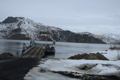
Keller Ferry

A bit of Washington State trivia: What was the first ferry route run by Washington State? 

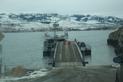
The Keller Ferry route across the Columbia River was taken over by the State in 1930 (wsdot.wa.gov/ferries-keller-ferry) and is still opperated by the State of Washington. The ferry connects Highway 21 across the Columbia (now Lake Roosevelt) at the junction with the Sanpoil River.  

Ferry landing on the north side

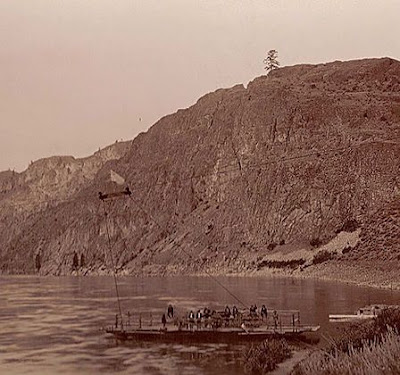
A ferry has operated at or very near this site since at least 1890 (https://www.historylink.org/File/11072). In the early days the crossing was classic cable system that used the powerful flow of the river to drive the boat attached to a cable across the river.

Keller Ferry prior to Grand Coulee Dam

The dock on the south side

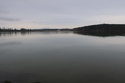
Looking north across Lake Roosevelt

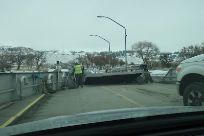
The ferry is free. As noted in the History Link, the ferry began operation as a free ferry in 1930 due to a restriction on federal funds for the overall improvement of the highway. The ferry also runs 'on demand'. If you pull up to the landing the boat captain will proceed over to pick you up. 

Highway 21 is not a heavy traffic route, particularly in winter like the day of my crossing. Further, the road up from the Columbia River to the high plains to the south is a steep 1,100 foot climb with hairpin turns. However, this route in the late 1800s and early 1900s was good way to get into the mining districts of the Okanogan Highlands and was also a route to move sheep mostly from the drier plains to the south across the river to the moist high summer meadows in the mountains of the Okanogan Highlands.   

Thursday, January 20, 2022

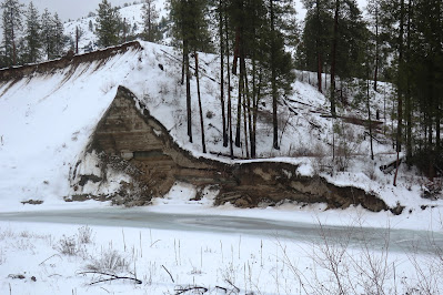
Rhythmites and Varves at the Lower Sanpoil River Valley

The Sanpoil River flows south from the central Okanogan highlands to the Columbia River. During the last glacial period, the Columbia was blocked by the Okanogan ice lobe to the west forming a large lake, Glacial Lake Columbia. That lake inundated the lower Sanpoil River Valley. The sediment deposited in that lake records the history of the lake including the repeated large floods that surged into the lake from the east when Glacial Lake Missoula repeatedly abruptly drained when the ice lobe that formed lake Missoula collapsed. The former lake sediments exposed in the lower reaches of the Sanpoil River Valley have a story to tell (Atwater,1986)

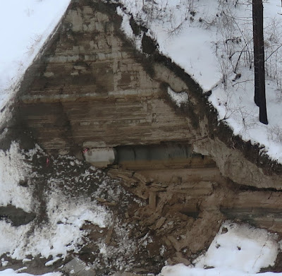
Driving down the Sanpoil River Valley, I got a glimpse of one of the lake sediment sections.


This section corresponds with Atwater's Ranger Station site, the uppermost lake sediment sequence. The thicker beds are sand deposits associated with the surges of flood waters. The finer layers are thin beds of lake sediments that record annual lake sediment cycles. The annual varve layers are not visible in the picture above due to distance. Altogether Atwater counted 89 flood events impacting the Sanpoil lake sediments and utilizing the annual varve layers the frequency of the Missoula Floods could be estimated as well.   


Thursday, January 13, 2022

Snoqualmie Falls at Flood Stage and Cle Elum Digs Out

I had some work in central Washington and had to alter my route due to Highway 2 being closed across Stevens Pass. I added a bit an additional detour as water levels in the Snoqualmie River were very high. 

Road closure in the Snoqualmie River valley 

The detour was a chance to see Snoqualmie Falls at flood stage.


The spray from the base of the falls obliterated any veiwing from the main view spot

Further on my journey I observed Cle Elum still digging out from the snow. Temperatures have moderated and it was just above freezing as I passed through town.


Friday, January 7, 2022

Marginal Revolution Geology Posts

Tyler Cowen at Marginal Revolution claims not care about geology:  https://marginalrevolution.com/marginalrevolution/2022/01/why-i-dont-care-about-geology.html

He finished the post with "One lesson of this post is that it is possible to be interested in things one is not interested in, and vice versa." 

A comment by Dinwar on the post was then turned into a post: https://marginalrevolution.com/marginalrevolution/2022/01/how-do-geologists-think.html

Dinwar notes that "Engineers and geologists think VERY differently, in nearly incompatible ways, which is fun because we work together all the time." I would tend to agree. Engineers are problem solvers and geologists spot the problems. I try to put effort into making sure the geology of a site makes sense to the engineers, but I also try to understand the way engineers can solve a problem so I can anticipate just how bad a geology hazard is or not. 

Dinwar finishes with a bit on field work "Field geologists are even worse–we do all that, only in conditions that would make any sane person run screaming." and he also has a note about safety managers. Navigating thick brush and steep rough ground is a skill set that is probably just as valuable as understanding the glacial history of an area, and it is an activity that most people might consider insane.