Monday, January 29, 2024

Lodge Pole Transplants

I have observed that large swaths of Shaw Island and Lopez Island are covered with stands of lodge pole pine. The lodge pole appear to do well in silty glacial till soils. The glacial till is very dense and hard and has very low rates of permeability. The upper soil above the unweathered till is only about 1 to 2 feet thick. Hence, the upper soil layer becomes saturated in the winter. Lopez and Shaw Islands are within the rain shadow of the Olympic Mountains so the total rainfall results in the till becoming essentially desiccated in the summer. Another climate factor is the San Juan Islands area subject to periodic very cold temperatures associated with the Arctic outflow of air from the Fraser River to the northeast. The combination of wet winter ground, dry ground in the summer and high very cold wind is a good match for lodge pole.  

During a recent venture I came across lodge pole pines growing within a logging road on the steep upper northeast slope of Mount Constitution on Orcas Island. The logging road was beginning to get colonized by brush and trees. 

The seedlings on the road were primarily western hemlock and lodge pole pine. There were a few Douglas fir seedlings, but they were heavily browsed by deer as was the ocean spray brush. There were couple of Sitka spruce seedlings as well. The dominant tree in most of this forest outside the clear cut is Douglas fir, but western hemlock thrives on this wet shady northeast facing slope and there are numerous clusters of Sitka Spruce in the near vicinity and scattered through this forest area likely due to the cooler temperatures and relatively high rainfall on the upper slopes of Mount Constitution. The lodge pole in this cool wet area appears to be a pioneer tree taking advantage of the wet hard ground of the old road bed. Large area of the upper part of Mount Constitution has stands of lodge pole possible due to the the same combination of wet winter and dry summer conditions but also the upper summit area gets very high wind from all directions and perhaps that and a periodic in the past lightning stikes provided the openings that lodge poles thrive in. 

My home ground on Samish Island on the northern edge of the Skagit River delta is underlain by concrete like glacial till and goes from wet soggy ground to desiccated every year. It is also subject to very high winds. In particular the south and east winds knock trees down regularly in the winter on out portion of the island. Elsewhere on the island it is the north or west wind.   

Given that the seedlings on the road were doomed I took a few lodge pole seedlings and one Sitka spruce seedling home. 

Lodge pole seedling in its new home.

Assessing the forest is not my area of expertise, but I have accumulated a few observations and try to keep learning. I did find some igneous rocks that I tentatively interpret to be part of the Turtleback Complex.  

Igneous rock of the Turtleback Complex


Thursday, January 25, 2024

A Few Notes on Israel Russell

Over the past several months I have encountered Israel Russell on several occasions. Russell did some of the earliest work on trying to figure out some of the remarkable features of Washington State (Russell (1893)Russell (1897) and Russell (1900). He made a significant effort in his writing style to appeal to non geologist readers as well as the technical detail needed for his USGS reports. Russell is referenced several times in a book I recently read, The Great Columbia Plain A Historical Geography 1805-1910 by Donald Meinig. I crossed paths with Russel again when doing some research for work I was doing in the Yakima Canyon. 

1892 View of Yakima Canyon from Russell (1893)
The view is to the north with Rattlesnake Ridge on the distant right side (there is a trail up that ridge).
The railroad grade is on the west, left, side of the river. 
The picture predates the road that was later built on the east side.

I think the picture in the Russell (1893) report was taken from the basalt outcrop below the top edge of the canyon to the left of the tall pine.  
   
Russel (1893) also described the Toppenish Landslide (toppenish-ridge-landslide-near-mabton) as well as the Great Terrace along the Columbia River near Chelan. 

Skye Cooley provides an overview of Russell's 1893 paper on central Washington (i-s-russell-s-reconnaissance-of-central-washington-1893). Note that Skye Cooley also has some great stuff on calcrete in eastern Washington and a really detailed post on clastic dikes in eastern Washington that I find to be consistent with my own observations. Nick Zentner Ice Age Floods Episode D discusses Russell with Skye Cooley. 

And just a week ago In the Company of Plants and Rocks discussed another venture of Russell at Mono Craters (visiting-mono-craters-with-israel-russell). Russell also studied the Malaspina Glacier in Alaska - work that greatly informed his observations along the former ice margins in central Washington including glacial water stream channels south of Lake Chelan in Knapp Coulee. I use images of the Malaspina Glacier as a analog for the past glacial ice in northwest Washington.    

Bretz (1910) described large glacial lakes that formed in the Puget Sound area when glacial ice advanced into the western Washington lowlands from British Columbia stated that "It seems fitting that to this lake of Puget Sound, with outlet southward through Black Lake channel and with levels controlled by that channel, a name should be given in tribute to the work of a geologist to whom our knowledge of the physiography of western North America must always be deeply indebted. In memory of Israel Cook Russell may this water body be known as Lake Russell."

Tuesday, January 23, 2024

Very Large Tree Spear

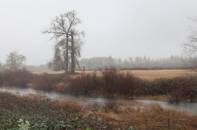
While doing some field work on a very wet day near the outer west coast I noted what appeared to be another tree spear (tree-top-spear). I do not know if these tree tops or limbs embedded in the ground have an 'official' term, but I apply the term tree spear for them.  

Tree spear is just the right of the two tall trees. 

I made a side trip to confirm what I thought I was seeing.


/

This spear appears to have been the limb of a cottonwood. It was very firmly embedded in the wet ground and did not budge even slightly when I pushed hard against it. The soil here is silt flood deposits.  

Saturday, January 13, 2024

Another Icy Bay - Alice Bay

I enjoy our periodic short burst of true winter weather. The cold periods in western Washington are short. I will say that while the areas subject to Fraser River outflow winds are a bit rough - 50 mph winds when the temperature in the teens and single digit range is not pleasant. 

The north edge of Skagit delta does get cold due to the proximity of the Fraser Canyon winds coming down across Whatcom County and over Bellingham and Samish Bay. The delta is generally a windy place, but Samish Island deflects the north wind such that the south side of the island is cold but not windy. 

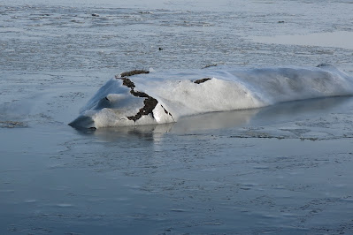
Alice Bay, a bay that is separated from Samish Bay by a low peninsula of salt water marsh was completely frozen over. Alice Bay usually completely empties of water during low tides; hence, the shallow water during high tides freezes.  

Alice Bay with Scott Point on the near left and Blanchard Mountain behind,
snowy Anderson Mountain on center left and Lyman Hill the ridge on the center right. 
Note the odd naming of Lyman Hill. The 'hill' is 800 feet higher than Anderson Mountain and 2,000 feet higher than Blanchard Mountain.

The tide range is on the order of 11 feet and therefore the ice layer has to rise and fall with the tide. The high tides cover the salt marsh during king tides and the shallow water over the marsh froze. 

Tidewater on the salt marsh. Elevated ground on the right is a dike that blocks the tide water from farm fields and a road. 

Island of salt marsh draped with ice.

Dike with sand bags. The tide water overtopped this section of dike last winter during a storm surge (Here).

Friday, January 12, 2024

Icy Padilla Bay

This winter has been very mild with no hard freezes until last night. Not sure of the local low at Padilla Bay, but it was somewhere in the vicinity of 6 F. The bay is shallow with broad tide flats that extend about a mile from the beach. The shallow sea water froze. It was a chilly night for the locals on the north shore of the bay as power was out most of the night.