Sunday, June 30, 2013

Bonnie Lake Precambrian Schist

1.5 billion year old schist on Bonnie Lake island. Shores of the lake are all much younger 14.5 million year old Columbia River Basalt  

The Columbia River Basalts cover over most of the ancient rocks of the former edge of North America in Washington State. The ancient Precambrian rocks poke up above the basalt in a band of higher ground south of Spokane where the basalt flows are thin. There are outcrops in the deep Snake River canyon near the Idaho border where the Snake River has carved down through the basalts. And there are a couple of isolated summits such as Steptoe Butte that rise above the floods of basalt. These Precambrian rocks were part of the former western edge of the North American Continent before all that other stuff to the west got added on.

15 miles south of and 15 miles east of the higher ground not covered by the basalt are two isolated outcrops of Precambrian schist noted on the Rosalia 1:100,000 geology map (Waggoner, 1990). The two outcrops are within a canyon on the eastern edge of the great ice age flood routes on the east edge of the Cheney-Palouse Scabland Tract. One of the outcrops is an island in Bonnie Lake. 

There are no roads to the lake shore and the lake is surrounded by private land, or where public, the cliffs present a challenge. However, Bjornstad and Kiver in On the Trail of the Ice Age Floods The Northern Reaches provide direction to access the island via watercraft up Rock Creek. The creek flows across private land but is a navigable waterway and hence is open to the public. Indeed fisherman use the creek to access the lake with small boats. This sounded like a great trip so after completing some field work elsewhere in eastern Washington, I camped at my secret hideout camp site in the Telford Scabland and then headed to Bonnie Lake in the morning (Aerial/Map View). 

Scabland Tracts (Modified from USDA, 2007)

When glacial Lake Missoula drained in the great ice age floods the waters surged into the Spokane area rapidly filled glacial Lake Colombia or glacial Lake Spokane (depending on the Columbia ice margin) and spilled south across the Cheney-Palouse Scabland, the Telford Scabland and the Grande Coulee (not shown above).  

As the water poured across the Cheney-Palouse Scabland Tract it encountered the Cheney Fracture Zone. The water scoured out the fractures which caused a significant of enough flow to be diverted eastward within the fractures to be concentrated at the Rock Creek flow path which carved a very deep canyon at Bonnie Lake. I suspect based on upstream topographic features that there may have been a precursor stream similar to Rock Creek today that may also have played a role in flow diversion. An even deeper canyon was carved downstream at Rock Lake as Rock Lake had added water diverted by another fracture zone as well as flows from flood waters that came down Pine Creek from the east. A similar but more spectacular capture of water into fractures or joints took place near Palouse Falls to the south (the-palouse-river-leaves-its-valley).


Rock Creek is crossed by Belsby Road which crosses the canyon between Rock Lake and Bonnie Lake. The creek is slow and passes through essentially a swamp of reeds and cat tails. I pumped up my inflatable kayak and began my paddle and enjoyed lots of birds. This included a female wood duck that played at having a broken wing and flopped around as though she could not fly to distract me as I glided past her ducklings hiding under the reeds.

In the swamp


The swamp stretch follows a narrow channel hemmed in by reeds and cat tails, but with the cliffs looming above it did not feel claustrophobic. After 1.5 miles the water opens up into the lake proper.

Bonnie Lake
Approaching the island

Landing spot

Upon landing I was greeted with schist containing a tightly folded quartz vein.
Tightly folded quartz vein

Muscovite-biotite-quartz quartzite schist

Island view looking north

Bjornstad and Kiver refer to the island as the Bonnie Lake Steptoe. A Steptoe is an isolated summit of older rock rising above younger rock. The name is derived from Steptoe Butte a summit 30 miles to the south of much older rock rising above the rolling Palouse landscape. In the case of the Bonnie Lake Steptoe, the island of 1.5 billion year old schist protrudes up into a lake carved 15,000 years ago with canyon cliffs composed entirely of 15 million year old basalt. A test of ones ability to grasp orders of magnitude.  

Steptoe Butte is named for Colonel Steptoe who famously survived with most of his men an attack by a united group of Yakimas, Spokane and Columbia First Nations a few miles east of Bonnie Lake. The leader of that attack, Kamiakin, lived at Rock Lake to the south of here after the wars ended.

The island is public. It happens to fall within a section of State Trust Lands managed by the Washington State Department of Natural Resources. The one square mile section of land includes the island and both sides of the canyon. Perhaps not the most profitable Trust Land section; however, a timber harvest took place on the upland area on the western side of the canyon within the past two years and grazing leases are part of the revenue from these lands as well. The island has no special designation or protections, but was clean and appears to have been fairly well treated by the visiting fishermen.       

Thursday, June 27, 2013

Go ahead, open that gate. Make my day.

Limited posts while off the grid for a bit. But some good landscapes. Had some typical hazards of geology work/ventures:  rattlesnakes, cliffs, and being in isolated spots as well as a paddle through a swamp. And don't forget bulls with attitude.
Go ahead, open that gate. Make my day.

Monday, June 24, 2013

Notes on Salish Sea Landscape:18,000 to 16,900 Years Ago

More bits from the talk. Again borrowing for the images produced by Haugerud and Greenburg.

The Salish Sea 18,000 years ago
The white is the Puget and Juan de Fuca ice lobes. As the ice advanced into the Puget lowlands it blocked the ouflow of water forming a large lake over the Puget lowland - the light blue on the map. Fine silts and clays were deposited on the lake bed. In the Seattle area these silts are called the Lawton Clay for excellent exposures at Fort Lawton/Discovery Park.
 
Glacial advance silts deposited in the proglacial lake prior to the arrival if the ice
 
Near the advancing ice margin the meltwater rivers and streams from the ice deposited thick layers of sand and gravel; the brown band between the ice and the lake on the above map indicates areas of active glacial outwash. This outwash is most often referred to as glacial advance outwash. Locally it may be called Esperance Sand in the Seattle area. 
 
Sand dominated outwash on shore line bluff capped with glacial drift

Glacial advance outwash with thin glacial drift cap on top

Glacial advance outwash with clastic dikes and deformation features

By 16,900 years ago the Puget lobe extended to south of Olympia (Haugerud and Greenburg)

During this time the ice left deposits behind in places and in other places the land was eroded. The direct ice deposits are glacial drift. Or a "a dog's breakfast" of very unsorted sediment ranging from clay to huge boulders.

Glacial drift. This particular drift image is from an older age age event. Glacial ice advanced into the Puget Sound area on multiple occasions.

Glacial erratic - boulder left behind by the ice in a glacial drift deposit. In this case the glacial drift was deposited at the top of the bluff. This erratic must have made a big thud when it rolled off of the eroding shoreline bluff.


LiDAR image of south Whidbey Island
The Puget ice lobe left streaks across the landscape
(Google Earth with HTML overlay)

Saturday, June 22, 2013

Notes on Salish Sea Landscape 20,000 Years Ago

For my shoreline bluff talk I started of with this image.  
 
The Puget lowlands before the last ice age
Dark blue in the upper part is sea water
Light blue is fresh water


Ralph Haugerud and Harvey Greenburg developed a video (youtube) of the Vashon Glaciation in Puget Sound and the first image is of a time right before the arrival of the Puget and Juan de Fuca ice lobes. The video uses elevation estimates, estimated sea level at various times during and after the last glacial period and estimated ice extent during the last glaciation.

The beginning of the video as shown above raises the question of What did the low lands between the Cascade Range and the Olympics look like before the arrival of the last ice sheet?

Today this low land area has deep trenches filled with sea water. In the image above, the deep trenches are shown, but are lakes.  The sidebar of the video notes that the deep trenches may not have been there. Possibly there were deep Puget Sound like trenches before the last ice age but they may have been oriented differently.

But another aspect of the image above is that the deep trenches are show as lakes. A low land plain extends between the Strait of Juan de Fuca on the northwest and Puget Sound on the south cutting Puget Sound (and Hood Canal) off from the sea rendering the deep Puget Sound trenches to fresh water lakes.

A look at sediment loads in our rivers today suggests that this is not an unreasonable concept.

Estimated sediment loads (USGS)

Note that the Skagit River has a massive load of sediment relative to all the other rivers draining into the Salish Sea in Washington State. The Skagit is the largest river, but it also drains from the highest mountains and includes two large strato volcanoes. The Nooksack to the north of the Skagit is a much smaller river, but it is draining out of steep, glaciated, and very high terrain and has a volcano as well. And of course there is a very big river just to the north without a sediment figure - the Fraser River.

While many of the steep bluffs along the shores of the Salish Sea are underlain by glacial related sediments from the last glacial period there are bluffs that are underlain by thick sequences of non glacial sediments.

100-foot thick sequence of pre ice age alluvial river sediments 

One of several peat layers embedded within alluvial sediments suggesting non glacial sediment

Thursday, June 20, 2013

Some Whidbey Talk References

As part of a talk I am giving or already gave depending on when you read this I assembled some references that can be found readily on line for further reading. Hence, I am using the blog to supplement my talk. I'll get the images up later. The talk was part of a workshop on shorelines. Regardless of talk attendance some good stuff below.


20,000 years of Puget Sound history in less than 3 minutes with animation of the Vashon Glaciation 20,000 years ago to present. Model developed by Ralph Haugerud with assistance from Harvey Greenberg, content assistance by Brian Atwater, edit and titles by Britta Johnson, and production by Amir Sheikh.
http://www.youtube.com/watch?v=YHWMHzi_deg&feature=youtu.be

Dave Tucker has some great posts on Whidbey Field Trips with excellent detail and references. He is also working on a book of Washington State geology filed trips.

Erratics:
http://nwgeology.wordpress.com/the-fieldtrips/glacial-erratic-field-trips/whidbey-island-erratics/

Blowers Bluff
http://nwgeology.wordpress.com/the-fieldtrips/whidbey-island-glacial-deposits/blowers-bluff-whidbey-island/

Double Bluff:
http://nwgeology.wordpress.com/the-fieldtrips/whidbey-island-glacial-deposits/useless-bay-and-double-bluff/

Another field trip near our talk

Thorsen Field Trip
http://www.nwgs.org/field_trip_guides/13.%20Whidbey%20Island.pdf

For geology maps some of which have excellent descriptions and discussions of the units and setting the Department of Natural Resources has a link to quadrant maps. Just click on the quadrant map you want.
http://www.dnr.wa.gov/Publications/ger_24k_mapping_status.pdf

The DNR put out a rapid assessment report on the Ledgewood Slide
http://www.dnr.wa.gov/publications/ger_qr_whidbey_island_landslide_2013.pdf

A few relevant Reading the Washington Landscape posts:
http://washingtonlandscape.blogspot.com/2011/03/puget-ice-lobe-turns-west.html
http://washingtonlandscape.blogspot.com/2012/06/once-icy-bay-turned-farmland.html
http://washingtonlandscape.blogspot.com/2012/12/kettles-and-dunes-on-whidbey.html

Hugh Shipman with the Washington State Department of Ecology has a fantastic blog on shorelines including lots of Widbey Island posts (62).
http://gravelbeach.blogspot.com/

Coastal Zone Atlas showing potential landslide areas
http://www.ecy.wa.gov/programs/sea/landslides/maps/maps.html

Aerial pictures of Washington State shorelines including older pictures
https://fortress.wa.gov/ecy/coastalatlas/tools/ShorePhotos.aspx

Monday, June 17, 2013

Bolton Peninsula III: Tilted Alluvial and Glacial Sediments

This is post III on the south shore of the Bolton Peninsula (bolton-peninsula-introduction and bolton-peninsula-ii-notes-on-twin-river). While the exposure of bedrock was fun to see, the shore to the east gets more interesting. Before I proceed or you read, I should note that the observations presented are from a rather rapid walk on the shoreline to get to a slope site I was evaluating and I was a bit pressed for time. In my mind this shore reach needs a lot more contemplation and careful locating, but has a great story to tell for those that have the tools, skills and time to read it. 

Approximate area of titled sediments

Birdseye (1976)
The reach of the locations shown is essentially along the reach of shore that says "Boulders" 

A note on my observations on this reach are consistent with Birdseye (1976). Birdseye (1976) notes Double Bluff Till at the base of the bluff overlain by pre Vashon stratified sediments capped with Vashon Till. My confidence level of the till being Double Bluff is not certain, and I would assume it is based on stratigraphic elevation combined with the very hard nature of the sediments adjacent to the till suggesting an older till versus the Possession Till. That said, I have not observed an inteveing till between the base of teh slope and the top of the slope Vashon Till. An issue others may be able to shed some light on in the near future.


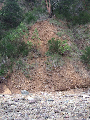
Glacial drift at base of the bluff that Birdseye (1976) interpreted as Double Bluff Till

The till is a very hard compact mix of silt to gravel with occasional boulders deposited directly by glacial ice. The Double Bluff Till has been estimated to be 125 to 185 thousand years old (Polenz, Slaughter and Thorsen, 2005). The till exposure is very limited. Most of the bluff slopes in this area are underlain by tilted silts, sands and gravel beds. These units are the Pre Vashon Stratified Sediments with no age constraint and they are stratigraphically above the till shown above.

Northwest striking and northeast dipping alluvial sediments


The tilt of the sediments is not that dissimilar to the tilt of the Twin Rivers Formation exposed on the bluff to the west. This raises an interesting question regarding the timing of the tilting of these units.

My last observation along this reach of shore was what I interpreted at the time as a possible contact between the older tilted stratified sediments and perhaps a much younger Vashon age glacial drift. Did I really see this correctly? I took a quick couple of pictures and made a few mental notes on the location and hurried on my way so I could get up a very steep tricky trail before dark.
       
Possible erosional contact between younger gray drift/outwash on the right
 and older oxidized sediments on the left.

View of same contact near the location where the bluff becomes lower
Note the presence of large glacial erratics on the beach at the location suggesting glacial till.

Whatever the case, the sedimentary units become horizontal to the east of the above site and another till unit is present at base of the bluff.


Sunday, June 16, 2013

Rural Element IV: Splintered Issues and Costs

It is becoming rather difficult to track exactly where things are at with Whatcom County's rural planning as required by the State Growth Management Act. The rural planning process has splintered into separate issues being fought in various arenas. My last post on the matter (whatcoms-rural-element-iii) only covered part of the rural plan struggles that are before the County Council. But there are aspects of the plan that are in Superior Court and another that was recently been ruled on by the Growth Management Hearings Board (against the County). In addition there are now financial aspects and full-on politics as this is an election year.

June 18 Before the Council

I ended my last post on the rural plan that is now before the council on an optimistic note regarding resolution of one aspect of the County rural planning:

In terms of the remaining issues the Council will be voting on, this will come down to being practical or taking a perceived ideological stance. I suspect we'll get a bit of posturing and speeches from some of the Council and then an understandably reluctant vote for the needed changes. And a couple of council members may take a proud ideological and completely irresponsible stand that will hopefully be a minority.
 
The Council will be voting on the newest version of the rural plan this next Tuesday. The Council did make some changes to fix some of the problem areas, but it appears that two properties are going to be left as future commercial property in an otherwise rural area contrary to the previous very clear rulings of the Hearings Board. Land use attorney Jack Swanson has convinced the Council to leave these two properties in commercial zoning.
 
Throughout this very long process of multiple Hearings Board rulings against the County rural plans the Council majority has retreated and removed various properties from suburban and commercial zoning to rural zoning. Why stop on these two properties? Council members are using an argument that they are taking a stand for property rights. While an ideological stance can be viewed as noble and principled, Why are the council members only defending the property rights of two property owners after having backed down everywhere else? 
 
If the Council votes for the plan in its current version, the Hearings Board will review the plan and almost certainly reject the plan for those two parcels. At that point, the County will either have to run the plan for these two parcels through the entire planning process yet again or appeal the Hearings Board ruling to Superior Court. The property owners will likely want to appeal the ruling as well. The process for these two parcels may drag on for a long time.
 
Court Cases

Whatcom County appealed to Superior Court a few aspects of the Hearings Board ruling from last January. Not much to report on that yet, although legal funding for an outside law firm has been used up on these cases as well as another Growth Management appeal. The County also faces a Court of Appeals case on population allocation.

Hearings Board Ruling on Rural Planning and Water

A bit over a week ago, the Hearings Board ruled rather strongly against the County regarding planning and water. This ruling deserves its own post as it gets at some much broader issues and what may result is complicated. Essentially the Board has stated that Whatcom County needs to do better planning and better consider water issues than it has been. A more detailed post may follow on this, but it requires some research and time not available.

There are couple of sound bite take a ways though. The first is legal costs (see below) and the other is the property rights argument.

Comments by a Planning Commissioner and by Council Members (Kershner and Brenner) have argued that the County is protecting property rights. As noted above, the County has had to retreat and remove urban and commercial zoning from large swaths of the county. But on the water issue, a counter argument could be made that the county is not doing enough to protect property rights. Water right owners are having their water rights threatened by the lack of consideration of water issues in the County Plans.

Legal Costs

The County Prosecutor has turned to outside legal services to assist in defending the various rural plans before the Hearings Board. The cost have thus far reached nearly $100,000 with terrible results in terms that the County has lost on most rulings.

The latest water planning ruling by the Board is a good example. Seattle law firm VanNess Feldman GordonDerr billed the County $26,701.89. A lot of money for a very big loss. That bill is on top of $18,936.60 already billed for the appealing part of Hearings Board January ruling. See Billings if you want details.

The Council will be considering increasing the contract with VanNess Feldman GordonDerr to $90,000 on Tuesday's Council meeting. 

Friday, June 14, 2013

Bolton Peninsula II: Notes on the Twin River Formation

I posted an introduction to the Bolton Peninsula (bolton-peninsula-introduction) over a month ago and had not followed up with any further posts. This post is limited to the southwest portion of the peninsula and the very excellent exposure of the Twin River Formation.

Twin River Formation, Bolton Peninsula along with large glacial erratic


LiDAR image showing Twin River Formation exposure area

The Twin River Formation is named for its type locality approximately 50 miles to the west at Twin River on the north side of the Olympic Peninsula. The Twin River Formation is part of a series of sedimentary units that overlie the thick Crescent Formation basalts.

The exposure on the south end of the Bolton is outstanding considering how much of the formation is not particularly hard rock. The exposure is the result of the south end of the peninsula is eroded routinely by southwest wind generated waves moving up Hood Canal and eroding the base of the slope and transporting eroded sediment to the west and east sides of the Bolton Peninsula.

Birdseye (1976) http://www.dnr.wa.gov/Publications/ger_ofr76-26_geologic_map_jefferson_co_24k.pdf mapped this unit along the shores of the Bolton.


Close up of Birdeye (1976) map of site

Birdseye (1976) denoted the bedrock with a dashed line pattern. I have been all over the slopes in Section 31 of the area on the map above and found most, but not all, of the slope to the west of the road to be underlian by bedrock and found that the bedrock extends to the north nearly to the the north end of the secition line.

Twin River Formation silt/sandstone

Exposure of Twin River Formation on Bolton

As can be seen in the above images, the rock is fairly weak and readily crumbles. Not exactly outcrop forming material. Hence, the steep shoreline bluff slope on the southwest end of the Bolton provides an unusual exposure of the formation including readily measurable strike and dips.


Twin River Formation showing well defined bedding striking northwest and dipping to the northeast


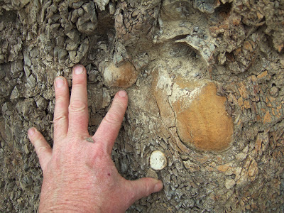
Like many of the sedimentary units above the Crescent Basalts, the Twin River Formation contains concretions


Twin Rivers Formation on the bluff face and within the partially covered bedrock platform beach


Boulder of a block of Twin River Formation sandstone on upper beach

I did not find any fossils in the formation, but then I am terrible at spotting them and many may be at the microscopic level.