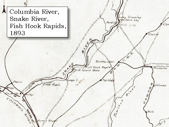
Fishhook Park is an Army Corp of Engineer Park on the shores of the impounded Snake River above Ice Harbor Dam. The park has camp sites, picnic areas, swimming areas and boating facilities associated with recreating on the lower Snake River. During a past era, I spent a fair bit of time on the lower Snake. In the summer the water is a lot warmer than the frigid Columbia.
The name Fishhook is derived from a rapids that was formerly located on this reach of the Snake River. But it also derived from a former resident, Fishhook Jim. I suspect his name was derived from the place.

Fishhook Park is a reminder of a past time and a gesture by the dam builders to remember what was once there as well as the people that once lived for thousands of years on the lower Snake.
William Clark described the Corps of Discovery trip through Fish Hook Rapids:
| "... A cool morning, deturmined to run the rapids ... [Clark, October 16, 1805] |
| Having examined the rapids], which we found more difficult than the report of the Indians had induced us to believe, we set out early, and putting our Indian guide in front, our smallest canoe next, and the rest in succession, began the descent: the passage proved to be very disagreeable; as there is a continuation of shoals extending from bank to bank for the distance of three miles, during which the channel is narrow and crooked, and obstructed by large rocks in every direction, so as to require great dexterity to avoid being dashed on them. We got through the rapids with no injury to any of the boats except the hindmost, which ran on a rock; but by the assistance of the other boats, and of the Indians who were very alert, she escaped, though the baggage she contained was wet. |

No comments:
Post a Comment