I was away from Washington State for a bit so a non Washington State post. I had some nice aerial views of a landscape I kind of like in northeast New Mexico. The high plains disrupted by abrupt canyons.
Ute Creek
Tramperos Canyon on the lower right and lots of ponds in the plain
The ponds are formed on the thin soils overlying the Ogallala Formation. This formation covers a fair bit of this portion of the high plains and has rather thick calcretes in the upper part of the formation. Calcretes form by precipitation of calcite within the soil forming a hard pan. It is a slow process that is common in semi arid landscapes and creates a hard pan. In this case places where water can stand as a perched layer. Calcrete can be a good aggregate for roads and building.
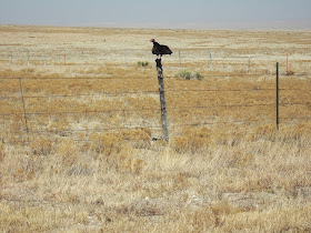
Northeast New Mexico at the ground level
The ponds are important for the grazing lands and the canyons are places of shelter.
This was former Comanche Land. A visit to this area makes it easy to understand why the Comanche completely stymied the Spanish for well over 100 years and Americans for roughly 50 years (comanchie-context-to-yakama-war). It was not until the bison herds were destroyed and US military went out and attacked the canyon homes of the Comanche bands that Comanche lost most of their home land.


In the oil patch of Edy County, we called it "caliche". Same thing as calcrete?
ReplyDeleteYes, with the exception that calcrete implies a much thicker caliche layer. In this case the caliche layer had a few million years to develop.
ReplyDelete