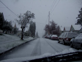
A bit of a surprise yesterday morning. A cold front moved in late the day before with cold air aloft. A convergence zone set up over northwest Washington early in the morning. As falling snow aloft fell it melted on the way down cooling the air enough to lower the snow level all the way to the surface. Classic April cold convergence event. A similar event took place a couple weeks ago in the Lynwood area between Everett and Seattle. I had a local field project in the morning so got to enjoy the snowy street slush. The snow stopped before flattening the just about to open tulips.


No comments:
Post a Comment