Wednesday, January 25, 2017

Star School District

My recent ventures took me into Washington State dryland wheat as well as scrub steppe rangeland. The wheat land is underlain by Palouse soils and the rangeland is primarily within the ice age flood channels. There is also a dune field in this area. This is a pretty sparsely populated area and has less people today than it once did. Mechanization of farms and wheat transport, better roads and better cars has reduced the number of folks in this region of the state.
 
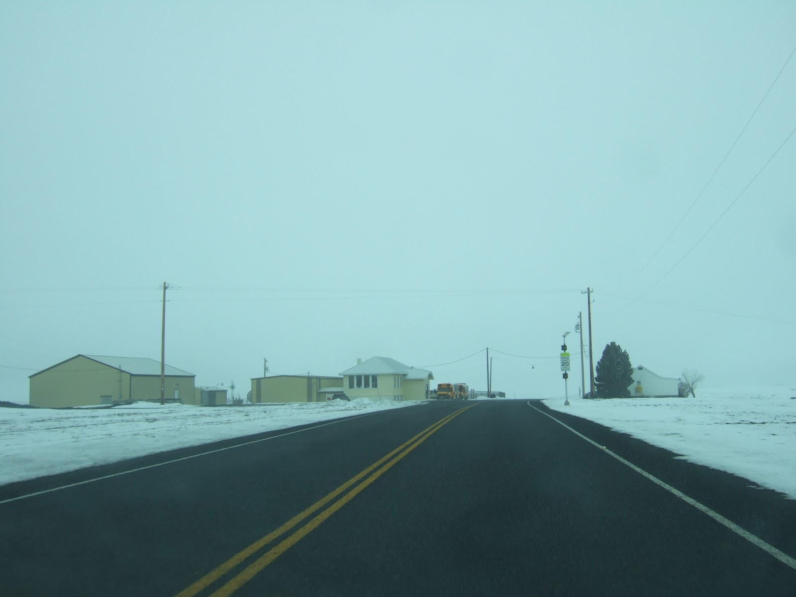
One survivor of the population decline could be seen on the horizon as I drove the Kahlotus-Pasco Road across the snowy wheat fields.


This cluster of buildings are the bulk of Star School District. The district serves 13 students (number from the latest State audit dated September 2016). The district has two teachers that teach in the single elementary school in the district.


About 10 miles to the southwest is another older school building that is no longer in use as a school.


This old school building was being used as a storage shed on a farm, but got a bit of a makeover in 1998 for the movie The Basket (trailer on youtube shows some school scenes). The movie setting was in Waterville, but the school scenes were shot at this old schoolhouse.


Tuesday, January 24, 2017

Freezing Rain Damaged Red Alders

Last week Snoqualmie Pass was closed due to freezing rain and snow. I did see some evidence of the freezing rain event. The tops of many of the red alders along the highway were snapped off. Kind of hard to capture with the camera but these pictures show the damaged trees if you click on the them to make them larger.


Monday, January 23, 2017

Big Variety of landscapes in One Day

A big plus of the Washington State landscape is that it has great variety. I got to experience some of that range today.
 
 My morning started with the Olympic Range.

View up the Duckabush River

I then headed east across Hood Canal on a floating bridge and then across Puget Sound via ferry. I then drove through Seattle, across another floating bridge and up over the Cascade Mountains.
Nearing Snoqualmie Pass

Central Washington was a mix of sun and fog.

And no trees obscuring the view or route.
End of the road

High hills and sage

I ended my day in ponderosa pine country and another city. 

Saturday, January 21, 2017

Notes from the Bellingham Women's March

I am not much for protests or marches, but I opted to delay for a day my field work trip and went to the march in Bellingham. It was not possible to capture the event scale from the ground.


Eddie Hayes did a better job with a drone shot.


I saw the drone and should add that the picture was from before the march began.

By the time I started on the march route people were completing the march such that the entire march route was completely filled with folks.


Monday, January 9, 2017

Evergreen Deer Browsing Notes

I have noted deer browsing on evergreens before (deer-doing-bonsai). While traversing through former pastures and hay fields on Shaw Island I noted the deer have been heavily trimming the evergreens. 
 
Douglas fir encroaching into the old hay fields have been clipped to low bush level excepting a few that are somehow able to getting a leader past browsing height.

The trees then pass into a poodle cut phase with a bushy bottom and top and a cropped area in between at browsing height.


Douglas fir are not the only cropped evergreens. The deer also crop the junipers.


One defense the junipers use is that cropped parts of the tree become thorny. This is a characteristic of young junipers.


The stand of junipers below has a thick bushy and thorny bases and more typical branching higher up.

Below is a picture of a mixed stand of Douglas fir and grand fir along a trail route between old hay fields. Both were being browsed and heavily cropped.


Grand fir branch

The above Douglas fir is just getting going after lots of previous browsing. This tree has some added protection in that it is growing on the edge of a thicket of rose.

Sunday, January 8, 2017

Shaw Island Juniperus maritima

 I found plenty of Juniper maritima along the southwest shoreline of Shaw Island. The first tree I spotted was a classic rocky headland site juniper. Shaw Island is in the rain shadow of the Olympics and so it was not a surprise to find junipers, but they seem to be doing fairly well along the harsh conditions along the coastal strip.


Much of the northeast side of Parks Bay is lined with juniper trees with Douglas fir, lodgepole and grand fir just inland.  


A short note on the bedrock on this shore. The northeast side of Parks Bay is Constitution Formation and the southwest shore is Orcas Chert. A major tectonic fault lies in-between in the bay. A bit Garrison Schist shows up in the sheared rocks just around the point.

On the south shore at Cedar Rock Preserve, a fat dense juniper grows at the top of the headland along with some very fine madrones.


Another juniper stands alone just above the bedrock between the two pocket beaches on the southwest shore of the Preserve.


Early notes associated with the initial land surveys noted that the forest on the southwest of Shaw Island was scrubby and of little timber value. Logging was for mostly local use and an effort to open up some of the meadows to farming - initially sheep and a few orchards and later hay and timothy.


Saturday, January 7, 2017

Shaw Island School - 127 Years of Education

I had a pleasant trip to Shaw Island for a couple of projects. Rather splendid weather for the trip. The ferry ride in the early morning was bumpy with a hard northeast wind frothing the water and keeping the ferry tilted a bit, but once south of Orcas Island and its mountains there was no wind.
  

Shaw Island has a small school. For many years the school was a one-room set up, but the school has had an addition and modifications in recent years. The modifications have been sensitive to the original structure. The building and site are listed on the National Register Historic Places (NRHP).

The school site has been in use since 1890 and is indicate on the 1895 T sheet map.


A striking feature of the T sheet map is that the area around the school has changed very little. The school site is still surrounded by forest. A small island library and historic museum are located across the street.

Shaw Island Library and Historical Museum

The museum and library were not open on the day of my visit, but are open most week days according to the sign on the library door. 

On this part of the island, the early homestead period appearance still prevails although slow changes continue to take place. In particular the farming activity is much less than it once was and the forest is going through changes as well.