Wednesday, September 30, 2015

Lummi Island Quarry Site Purchased by Lummi Island Heritage Trust

Lummi Island and Lummi Peak

I did some work on this project: lummi-island-quarry-site-to-be-protected. The Lummi Island Heritage Trust and the committee they assembled to look into this complicated deal was a great group to work with. My role was to assess the quarry mine, aggregate and quarry rock markets with a particular review of market conditions both current and future for shipment via barge. I also evaluated policy and politics of permitting the mine expansion. I was glad to be able to contribute to figuring out this unique project. The best part of the project was that it required a lot of other unique skill sets and it was a great learning experience for me to work with the group that contributed to figuring this unique project out.

The decision making process could not have been easy for all the parties involved. I completed my work on this almost two years ago. Lots of hard complicated stuff for the Lummi Island Heritage Trust to work through, but also for the board and parties that owned the land.   

Tuesday, September 29, 2015

Notes on Upper Skagit Complex Fire

Yet another fire area from the 2015 wildfire season. The Upper Skagit Complex took place in forest. It burned up the Skagit River gorge along both sides of the highway. Hence, a drive over the North Cascades Highway will take you through the path of a forest fire. (Note Highway 20 over Sherman Pass east of Republic passes through a forest fire burn from a 1990s fire through a larch forest).   


My windshield was not particularly clean

The fire path and the view shown above is a good lesson in understanding how fire passes through a forest. The intensity of the fire varies a great deal. Many trees do not burn at all. Wet areas will survive the flames as will areas when the fire burns through an area at night.

This section of the fire burned into the rock large landslide that close the highway a few years back. The newish young red alders just above the highway were untouched, but upslope the fire must have been hot with had burning of the forest despite the rocky ground.
Most of this slope burned with some sections very intensely burned. But even then stands of green remain.
These trees appear to have survived, but despite the lack of understory on the talus slope their trunks were singed.
This area adjacent to the road burned, but the burn was along the ground. My understanding of this fire via reports from on the ground was that a fair bit of slow burning took place within the ground mass of the forest. Roots of the trees burned slowly for days and then the trees fell over, rolling down the slope. Indeed I noted lots of logs that appeared to be recent tree falls along the road as well as marks on the pavement indicating log falls on the highway.

The town of Newhalem with Newhalen Creek valley behind.

Newhalem is a company town owned by Seattle City Light as part of the Skagit River hydroelectric system owned and operated by Seattle. The fire burned around the town in part due to fire response efforts.

The late August storm event put this fire out. A remarkable storm. Most typical years this fire would have continued burning all the way until steady falls rains arrived.

The fire extent was not remarkable in area for this section of the North Cascades although the more fire prone areas are a typically a bit further east. Additional fires burned in more out of the way places further up the Skagit Valley this year with one fire reburning an area burned just a few years ago.

A good take away from this fire for those passing through is that acreage or square mile burned reports do not account for the fact that these burn areas are only partially burned. What will remain is a mixed age stand of trees with standing dead timber. By some measures a healthy ecosystem.

Monday, September 28, 2015

More Fire Notes: A bit of the Chelan Complex and Pateros One Year Later

I was not on a fire tour of central and eastern Washington; however, the recent burn areas cover a lot of ground. After my work adventures in central Washington including a site that happened to have been burned over, I headed up Highway 97 along the Columbia River and passed through a portion of the Chelan Complex fire that had expanded well beyond the Chelan area. Bad impacts in Chelan, but the fire ran up the Columbia River valley including crossing over the river.


Fish hatchery below slope up to Chelan

One aspect of some of the burned areas was how thin the fuels were. The slope above is dominantly gravel covered and yet the fire burned hot and got down the slope into the trees and brush just above the hatchery buildings. I noted other burned areas where the fuels appear to be so thin it was hard to tell it had even burned at all.

View of the east side of the Columbia River

The east side of the Columbia River along the river stretch north of Chelan is with the exception of a few remote homes sparsely populated. There is no road on the east side of the river and the ground is very steep so access is minimal. Based on what I saw on the plateau above, the control efforts were above the slope
Dry land burnt over between the terraces where orchards are present and the highway

Approaching Pateros from the south

Pateros was the site of a bad fire in 2014 (very-brief-notes-on-pateros) that burned into the town and destroyed several homes. The slope above the town, now gold grass burned from above and into the town. The fact that the fire managed to get past the irrigated orchards on the high terrace above the town and then burned down the grass slope and burned homes is a bit humbling to think about. Fire, hot days and wind are a bad combination and will require some thought in reducing fire risk in this dry area of central Washington. 

Sunday, September 27, 2015

Fire Notes on West Edge of Waterville Plateau

I was up on the west edge and slopes of the Waterville Plateau above the Columbia River across from Chelan. Some of the biggest fires this summer were around Lake Chelan. I have heard mixed reports of the fires around McNeil Canyon Road as they took place while the Chelan fires were at their worst. There were reports of lightning caused fires at McNeil Canyon and reports of embers from the Chelan fire blowing across the river and setting fires on the east side of the Columbia. This later was widely reported for an area north of McNeil Canyon.   
 
Burned range land looking north.
Black ridge on the left horizon was part of the massive Chelan Complex Fire


Most of the trees survived this burned area
The foreground was open range land
Wheat fields, now plowed are located across the road 

Burned slope on upper McNeil Canyon

Riparian area in canyon was fully burned

View down McNeil Canyon to the west with McNeil Canyon Road on right
 
Open range land with widely spaced trees
Given the appearance of the trees the fire burned very hot and high when it reached this tree area
Note the hint of green on the slope from new grass

Grass has already sprouted from early fall/late summer rain

Mixed results for these trees with some surviving and others not

Close call for this home
Note fire retardant slurry (red area) behind home 

South edge of burn appears to be checked by a plowed track.
Trees suggest the fire was burning mild in this area

All in all a mosaic type burn with trees killed in some areas, thinned in others. Mostly dependent on heat and wind at the time the fire passed through areas. The pattern of burning makes it clear why the area looks the way it does. A mix of open forest, brush and range land.

Saturday, September 26, 2015

Notes on Wenatchee Fire

I had some field work in central Washington and got a bit of a glimpse of some of the burned areas from this summer's wildfires.
 
View of Wenatchee from East Wenatchee
Burned area was the Sleep Hollow Fire

At the edge of the city numerous homes were burned. The homes destroyed were in an urban setting adjacent to scrub steppe and grassland. Certainly causes one to rethink the hazard the low growing grasses in eastern Washington pose.


1991 aerial showing orchards and new homes on the west edge of Wenatchee

Same view from May 2015 with red circles around destroyed homes
Note that four homes well away from the edge of the city

The ground to the west of Wenatchee is steep and rugged, but there are roads and trails. However, despite the access and the fact the fire was burning downhill, this fire was very fast and due to high heat and wind.
Flying embers ignited fires over one mile from the edge of the city.

Red circle marks where buildings burned

Given the speed and intensity of the fire, one positive take away is that no one was killed. In that regard, emergency responders in central Washington have done an amazing job.

The fire that burned into Wenatchee and a similar fire that burned into Pateros might require some rethinking about fire hazard along the edge of urban communities. It is clear that controlling range fires when wind and heat combine is practically impossible.

Much attention and money has been placed on forest health and management in regards to wildfire. But rangeland and grassland management is clearly an issue. The really big acreage and fast moving fires in central Washington have very often involved a rangeland component and Wenatchee and Pateros are cautionary lessons.  
 

Thursday, September 24, 2015

Early Pope Fears in the Northwest

Came across a bit of Pope fear mongering while doing some research this morning.

"Popery is making a desperate effort to engrasp the whole country....." - Letter to the ministers and people of the Associate Church from James Miller, 1850 from Oregon.

"The idea of going to superior schools and teachers is fascinating to parents and children in the West. This is the way the Papist acquire such influence" - letter from Oregon 1850s.

An early driver of American settlement in the Oregon Country was a fear of the Pope. Or at least bringing up that fear was a good means of acquiring funds used to bring non Papists to the Pacific Northwest. 

Wednesday, September 23, 2015

Notes on the Deming Glacier

A bit more with more on the way regarding North Cascade glacier retreat. The Deming Glacier on the southwest side of Mount Baker is an important glacier for river flow in Whatcom County. The glacier drains into the Middle Fork of the Nooksack River. The City of Bellingham has a diversion dam on the Middle Fork that is sometimes used to augment water levels in Lake Whatcom, the city's main water source.

I outlined the glacial extent from the Mount Baker USGS topographic map.


The glacial ice extent on the map is from aerials taken in the 1980s. This point in time coincides with the end period of glacial ice advance on Mount Baker glaciers that ended in the 1980s.

Since the 1980s the glacial ice has retreated steadily back and is now even further back than the previous retreat that ended in the 1950s.

Blue lines mark the 1980s ice extent from USGS topographic maps

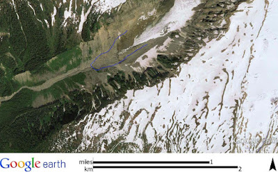
Terminal of Deming Glacier showing retreat since the 1980s (blue line)

1950 aerial

1979

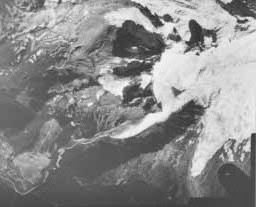
One can see the challenge of assessing precise ice margins in the 1950 aerial. The resolution is not great and with much of the lower end of the ice covered by debris, the actual terminus is a bit hard to determine.

More recent retreat can be seen in a Google earth view from 2013 and more retreat has been measured over the past two years.


Mass balance measurements are not available for the Deming Glacier. As important as this glacier is measuring mass balance is not a easy task and the Deming is too steep and crevasse covered to routinely venture out onto for making measurements. Hence, we only have a limited sense of ice mass based on terminal measurements. That said, recent investigations of terminal moraines on Mount Baker allow for some long term climate history since the last ice age Latest_Pleistocene_and_Holocene_glacier_fluctuations_on_Mount_Baker_Washington.

Monday, September 21, 2015

Darrington Phyllite Fabrics

One of the major formations of the Northwest Cascades is the Darrington Phyllite. This unit is a former ocean floor mud that has been metamorphosed. The fine layers of silt and sand are highly contorted and folded.  


But more than the folding and contortions of the original sediment, the Darrington Phyllite has more than sedimentary layering. The rock contains multiple metamorphic fabrics from its past deep burial and strain.

This hand specimen from Jones Creek outside of Acme has sedimentary layers (parallel to the palm of my hand), a metamorphic fabric aligned with my fingers and a third fabric a bit oblique to my life line. This rock has had a long hard life that had realigned its minerals more than once.   

Thursday, September 17, 2015

Notes on Mount Baker Glacier Trends

The Seattle Times ran an article on the ongoing glacial research is the North Cascades:  seattletimes.com/seattle-news/science/disastrous-low-snow-heat-eat-away-at-northwest-glaciers.

The combination of very little snow last winter and very warm temperatures through the winter, spring and summer have been cause for questions about how our Cascade Range glaciers are doing. Mauri Pelto's work in the North Cascades over the past 30 years has been gaining attention and this year sort of upped that interest - hence the Times article.

The overall trend since measurement of mass balance of glacial ice was started in the 1980s has been a loss of glacial ice. 

Cumulative mass balance for several north Cascades glaciers
(Glacier Mass Balance Bulletin, 2013 2013_gmbb12.pdf

The Easton, Rainbow and Sholes are Mount Baker glaciers. The Lower Curtis Glacier is located on Mount Shuksan east of Mount Baker. (Note that Curtis is named for Asahel Curtis. Curtis took numerous photogrpahs of glaciers throughout the Cascades and Olympics as well as important images of development in Seattle. He was Edward Curtis' brother). Yawning is a small glacier near Cascade Pass near an area of lots of big glaciers.

Prior to the mass balance measuring, all we have regarding quantitative measurements of glacial mass in the North Cascades is from the South Cascade Glacier (wikipedia.org/wiki/South_Cascade_Glacier). The South Cascade Glacier has been steadily monitored since the 1950s and has shown an overall decline in ice volume since the 1950s. It has has the longest monitoring record of any glacier in North America. But that record shows how little glacial trend data we have.

Without mass balance data, glacial extent or area has been used to get a general sense of glacial ice trends. Harper (1993) (Link) provides a good overview of some of the trends in glacial ice in the North Cascades from other workers as well as his own evaluation of old aerials from Mount Baker. The short story is that most North Cascade glaciers appear to have gone through a period of retreat to about 1950 from previous Little Ice Age expansion. Post 1950 glaciers on Mount Baker as well as the Curtis Glacier noted above. advanced until about 1980. Since the mid to late 1980s the overall trend has been retreat. Harper just caught the beginning of that trend.  

The annual mass balance measurements of three of the Mount Baker glaciers that Pelto has been monitoring does vary from year to year, but the overall mass balance of the three glaciers have all declined with more years being negative and more large negative years.

Annual balance ((Pelto and Brown, 2012)

Glacial balance in 2011 showed some ice gain, and 2012 (see Seattle Time article chart) showed some ice gain as well. 2013, 2014 and 2015 have shown declines with the 2015 decline taking the cumulative level to a new low.

I pulled up the Wells Creek SNOTEL snowpack data to do a little comparison with the Mount Baker ice balance shown above. Wells Creek is fairly close to Baker and is relatively high in elevation compared to other SNOTEL sites.


The ice balance gain of over 1 meter water equivalent in 1999 corresponds with a big snowpack year at Wells Creek.  The 1 meter gain in 2011 also matches a big snowpack year. Low snowpack years also correlate with big ice loss years. And more years have been losses than gains with more bigger losses than gains. The 2015 loss this year will take a lot of big snowpack years to make up. So while this year delivered a big blow to the ice mass in the North Cascade glaciers, the trend of ice loss was already ongoing. While the short record of SNOTEL sites as well as quantitative mass balance measurements makes definitive trends hard to figure, the data strongly suggests that glaciers on Mount Baker are out of equilibrium with current climate. How much of current climate is shifted due to global climate change versus local variability should give atmospheric and glacial folks lots to work on.  

Friday, September 11, 2015

The Swift Creek Fix: Maybe Next Year Mr. Ericksen?

Ralph Schwartz did an article (bellinghamherald.com/news/local/article) on the Swift Creek funding issue and State Senator Doug Ericksen. I had been critical of Washington State Senator Doug Ericksen (washington-state-senator-doug-ericksen) and his failure to keep funding for Swift Creek project in the last state budget (click on the Swift Creek tag to read up on the Swift Creek problem). In my post I put forward that Mr. Ericksen failed his district very badly and intentionally during the last legislative session.

Ralph Schwartz gave Senator Ericksen  a chance to explain. Mr. Ericksen is a very good politician and did a brilliant job. He dismissed my criticism "as an attack from the political left". This is a good approach particularly in his district which is very heavily GOP. He further explained that funding of the Swift Creek project got bumped in favor of a potential fix to the City of Lynden's water rights troubles (I should add that he also added funding for a project in the City of Bellingham that the City of Bellingham did not actually seek). This position of priority to Lynden is also politically smart as far more people live in Lynden than the sparsely populated farmland along Swift Creek, and Lynden was clearly seeking Mr. Erickson's help. Politically giving Lynden priority is the smart political thing to do. Whatcom County was also clearly seeking help with Swift Creek. Mr. Ericksen had to make a tough political calculation and he picked Lynden (that is assuming that it truly was an either or situation). One could speculate that he does not want to help out the County politicians - Whatcom County Council are not of his party and he lost an election for County Executive to the current County Executive.

I by no means am being critical of Mr. Ericksen's political decisions. Politics is not easy and I actually admire Mr. Ericksen's skill. He is far better at it than I ever was. That said, part of being an activist is trying to make your political leaders bend to your way of thinking. Easier if you are in their political tribe. Difficult if you are of the other tribe. In this case I am clearly in Mr. Ericksen's mind of the Left Tribe and so my purpose must have been to attack him. However, it was not as an attack from the left but as a mean to simply say "Hey Doug, Why was the Swift Creek project funding removed from the proposed budget?"  

I will still suggest that Doug Ericksen got this issue wrong. I would note that Lynden has yet to design or begin permitting the pipe so the chances of the project using money in 2015-2016 is very very low. In the mean time the Swift Creek project was and is ready to go. Lynden has a variety of resources to solve the potential water rights problem they are in. State funding of one solution certainly is a big help. However, the property owners, farmers, businesses and the City of Nooksack (and potentially the  City of Sumas) along Swift Creek and the Sumas River downstream of the Swift Creek confluence really do absolutely need outside help. Federal regulations regarding asbestos have severely limited what can be done and is an unexpected changed condition with terrible consequences for those impacted. This is the single largest threat to farmland in Whatcom County.

I can only hope that Doug Ericksen will be true to what he said in the article and continue to work on solving this problem. The problem is politically simple: Don't alter the Governor's and State House budgets regarding Swift Creek in favor of other projects. Maybe next year?      

Wednesday, September 9, 2015

Idaho and Oregon Proecting Washington from Zebra Mussels

Crossing into Idaho and then again Oregon I was reminded of a previous post: conservative-issue-zebra-mussels.

Watercraft inspection station in Idaho

Washington State is getting some protection from Idaho and Oregon. The station stops are temporary. I spoke with the inspector in Idaho and she said they had inspected 15 boats that day so far. All checked out fine.

Posting has been limited due to being away from any internet connection and when connected bandwidth was limited and other communication had priority - it was sort of like the old days of dial up for those that remember that brief era.
 

Thursday, September 3, 2015

195 Million Year Unconformity and an Archeological Site

I've been meandering around Petrified Forest National Park as Lisa has a stint as the Artist in Residence (artist-residency-at-petrified-forest) at the park. It has been an enormous learning experience figuring out Chinle Formation members and beds. I am very much out of my geologic expertise. A very different landscape.  
 
One exercise I have been doing is walking contacts simply because one can and one can learn a lot about a specific bed or unit by walking the contact. A 195 million year unconformity is located in the park where Bidahochi Formation or even younger sediments are unconformably over the underlying Chinle Formation. I took a walk along this contact to get a sense of the younger lake beds.
 
Possible Miocene-Pliocene lake sediments overlying Chinle Formation 

The much younger lake sediments are not readily discernible from the underlying pedogenic clay rich silts of the Chinle Formation. I did find what I believe to be little clumps of diatomaceous material within the reddish brown lake sediments.

Diatomaceous? material in lake silts 
 
During my walk along the contact I also spotted a spectacular bit of petrified wood.
 
Colorful piece of petrified wood

Using drift of sediment eroded out of a formation is also a way to trace outcrops when actual exposures are missing. The only problem with this bit of colorful petrified wood is that it is completely out of place. The petrified wood is supposed to be well below.

Anthropogenic processes need to be remembered. This bit of petrified wood represents an archeological site and shortly after spotting it I noted a few more and then noted that some of the pieces were marked with flagging. This site turns out to be a recently identified archeological site of unknown age. This landscaped has been occupied for a very long time.

Based on the petrified wood fragments I observed, the people that left these colorful shards had gathered colorful petrified wood from the valley below and then worked the material while camped or living on the old lake sediments which also happen to have good views across the plains in three directions.

A fun accidental observation that had already been discovered. It may be a while before much is known about this site. Over 2,000 sites have been identified in the park and much is still to be learned.