Thursday, December 31, 2015

Borealis Glacier Notes

 
The Borealis Glacier is located above the confluence of Thunder Creek and McAllister Creek. This glacier has a terminus elevation slightly above 6,000 feet. Its accumulation area extends up to about 7,600 feet. The lower part of the glacier as can be seen on the above topo is very gentle and has been fed by ice falls, two of which are contiguous with the lower glacier, from the higher steep glacial area above. 
 
Although the Borealis Glacier is located along a high glacier clad spine of the North Cascades, the glacier is located on the dry side of that spine and precipitation drops off significantly to the east. The next ridge over has much more limited glacial ice. The slopes below the Borealis to the east and northeast have forests that have burned on a frequent basis.
 
A review of historic aerials indicates that the area covered by the Borealis of glacier did not change much between 1950 and 1990. 
  
1950

1979

1990

The lack of trees and vegetation around the perimeter of the glacier suggests that it previously extended further east and north. The vegetation has been slow to reestablish as much of the area is bare rock and this area is over 6,000 feet and well back within the range such that winters are much colder. This area is getting into one of the few areas in Washington State where there is a true tree line in the mountains - a tree line defined by cold temperatures versus simply too much snow.

I got to know the Borealis Glacier rather well as I camped for nearly a week adjacent to the glacier and walked across it every day. It was on the Borealis that I encountered my first Moulin. I even ventured up to the top part of the glacier with crampons and ice axe. That venture was rewarded with finding golf ball sized garnets.

Large garnet in pegmatite

At the time I had a general sense that the lower Borealis was wasting and that the supply of ice from the upper glacier area was not enough to maintain the lower glacier. But that was only a guess based on one summer observation. However, subsequent imagery shows that indeed the Borealis is in major retreat. My short cut across the glacier from my old camp site has turned into a lake.

2009
 
One final personal memory note. This trip was a solo venture. Sadly I had a camera/film issue and have no pictures from that venture other than rather dull geology pictures of rocks (that was my purpose). While the solo glacier traverses with crampons and ice axe to the high ridge line may seem dangerous, the hike out through the forested slopes below may have been the most dangerous hike I have ever done. Descending into thick cliffy forests makes route finding seem like a lot of lucky guesses and forces routes towards very uncertain directions. In the end I ended up reaching the valley floor about a mile further west than my initial intent, but greatly relieved to have gotten down without having to spend the night on the slope or doing any significant back tracks.


Wednesday, December 30, 2015

Quake Wake Up in Northwest Washington: Short Update

This woke a few people up in northwest Washington.

From the PNSN site

In Bellingham I felt two shock waves about 4 seconds apart. The first was stronger. Can't say much about the quake at the moment. I am sure the seismic folks will have to get busy figuring it out the motion. The quake was fairly deep - generally a good thing.

Update: The depth of the quake corresponds fairly well with the depth of the subducting San Juan Plate. Shifts and movements in the deep part of subducting plat will cause periodic quakes. This movement was not located along the "stuck" part of the subducting slab. That area is to the west and is shallower.

PNSN has a map of the epicenter on the surface. Keep in mind the epicenter is 50 km down as well. For Victoria the epicenter is further down than it is horizontally - hence the epicenter is over 50 km away from Victoria event though the map shows it as 11 km away. The map also shows where the quake was felt. You can go on line and fill out a form to add to this map http://earthquake.usgs.gov/earthquakes/eventpage/uw61114971#impact_tellus. It is useful information for how shock waves travel and where they are felt that casts a larger net than seismic stations.

Image from: 
 

Tuesday, December 29, 2015

North Cascades Glaciers: Notes from 1990

My graduate thesis field area involved an hypothesized fault and metamorphic gradients. But it was hard not to make note of glaciers in my field area.  

 Inspiration Glacier with Tepeh Towers and Klwatti Peak

Crossing the variety of glaciers in a safe manner took some planning and route consideration. Ice falls below the hanging glaciers were a significant hazard. One noteworthy observation was that lots of bare rock was exposed from areas where there had been glacial retreat.

Eldorado Glacier with moraine in foreground

The bare rock provided for excellent exposures of structures and contact relations as good as any road cut or mine wall.

Easy scramble and great bedrock exposures

At the time of my ventures in this area of the North Cascades in 1989 and 1990 the status of glaciers in the North Cascades was a bit sketchy as was my background on the glaciers. The South Cascade Glacier was the only glacier with mass balance data with other inventories reliant on historic aerial images. The overall pictures was that most of the glaciers had undergone substantial retreat post little ice age maximums. There was some sense that maybe the retreats had slowed. 

While I was not doing any glacial studies other than adding some very minimal mapping of moraines, my sense of glaciers in my field area in 1989 and 1990 was that most were retreating. This was mostly due to seeing large tracts of old ice that was wasting away along the margins of many of the glaciers.    


Wasting layers of glacial ice - note Mike on lower right of ice for scale.

Saturday, December 26, 2015

McAllister Glacier

The summer image below gives a sense of where most of the glacial areas are located in the North Cascade range. 

USGS 2013 image
 
The South Cascade Glacier has one of the longest mass balance measurement record, dating back to the 1950s (glacierstudies/scascade). Mauri Pelto began long term mass balance monitoring of several additional North Cascades glaciers starting in the 1980s (http://www.nichols.edu/departments/Glacier/). Many of those glaciers are on Mount Baker. North Cascades National Park began mass balance monitoring several other glaciers in the 1990s (nps.gov/glacial-mass-balance) in the hopes of capturing a range of glacial settings with the Park.
 
One of the glaciers not monitored is the McAllister Glacier, its location noted on the above image. I got a bit of a peak-a-boo view of the lower McAllister Glacier in 1990 when doing field work on the Eldorado Pluton. The view was from the sharp edged divide between Marble Creek and McAllister Creek valleys.


Views of McAllister Glacier from the west
Crevassed ice in the foreground are small hanging glaciers above the valley
The terminus of the glacier was 3,000 feet below 

The McAllister Glacier is tucked away in a very hard to reach and very rugged valley with no trails deep in the core of the North Cascades. While there are hundreds of glaciers in the North Cascades, very few of them extend down into valleys like the McAllister. What is more, only the Carbon Glacier coming off of the northwest side of Mount Rainier extends to a lower elevation than the McAllister. The Deming on Mount Baker formerly reached to a lower elevation but it has receded to higher elevation terminus. The McAllister Glacier terminus is over a 1,000 feet lower in elevation than the more famous and far more studied South Cascade Glacier. 
 
Despite its low elevation reach, the McAllister is rather poorly suited for mass balance monitoring - it is remote, the glacier is complex, much of it appears dangerous to spend time on and a fair bit of the lower glacier is fed by avalanches off the steep mountain sides above.
 
McAllister Overview
 
Dashed blue outlines are the two areas of upper glacier that feed the lower glacier via ice falls down cliffs to the lower glacier. Blue arrows note other sources of lower glacial ice via avalanches. The upper slopes above the glacier are about 8,000 feet. The glacier terminus is at currently at 4,100 feet.
 
Like most of the North Cascade glaciers, the McAllister has been receding.  
 
1947

1979

1998

Estimated terminus locations based on historic aerials showing ice and vegetation
Note the lake is not present in 1947 but is occupied by ice at that time
The retreat between 1947 and 1979 was moderate
The pictures I took were from 1990 and the lake was present
Substantial retreat has taken place in the 1990s and 2000s
 

Thursday, December 24, 2015

A Change of Holiday Plans: Misadventures at Snoqualmie Pass


The scheme was to head down to Seattle and spend the night and then head over the pass this morning. But the shift in weather forecasts was not looking good. The pass reopened yesterday afternoon so we made a run for it. Traffic was light. It looked like the change of scheme was a good one. A half mile short of Denny Creek, where the road steepens, we came to a stop. The pass was closed again. A couple of hours later we began to move as we along with our fellow travelers were routed into a U turn and headed back. Contrary to simply clearing slid cars and trucks off the road, the snow accumulations on the slopes above the pass had reached the avalanche threshold.

The turn around drove home the economic impact of I-90 over Snoqualmie Pass. Miles of trucks lined the road side - blocked from their schemes of goods delivered to wherever they were headed. The cost and practicality of other routes are simply too high. 

From near our stopping point last night
 

Tuesday, December 22, 2015

Lateral Moraines and Boulders Above the Columbia

Finally got around to fixing a couple of glitches on the blog so I changed the banner picture as well while I was at it.


The pictures is from the upper slopes above the east side of the Columbia River across the river from Chelan. The slope consists of lateral moraines from the Okanogan ice lobe that covered the plateau to the east. As the ice retreated from the area a series of lateral moraines were left behind marking sort pauses of the ice retreat.

The massive boulders are nearly all basalt plucked from the top edge of the plateau. Technically most of them are glacial erratics in that the the underlying bedrock under the moraines is much older orthogneiss and granite.

The picture was taken in late spring while the grass was still green. This area is susceptible to wildland fire. It is wet enough for some pine trees on the upper slope but the fire recurrence in this area is fairly frequent and has minimized the tree establishment. This area partially burned last summer.

Monday, December 21, 2015

A Geophysics Christmas Story

I posted this link to a "Human Intelligence: A Holiday Tale" by Kurt Andersen before. But it is worth linking to again given the season. A good science-based (fiction) explanation of the holiday.

http://www.wnyc.org/radio/#/ondemand/108724   

Friday, December 18, 2015

Personal - Property Benefits This Winter

On a bit of a personal note, Lisa and I bought a 14-acre property this year. The motivation was in a large part to have a larger studio space so Lisa can do larger landscape paintings. The property happens to have an old, but structurally-sound shop/barn building. There is a small cabin as well that requires some improvements to be habitable. 

Most of the property is in a conservation easement as the property has some habitat for a couple of specific species. Outside of the conservation easement we have had some benefit from the new property. 

Beginning of stand density reduction

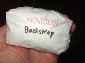
One of my deer hunter friends inquired soon after we got the place. I was sure that he would have success and we got some benefit with our permission granting.


Wednesday, December 16, 2015

Hoquiam Landslides, January 2015

January 5, 2015 was a bad day for the City of Hoquiam. Flooding and then landslides hit several areas of the city. The recent landslides are obvious scars on the steep slopes on the north side of the city. The worst area was along the steep slope of Beacon Hill.  

One of the destroyed homes still on site 11 months later 

Location of two former homes

An interesting bit on the three homes hit by slides along Queets Avenue is that two were occupied at the time the slides came down. One was pushed off its foundation into the street, but no one was injured. Impressive in that it suggests the home framing structure must have been strong.


Most of the soil on steep slope has slid 

 It is readily apparent that the top soil layer pealed away from the hard unweathered bedrock on the steep slope. It also appears that more material will likely come down the slope.

This section of slope did not slide in Jan 2015

1990 aerial view of area with Beacon Hill Road above the neighborhood

2013 view of land cleared above the slide area.

Other areas of Beacon Hill had problems as well including the road to the hill top which was blocked by slides and homes were damaged and destroyed that were above the other slide areas.

The slides were a hard hit to this city. The landslide damage just to the city property was estimated at $1.8 million. But tough for home owners or renters as landslide insurance is very rarely carried.

The damage cost to the City of Hoquiam was $1.8 million. A tough nut for a city that has been seeing some significant declines in tax base. The closure of the Harbor Paper mill in 2013 cut $500,000 out of the annual tax revenue for the city and 240 jobs left the city. The city staff level has declined nearly 30% since 1995.

The city reported that a DNR geologist inspected the slopes of Beacon Hill after the slides(http://cityofhoquiam.com/landslide-flood-disaster/). This could not have been an easy task under the circumstances. The brief report concluded with a not very comfortable ending:

Residents along Queets Avenue (with the exception of the homes condemned) are hereby advised the city is unable to assess or determine the condition of their home or property.
Although there has not been any visible significant movement today of the hillsides along Beacon Hill, the city cannot guarantee the safety of any structures above or below this area. Each resident is urged to contact their insurance provider as well as engineering and licensed geological experts to determine the status and safety of their premises should they chose to return.


Monday, December 14, 2015

Washington State Outer Coast

I live less than a mile from a salt water bay. However, I really do not feel like I live near the ocean. A trip to the ocean beaches versus the inland waters beaches of Washington is a fairly long drive. I refer to the ocean beach and shores of the western edge of Washington State as the "Outer Coast".  

The southwest outer coast is made up of huge sand beaches with large drowned estuaries of the Columbia River, Willapa Bay and Grays Harbor. The sandy shallows extend far off shore and hence the initial breakers are a couple of thousand feet off the beach.

Surf from near Ocean Shores

It was hard to judge how big the initial waves were. The National Weather Service had predicted 20 to 25 foot swells off the coast down from 25 to 30 two days before. The NWS also issued this warning:

A HIGH SURF ADVISORY MEANS THAT HIGH SURF WILL AFFECT BEACHES IN
THE ADVISORY AREA...PRODUCING LOCALIZED BEACH EROSION AND
DANGEROUS SWIMMING CONDITIONS.

No desire to swim, but we did venture out in the stormy weather to Point Brown near the end of the long Ocean Shores peninsula.

Beach combers looking for storm treasures

The rain hurts when the wind is blowing 50 mph. There was a 2-foot storm surge added onto the already high tide. I noted the pair of folks above were pros - they wore goggles. A brilliant idea with the high wind and rain and flying salt spray. One other note - I took a look at the large jetty rocks and they sure look like they came from greenschist quarries in Skagit County. Big massive blocks that can take large waves. 

Around the tip of the peninsula we checked out the recent and ongoing erosion.

End of the old road to Protection Island

20 years ago all the water area in this picture was land

Shoreline barrier peninsulas are dynamic places. The southwest Washington State coast is a land of barrier peninsulas and like similar landforms on the Atlantic coast and Gulf coast of the United States this is a place of changes that can readily be seen within individual life spans.

A look at Google earth for a quick sense of the change captures the change since 1990. Protection Island (currently and in both images a continuation of the spit) is on the right in the image below. Point Brown is on the left.

1990

2013

Natural change, dredging to keep the harbor open, jetties and marinas all can trigger changes in the shoreline processes and where sediment gets eroded and deposited. Compared to the Atlantic coast and Gulf coast our beaches might be a bit more dynamic due to the greater frequency of large storms with high wind and the very large waves the Pacific Ocean routinely sends up against our outer coast. We also have a bit of a tectonic issue that adds an additional and very significant dynamic to the shoreline processes. (I will note I had my tsunami escape routes in mind at all times)

A closer look at the erosion site shown above over time:

1990 (note the road)

2006

2011 (note the road ending in the water)


Friday, December 11, 2015

Physics and Minorities: A Non Answer to Chief Justice Roberts

CHIEF JUSTICE ROBERTS:  What ­­unique perspective does a minority student bring to a physics class? 
MR. GARRE:  Your Honor ­­ 
CHIEF JUSTICE ROBERTS:  You're counting those among the classes in which there are no minority students. And I'm just wondering what the benefits of diversity are in that situation? 
MR. GARRE:  Your Honor, we can talk about different classes, but ­­ but this Court has ­accepted in Bakke and Grutter, and I think it accepted again in Fisher, that student body diversity is a compelling interest.


The question Robert's asked is a good one. I can not answer Judge Robert's question, "What unique perspective does a minority student bring to a physics class?" The reason I can not answer the question is that in my physics classes (I took 7 physics classes) there were no minority students. 

I still wish I would have had the opportunity to have gotten to know that answer. It was a short coming of much of my university science education. 

 
(Complete transcript (supremecourt.gov/oral_arguments/argument_transcripts).
The University of Texas was defending its admission policies for student diversity this week before the Supreme Court. The question by Justice Roberts got some attention (roberts-affirmative-action-physics). The question is a good one. And one that I have found many scientists have noted in their own personal experience. The answer within the transcript is not directly towards the point of the question and is lost in precedent case reference and within the larger context of the various nuances of efforts to ensure a diverse experience for university students. And in this case the oral arguments are rather choppier than even the usual dialog that takes place during Supreme Court oral arguments. 


Wednesday, December 9, 2015

Wet Notes from Field Days in Winter

Part of doing geology field work is getting wet, and the last few days have given me a share of that. But the rain was mild and big rains and leafless trees and brush can make the job of assessing conditions easier than the dry times and jungles of summer. 

Shades of back and white on Puget Sound

Water flowing out of a catch basin

Drain pipe on a steep slope

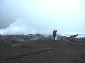
Drift wood adrift after a fairly large storm surge tide

Water run off heading over the lip of a steep bluff

A long ways down and hence a long walk around to inspect the bluff

Black and white view in the San Juans

View towards Obstruction Pass and Peavine Pass from Upright Head on Lopez

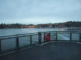
Leaving Friday Harbor