Wednesday, April 30, 2014

Revisit to Shore Reach and the Big 1998 Toandos Landslide

I got to revisit a reach of shoreline that I had not seen for a few years, but have visited numerous times in the past on the east shore of the Bolton Peninsula or the west side of Dabob Bay.  


Like much of the Bolton Peninsula, the shore here is fronted with very steep and fairly high bluffs. The forested slope on this reach is a bit deceptive. There a cliffs within the trees and access requires knowing the routes that are passable, local permission or trespass. The route I took on this trip is not very advisable and required a high tolerance for getting scratched up. But, I did have the beach to myself which has always been the case at this reach.

The bright green trees are mostly red alder and mark some of the more recent thin slope failures that have taken place at this shore reach. The bluff is underlain by very hard compact glacial drift and glacial outwash some of which appears to be at least a couple of ice ages old based on the hardness as well as stratigraphy of two tills being present on the slope at a couple of nearby sites.

My first visit to this shore reach was in 1998 and at the time there was a lot more bluff exposure. A great many landslides had taken place on this reach and throughout the area due to a some remarkable snow/rain storms. Since then there has been little action and the the beach is stable and little if any erosion has taken place at the toe of the slope in part due to the large sediment influx that was contributed by all the 1997 though 1999 landslides.

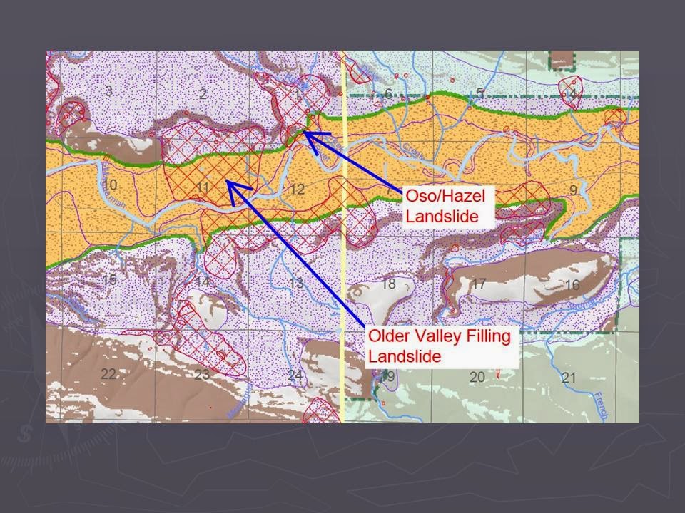
The really big landslide of the area is a across the bay and I had a nice view of the old scarps on the Toandos Peninsula.

Large landslide scar above Dabob Bay 

I've been to this slide a couple of times and did an evaluation of the stability of the slopes at several points along the bluff. The big failure is in the center of the above image. At that location the entire bluff collapsed. The trees on the lower bluff have grown up on part of the landslide deposit since the bluff collapse in 1998. The top of the collapse is 400 feet above the bay and the width of the slide area was 1,400 feet. Additional slide areas were located immediately adjacent to the slide. A resident on the Bolton side of the bay told me the wave height from the slide that reached their shore was 7 feet high.

The geology of this slide is rather unique. The entire bluff at that location is sand. It is somewhat compacted, just enough to hold a steep slope - for awhile. I noted bits of charcoal within the sediment on the bluff suggesting a non glacial interval. The site suggested a valley cut into older compact geologic units and then filled with sand over a relatively short time frame. 

Tuesday, April 29, 2014

The "New Lands" to the East of Anacortes

The Anacortes water front faces east and like many water fronts consists of a swath of fill over the former tide lands. The filling of the tide lands took place relatively recently.  
 
1969
 
Highway 20 is the broad road on the south. The highway comes to a T intersection and then heads north on Commercial Avenue, the main street of Anacortes. The paper mill is the large industrial complex that extends out into the water on a mix of fill and piers. 
 
1978

The big changes began in the 1970s. A rock sea-wall was constructed and the bay to the east was dredged for shipping to the refineries located to the east if Anacortes at March Point. The dredged material was pumped and dumped behind the wall to create new land. The 1978 aerial captures the late sated of the filling project. Note as well the small homes that had been on the northeast part of the 1969 image had mostly been removed.

1993

The initial use of the filled land had begun and the land back behind the fill to the west was beginning to develop as light industrial land. The development on the fill area itself was and still is a boat yard.


2013

Over the past twenty years the industrial land has developed. A significant part of that development has been boat related businesses. Several of those large buildings are boat manufacturing businesses. The paper mill is now gone and a significant amount of cleanup has taken place around the mill site.

The remaining portion of the filled are is likely to be used as a boat yard. A part of the "new land" is managed by the Washington State Department of Natural Resources (DNR) as it was formerly state owned tideland.

Monday, April 28, 2014

The Unit Train Era in Western Washington

Cook Road Interchange

I had a short pause in my ventures up the Skagit River valley. A unit train of oil tanker cars passed across Cook Road as I exited the freeway so a bit of a delay.

There were plenty of comments during the EIS scoping process for the proposed coal terminal in northwest Washington regarding train traffic impacts. All the while, projects were approved to expand the rail terminals at the Whatcom County refineries and suddenly one mile plus oil tanker unit trains from North Dakota are part of the Washington Landscape.

The trains pass across Cook Road at a reasonable speed so my delay was not too long. But note the truck in front of me. The truck was just exiting off of I-5 from the north bound lane and was blocked from completing leaving the exit ramp due to the back up of traffic. I had stopped to allow space for the exiting cars and trucks even though I had no stop. I was not able to capture the backup, but cars were backed up the entire length of the exit ramp with a few pulled over on the freeway margin before the ramp.

From a policy perspective it will be very interesting to see if any mitigation for these impacts from increasing unit trains associated with export terminals are proposed or what the threshold will be for determining which intersections or rail crossings will deemed as a significant impact. Previous projects that increased unit train traffic through the region have been approved without having to mitigate the traffic impacts (specifically rail terminal improvements at refineries in Whatcom County). Rail transit was here long before cars and trucks, but the advantages and encouragement policies given rail plus the requirement that they have to haul were given long before the idea of mile long unit trains became part of the landscape and long before cars and trucks relegated rail transit to little value to local communities. This is not a new issue, but it is new for several communities in western Washington including Cook Road. Perhaps a longer exit ramp will be needed.     

Sunday, April 27, 2014

Gravel Pits and Piers

A bit over a year ago there was some legislative stirring in Olympia regarding stream lining of pier projects. The target was the "pit to pier" proposal in Jefferson County (sb5805-pit-to-pier-gravel-and-landslides), a scheme to get gravel from a mine into barges on the north end of Hood Canal for cost effective shipping to demand centers. The scheme involves building a conveyor belt system from a huge gravel deposit to a loading pier to be built on the shore and extending out across tideland to deep water. The project has languished.
 
The project is not the first "pit to pier" scheme on the shores of Hood Canal. Large gravel terraces are found at numerous locations along the west side of Hood Canal. The deposits were formed within glacial ice margin lakes along the eastern front of the Olympic Mountains during the late stages of the last glacial period (some older ice age deposits are present as well).
 
These big high quality deposits can readily be seen along Highway 101 with the deposits just north of Brinnon and on the south side of the Hama Hama River being a couple of the better examples.
 
Hama Hama gravel

Delta gravels at Hama Hama

The Hama Hama deposit is particularly large and there was for a time a proposal to load the gravel onto barges as Hood Canal is located essentially across the street. The project failed to advance, but the gravel remains. A case of high local supply and low local demand versus say urban Seattle with high local demand and very low local supply.

Gravel and rock mining with water access and the associated resource conflicts will likely remain a periodic policy battle ground for generations.   

Thursday, April 24, 2014

Personal Tradition in Fife

I ventured to Tacoma for a project and wrapped up with a bit of a personal history/tradition. In the early 1990's I spent the better part of a year at a Superfund Site project on the Tacoma Tide Flats. The site was no longer tidal, but had been filled a century ago. 

Just off the tide flats to the east across the Puyallup River is the town of Fife. At the time Fife was still rather small, but was clearly going through rapid change with the old truck farms on the river plain converting to warehouses and other development much of which was associated with increased port shipping capacity at Commencement Bay. 

Along the old highway there was and still remains a burger joint of the past, mostly bygone era - the Pick-Quick. Despite all the changes and all the chain restaurants typical of old highways and adjacency to freeway interchanges, Pick-Quick is still there, and despite the cold rain was plenty busy. I had a burger and a blue berry shake and then braved the traffic for the journey home. The fact is their simple fare is simply good. 


The old motel across the old highway from the old days is gone, but the sign remains. Pretty good sense of humor though for those that know your movies.


Tuesday, April 22, 2014

Landslide Discussion with Whatcom County Council

Whatcom County Council wants to start a dialog on landslide hazards and I was asked to make a presentation. The following are the images from the presentation with just a few notes. John Thompson, geologist with Whatcom County Public Works River and Flood and Natural Resources will present some information as well. A strength Whatcom County has had has been staff geologists that have played a role in reducing hazard risks.
 
I decided to start the talk with a brief overview of the Oso/Hazel Landslide with some emphasis on the fact that this slide risk was well known by geologists and was foreseeable.


Snohomish County Geohazard Map

LiDAR of Oso area landslides showing age relationships of past large slides

State DNR checked the slide after a storm event in 2009
 
Most comparable Whatcom County slide to Hazel is the Clay Banks

Recent river blocking slide at Clay Banks

Block of clay showing run out extended beyond current river

LiDAR of Clay Banks and Nooksack River impingement

Aerial of Clay Banks area

This small collapse of an old logging road traveled over one mile


Bark stripped off tree at upper end of failure

Slide mobilized large boulders and wood in debris flow

Home damaged by debris flow/flood

Boulders, logs and mud from debris flow

Small shallow slide in big leaf maple dominated forest

Damaged home from slide

Another slide down small stream

Directly aimed at home
Lifted from Dart's paper on rock failure in New Zealand

Rock failure above the Skagit River in Whatcom County

Damaged truck and dock

Swift Creek Landslide

Fracture scarp on upper Swift Creek Landslide

Bald Mountain Slide in Canyon Creek watershed includes most of the forested slope
Picture taken from a vantage point on another deep-seated  landslide

LiDAR of lower Canyon Creek

Bedrock deep-seated failure in Jones Creek above the town of Acme

Upper part of slide with trees on slide

Assessing the passage of a debris flow on Jones Creek

DEM of massive Church Mountain Landslide
Slide is approximately 2,000 years old
Town of Glacier is built on slide

Bedrock landslide on unknown age near Kendal

Staring point of conversation

LiDAR and property lots from Jefferson County Parcel Search web page

Potential landslide risk hazard maps

Screen shot

A popular quote for geohazard types
 

Sunday, April 20, 2014

Notes from the West Side of Marrowstone

I had a project on the southwest shore of Marrowstone Island near the upper, south end of Scow Bay. The beach here is primarily gravel at the surface but with a mix of sand and silts under the gravel as well. Except for the upper beach the tidelands here are crunchy with various tidal sea life too the point of influence where I walked.

barnacle encrusted beach gravel

Great heron sharing the beach with me

The protected nature of the bay is such that the gravel remains undisturbed for long periods and as such becomes encrusted with barnacles and muscles and the underlying sediment is full of clams as well as sand dollars.


The shoreline bluff is primarily glacial drift. The discontinuity of a thin bed of cross-bedded sands formed a rather continuous line along the shore bluff perhaps a brief period when subsurface water flowed under this part of the ice sheet.

A very red skinned madrone at the top of the beach and base of the bluff

The above spectacular madrone was one of several in a stand and like many large healthy madrones despite the shoreline position, this madrone was rooted into a midden of shells and charcoal.

Shell fragments, charcoal and fire cracked andesite cobble

Layer of clam shells. Just a note - When I see these locations I look only.


The shore is not entirely glacial. Outcrops of sandstone rise above the beach level for a brief section of the shore.

Barnacles encrust the bedrock, but the odd concretions that dominate this formation are present although no where near as spectacular as the concretions on the east side of the island marrowstone-island-geology-trip-to-see-concretions 

The bedrock outcrops on the island are oddly limited to the shoreline only - as far as I know and as far as geologic maps of the island show. At all locations the bedrock is covered with drift and does tot extend to the tops of the bluffs. There is likely some sort of normal fault cutting across the island as the south half of the island has bedrock outcrops and bedrock has been encountered in well borings while depth to bedrock on the north half of the island has not been reached even with relatively deep wells.