Saturday, January 30, 2016

Supreme Court and Demand Curves: A Win for Marijuana?

The U.S. Supreme Court made a major ruling on electric energy policy this past week (FERC v Power Supply Association).

The ruling is favorable to efforts for shaping the electric peak demand curves. That is it will be easier for utilities to lower high electric demand by rewarding (paying) some consumers to shut off or lower their electric use during periods when the demand begins to surge.

"Not only do rates rise dramatically during these peak periods, but the increased flow of electricity threatens to overload the grid and cause substantial service problems. Faced with these challenges, wholesale market operators devised wholesale demand response programs, which pay consumers for commitments to reduce their use of power during these peak periods. Just like bids to supply electricity, offers from aggregators of multiple users of electricity or large individual consumers to reduce consumption can be bid into the wholesale market auctions. When it costs less to pay consumers to refrain from using power than it does to pay producers to supply more of it, demand response can lower these wholesale prices and increase grid reliability. Wholesale operators began integrating these programs into their markets some 15 years ago and FERC authorized their use. Congress subsequently encouraged further development of demand response." - US Supreme Court.

A group of power supply companies wanted to maintain their favorable position by limiting payments to businesses or groups that lower demand. That way they could charge large sums to meet peak demands without the worry of competition from someone getting paid to turn off the power.

Large consumers of electricity have been dining this in Washington State for some time in association with the BPA. As computers and data management get more sophisticated bring more users of electric power into lowering the peak demand curves should increase. Energy Northwest has been developing a demand response system with a number of public utility districts (PUDs) in Washington State that thus far has been passing tests to the system (Energy Northwest Demand Response Project).

The approach will save large electric consuming businesses money as they will get paid to cut back when demand gets high and this approach will keep prices down for everyone by avoiding having to pay very high peak demand rates to power producers. As systems get more sophisticated more businesses and perhaps even homes will be able to participate in the market and thus smooth out the energy demand curves.

Much of the marijuana in Washington State is grown in doors and are big consumers of electricity. Most marijuana production although very green in color is far from environmentally green for that reason. However, the business may be well suited for participation in shaping demand curves.

Avoiding peak demand will shape how various electric supplies will operate and if it works well minimize the need to build or turn on new peak power plants.  

Friday, January 29, 2016

It has been another warm winter for the lowlands of western Washington. But regardless of the mildness I was still surprised to see this clump of blooms on a slope in the San Juan Islands.


I have no idea what the plant is or if it is native. Plant IDs are a weakness in my understanding of the world. The bloom was on a south facing slope with rocks and was near the water. Hence, a mild climate spot that seems to be working well for this plant.

The site did have some other native tree favorites:

Juniperus maritima

Arbutus menziesii
This growth habit is common on south slopes in the San Juans
The root mass appears to survive burning and cutting and sends up new trees

Monday, January 25, 2016

Whatcom County and Lahar Struggles


Whatcom County is in the midst of updating its Comprehensive Plan. Comprehensive plans are wide ranging documents that set broad planning policies around future development and natural resources and facilities planning. They also establish policy guidance for geologic hazards.

A public hearing on the updating of the Comprehensive Plan will take place Tuesday January 26 before the County Council. I suspect there will be lots of public comment on population growth projections, protection of habitat and likely some direct and indirect stuff on coal and oil terminals. Geology hazards - I will weigh in on lahar hazards.

The Planning Commission, an advisory body, has forwarded their version of the plan to the council. That plan includes a significant change in lahar hazard policy. The policy change would set up establishment of removing all limits on development within potential lahar hazard areas. The change was instigated by comments to the Planning Commission by the Building Industry Association of Whatcom County. The comments unfortunately reflect a poor understanding of lahar risk and consequences.

Thus far I sent the County Council this email:

The language adopted by the Planning Commission would be a major policy shift. I have not seen the original language suggested by staff but note that they took a different view per the draft I saw that came out of the Planning Commission. The policy shift would require a substantial change to the critical areas section on lahars. It also may impact how planning in the potential lahar areas may move forward in the future.   

The Planning Commission approach will mean no development restrictions in lahar areas. The way the PC has written this also could allow zoning changes within lahar areas that could intensify development within know lahar risk areas. 
 
My own view is that there should be limits on development in the lahar areas, but some easing of the rules can and probably should be done regarding some levels of commercial developments. I believe that Planning is working towards addressing that issue by setting an upper limit of some sort. The other issue is for residential development, the current regulation directs the review of residential development to a general part of the code that may be best to drop as it really is not applicable or requires unnecessary review of the obvious - I think that is being addressed as well. 
 
One other area of possible discussion could revolve around distance along the lahar routes. The longer the distance the lower the potential risk or the more likely that some actions will be taken to address the sediment associated with the lahar/mud flows. A lahar will cause all sorts of problems all along the Nooksack in terms of flooding. Lahars to the east off of Baker will cause all sorts of trouble on the Baker River, PSE's hydro projects and Skagit County.  However, dredging of the river to maintain the river course may be a viable solution. This is exactly what took place along the Cowlitz River at I-5 and within the Longview/Kelso area post Mount Saint Helens eruption. The other aspect of distance is that there is more time and warning for escape.  But for areas close to the volcano, the scale of the event and the area immediately impacted can be really horrible. The terrible example being Nevado del Ruiz in Columbia where approximately 27,000 people died in a lahar event. We are somewhat fortunate that thus far we do not have a substantial population or development within areas of potential lahar. While we can say these events may be viewed as rare, they are inevitable and absolutely will happen. Essentially all of the Cascade volcanoes have had large lahars in the past on multiple occasions.   

Saturday, January 23, 2016

Skokomish River - Washington State Flood Champion

The National Weather Service has color coded warnings on their map. A routine winter warning for western Washington is a bright green flood warning is southwest of the elbow in Hood Canal. The flood warnings apply to the lower end of the Skokomish River. 


I had a wet day in the field on Thursday near the Skokomish.

Mid day liquid sunshine slogging through clearcut to site visit

The weather broke Friday morning and I had nice views of the fairly typical flooding on the Skokomish under brighter circumstances than the day before.

Flooded fields


This guy opened is door so he could make sure he was staying on the road as drove a flooded section.
There are plenty of warnings about not doing this.
However, this road goes under water so often, maybe the locals are expert.

River is to the far right.
Logs that wash onto fields are drug and piled on the fields edge.

The presence of development within this frequently flooded area suggests that the flooding has been increasing over the years. Some casual effects have been suggested for the increase frequency of flooding: excess sediment in the river from past logging practices, a dam on the river that has reduced the capacity of the the river to routinely move sediment and tectonic uplift of the delta area reducing the gradient of the river. Some reduction of flooding has been accomplished by removal of dikes downstream of the flooding area and by the construction of a elevated bridge over part of the flood plain.   

Thursday, January 21, 2016

Nice Coastal Fossil Summary Link

I came across this lengthily blog post on The last decade of marine vertebrate paleontology in the Pacific Northwest

There is not much I can add to this. It is a nice summary of recent work and findings in the coastal marine sedimentary rocks.

The post by Robert Boessenecker notes that there are significant challenges to fossil collecting sites along the Washington State coast.  "Paleontological fieldwork in the Pacific Northwest is challenging - the maximum and minimum tides are more extreme than central California, the localities are often more isolated, it's usually far windier and colder".  "Unlike the California coast, which has many fossil sites conveniently located within an hour's drive of various large universities and other paleontological institutions, most of the fossil sites in the Pacific Northwest are a bit further of a drive. Coastal fossil sites need semi-constant monitoring, as erosion is rapid and new fossils can be exposed after every storm at some localities."

So what I will add is that a couple of years ago I walked a stretch of coast that has revealed some very critical early whale fossils. My purpose was geomorphic. It was cold and windy and the tides were a significant concern for my purposes. I did find a few clams and gastropod fossils. The site had active erosion and landslides (big slides) so there was ample new exposures. It was a very good example of the logistic challenge Boessenecker describes. The site is not a bit further of a drive from any institutions I know of - it is a long drive! and a long hike. 

Tuesday, January 19, 2016

West Bar Giant Current Ripples

Bruce Bjornstad has been putting together aerial imagery videos of the various ice age flood features along with explanatory graphics. His latest is on the giant-ripples at West Bar south of Wenatchee.

While the snow conditions I had when viewing the giant ripples helped, giant ripples can be a bit challenging to see on the ground and even harder to photograph. The aerial fly over had near perfect lighting.

Great imagery and graphics explaining this feature - enjoy.


Monday, January 18, 2016

A Music Break: Mary Fahl at the Royal Room

Last week I was listening to a rendition of 'The Town I Loved So Well', a bit of folk with a political commentary on the troubles in Derry, Ulster, Northern Ireland. A version of 'Dawning of the Day' by Mary Fahl followed on the mix of songs.

Mary Fahl has written new words to this traditional Irish song in memorial to the first responders on 9/11.


If you are not directly familiar with Irish music, the melody is still likely familiar. A well known version is the version that replaced the original words with the poet's Patrick Kavanaugh's poem "On Raglan Road".


'Dawning of the Day' is a traditional Irish song dating at least back to the early 19th Century. There is another similar song of the same Irish name 'Fáinne Geal an Lae' dating back to the 17th Century as well. That song has a mix of myth and geology. But the more recent version is better known.

Mary Fahl stopped in Seattle this past weekend at the Royal Room on Rainier Avenue in Columbia City. It was a very wonderful show by a passionate singer. Felt very fortunate to catch her being here in Washington. I particularly enjoyed 'Everything's Going To Be Alright' because of the heavy astronomy/space exploration angle.


Saturday, January 16, 2016

Tsunami Struggles in Oregon

A bit of a follow up on the now famous "toast" quote from last summer (notes-on-everything-west-of-i-5-will-be-toast).

From Chris Goldfinger atquake.wordpress.com:  "Well the people of Seaside rejected a bond measure to move the schools, Gold Beach is putting a hospital in the tsunami zone, and OSU and OMSI are putting schools in the tsunami zone.  Really, I’m not making this up."

The student leadership that live and study at Seaside Schools apparently have a different policy view than the voters http://www.dailyastorian.com/Local_News/.

I previously noted a policy struggle in Newport and Oregon State University (tsunami-policy-newport-Oregon). That struggle has continued (oregonlive.com/osu_quake) and raises interesting policy issues. Add to this discussion the struggle Gold Beach, Oregon has with hospital planning (pb.org/new-hospital-planned-in-tsunami-zone).

In reading the articles, reviewing various planning documents and back and forth letters I have a few takes on the issue.

First, it is relatively easy to have my own specific sense of what the policy and approach should be. However, that is my own personal view. I do not live in these communities nor do I see the world the same way. Policy for planning is hard and takes time and requires lots of information and working through various values people bring with them.

Second, this issue is rather important to me from a work perspective. I am involved in geohazard work including development of regulations regarding tsunami hazards. Washington State's approach to geohazard planning is different than Oregon (a whole separate discussion).

My take on the Oregon State Science marine science center is that at least part of the center should be down by the water. The part that requires salt water tanks and direct operations involving sea water. But the bulk of the offices, conference rooms, and classrooms should be outside the zone. Those parts with large numbers of folks that are not water dependent uses should be located elsewhere.

The Gold Beach hospital issue strikes me as a planning failure. As a geohazard person it is truly awful to come in after the fact and deliver the bad news that a site where lots of effort has already taken place. Gold Beach and for that matter Seaside are really in a tough spot. But one way to look at these situations is that these communities developed where they are over a time period and it will take a long time period to move these communities to a safe place. If the State is going to weigh in on local matters, the State should be willing to assist. From a State policy perspective this makes financial sense. Having no hospital to serve Gold Beach and the county it is in will be an enormous burden when the big quake hits.

A final note. I remain struck at how well emergency planners have been doing in thinking about tsunami hazards and how poorly development planners have been doing. It explains the whole "everything will be toast west of I-5" comment.   

Thursday, January 14, 2016

Baker Window


Nooksack Formation along Baker Lake Road

I ventured into the Baker Window last week. A window in geology terms is a structure where there is a hole in the overlying thrust sheet or sheets. The rocks under the thrust sheet are exposed in the window area.

Schematic overview of a thrust system. A hole in the nappe which exposes the underlying rocks below the thrust fault is called a window. A klippe is an island like block above the thrust likely due to erosion or additional faulting. Schematic from Wikipedia:  ( https://commons.wikimedia.org/wiki/File:Thrust_system_en.jpg#/media/File:Thrust_system_en.jpg)


Simplified geology map of Baker Window  (Tabor and others, 2003)

The Nookasck Formation (light blue and N) is exposed in the Window. Thrust nappes over the Nooksack Formation from base to top are the Excelsior Nappe (EX), Welker Peak Nappe (WP), Shuskan Nappe (S), and Gold Run Pass Nappe (GRP). Tabor and others (2003) suggest that the window is in part exposed due to a extensional fault noted on the west side of the Baker Window.

One can see that Mount Baker is sitting in the middle of the window. The rocks of the volcano are not part of the window. Mount Baker is a recent overprint that happens to be smack dab in the middle of the window significantly obscuring the exposures of Nooksack Formation posing a bit of a challenge correlating units across the area.

The Nooksack Formation is the autochthon and the nappes above it are all considered allochthonous. That is the Nooksack Formation was there first and the nappes all were moved via thrust faults to their present locations. At least three of the nappes are considered distinct separate terrains with uncertain origin, but likely came from very far away places. The Nooksack Formation itself also may originally have formed elsewhere, but relative to the above nappes it was there first and has not undergone as much metamorphism as the nappes that overlie it.

The Nooksack Formation rocks on the north side of Mount Baker are somewhat different than the units on the south. As Tabor and others (2003) noted, "Where fossils are absent, some of the more deformed clastic rocks of the Nooksack are difficult to distinguish from rocks of the Late Paleozoic Chilliwack Group". Indeed, earlier maps as recently as 1986 (Brown and others, 1986) put some of the Nooksack Group as Chilliwack.

I stopped at the cliff along the road shown above and looked for fossil belemnites, a definitive feature elsewhere in the Nooksack Formation. I found no fossils and found the rock to have multiple distinct slaty cleavage development. Those observations are consistent with Tabor and others (2003) as well as my own memory when I stopped along this road in 1983 with Chuck Ziegler during his time working with these rocks.


Wednesday, January 13, 2016

Samish Island Great Blue Heron Rookery

We had a sunny dry day last Saturday to take a walk about at the Samish Island heron rookery. The rookery is where great blue heron nest in trees on the island. The rookery is within a fairly mature second growth mixed species forest. The Skagit Land Trust was conducting a yearly nest count with volunteers.
 
Proud property owner of conservation easement

great blue heron nests

Tagged tree with nests 

Egg fragment on forest floor

Fire scarred mature Douglas fir with heron nests

Besides the heron nests I spotted a few other forest features

Douglas fir stump with bark having grown over the stump post cutting

Pacific yew

Glacial erratic
The forest is underlain by glacial drift

Monday, January 11, 2016

Upright Head Preserve Erratic and Forest

One last post on Upright Head (upright-head-wdot-property-walkabout and upright-head-conglomerate).
 
To the west of the Lopez Island ferry landing is Upright Head Preserve. The preserve was purchased by the San Juan Land Bank (sjclandbank.org/protected-lands).
 

A fair bit of the forest in the preserve is typical western Washington forest.

Western red cedar

Western hemlock

Trial through forest towards northern tip of Upright Head
The trail follows a former road route

The northern tip of Lopez at the north end of the preserve has another stand of junipers with madrones and balds as well as view to the north.


From left to right:
Orcas, Obstruction, Lummi and Blakely

For glacial minded folks there is a large glacial erratic in the forest east of the main trail. A bit of the British Columbia Coast Range brought to Lopez Island during the last glacial period.


Sunday, January 10, 2016

Junipers, Sagebrush, Comedy and Terror

Plenty of computer screens have been covered with words and takes on antigovernment militant takeover of buildings at the Malheur Wildlife refuge in Oregon. I find it a fascinating mix of comic and terror.

For those that want to get into the details of the background story that led up to this current drama, its worth reading the BLM grazing permit denial for the allotments that the Hammonds had been using (wildfiretoday.com/dHammond_grazing_decision.pdf). It is worth considering what it must be like as a range or fire manager in dealing with folks like this. There is comic and terror in this document.

Some imagery of the Kumbo Butte burned area where one of the wildfires took place took place:

2006 image
Dark vegetation are western juniper trees

2006 image (USGS) of north edge of burn area
Note fire scars along road

2011 image
Note that there are now much fewer western junipers

The Hammond Ranch is within the Donner und Blitzen Valley north of Frenchglen at the west base of Steens Mountain. For those familiar with Oregon geology it is a bit north of the Diamond Craters area. The allotment area where the permit was denied is high elevation juniper and scrub steppe. Range land without western juniper and sage brush is more valuable for cattle - hence the use of matches during August 2006. The actions that took place in 2006 were comic but also terror with no regard to the risk those actions posed to fire fighters and other properties.

Friday, January 8, 2016

Snow Day

I generally do not like to do field work in the snow. It is not the cold. Snow limits my ability to see and read the landscape. But the snow cover was thin enough at this site that other than awkward footing on snow covered limbs and branches, visibility and access to the soils was adequate. The site was also located in an area that I had done a fair bit of previous work. This trip simply meant confirming a few things.


The snow was on the order of 8 inches with thinner patches in the forest so digging through it was not much of a chore. The soils were well drained glacial outwash and moraine material as expected from previous ventures.


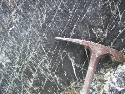
I did get to see some bedrock. Metamorphosed sedimentary rocks with multiple cleavage surfaces and dissolution veins. A future post for that rock's story.

Wednesday, January 6, 2016

Upright Head WDOT Property Walkabout Notes

The east side of Upright Head on Lopez island is owned by the Washington State Department of Transportation. After checking out the conglomerate in the road cut down to the ferry (upright-head-conglomerate), a visit to the WDOT property to the east is a pleasant natural park setting with nice views, more conglomerate and mix of bedrock balds and unique forest.  

Looking north to the ferry dock and Orcas Island with bald in the foreground

One of my favorite Juniperus maritima trees is located at this site.


Besides the relatively tall juniper on the WDOT property, there are patches of small young junipers as well as some very photogenic specimens.


There is also a patch of Querus garryana (Oregon white oak or Garry Oak) and a few Pinus contorta (lodgepole pine)

patch of low growing oaks

lodgepole foliage and cone

Towards the south is a very nice stand of Arbitus menziesii (Pacific madrone).


Madrone and Douglas fir with salal understory

Up the slope through the madrone/fir forest back towards the road is a engineered wall built of gabbion baskets supporting the long term parking area above.


Sunday, January 3, 2016

Upright Head Conglomerate

With the short winter days and three projects on three different San Juan Islands I had a bit of a lay over wait for the ferry from Lopez Island to San Juan Island.


The ferry landing at Upright Head has plenty of interesting sites on public access land. Hence, one can get in the ferry wait lineup early (not really an issue mid winter on a week day) and spend the time waiting by taking nearby short hikes.

The very first site to check out is the great road cut exposing pebble conglomerate adjacent to the road down to the ferry.


Conglomerates can have a very good story to tell, but despite the great exposure and easy access to this conglomerate deciphering this conglomerate's history has been a challenge. Whetten (1975) recognized that this conglomerate was younger and had a different history than conglomerates on the south part of Lopez. Brown (2012) has incorporated the information extracted from the pebble make up and age dates of zircons in the conglomerate to constrain the final assembly of the San Juan thrust nappe sequence.


Figuring out a story from conglomerates requires knowing a lot about potential source material. Where did the pebbles come from? This particular conglomerate has pebbles that resemble two thrust nappes to the north - Orcas Chert/Deadman volcanics and East Sound Group/Turtleback Complex. Pebbles associated with other thrust nappes are not present suggesting that those formations had not yet been thrust onto the San Juan nappe sequence when this conglomerate was deposited see (Brown, 2012) .

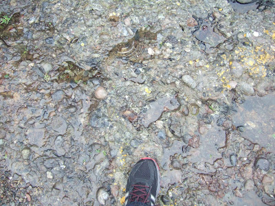
There are lots of other conglomerates in the San Juans. The older conglomerates are more metamorphosed. In this conglomerate the metamorphism is subtle. At the outcrop level there are a few hints. In most places, but not all the bedrock fractures at least partially through the pebbles (see above pictures). But in other places the fractures go around the pebbles suggesting some differential strain. But in the images below note the dissolution fractures in the rock including some that cut straight through pebbles.


While the best exposure is the fresh cut slope in the rock that the road, the same formation can be observed in its more native condition on bedrock outcrops along the shore and shore bluff to the east.


A walk to the shore bluffs is well worth while and includes great views as well as an interesting mix of trees.